MyTopo
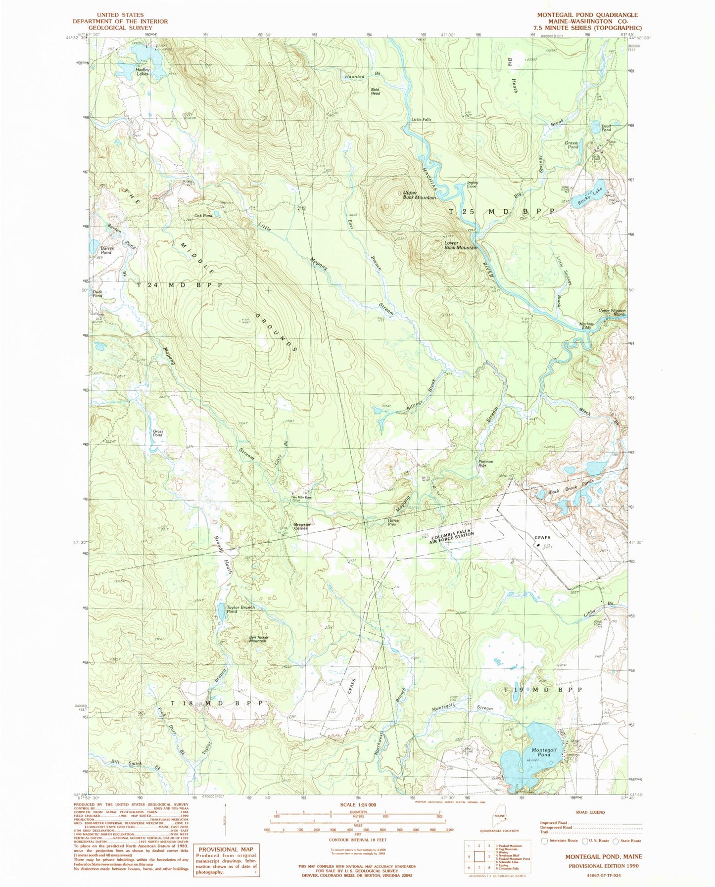
Classic USGS Montegail Pond Maine 7.5'x7.5' Topo Map
Couldn't load pickup availability
Historical USGS topographic quad map of Montegail Pond in the state of Maine. Map scale may vary for some years, but is generally around 1:24,000. Print size is approximately 24" x 27"
This quadrangle is in the following counties: Washington.
The map contains contour lines, roads, rivers, towns, and lakes. Printed on high-quality waterproof paper with UV fade-resistant inks, and shipped rolled.
Contains the following named places: Bald Head, Barren Pond, Barren Pond Brook, Ben Tucker Mountain, Big Heath, Big Springy Brook, Bill Smith Brook, Billings Brook, Black Brook, Black Brook Ponds, Brandy Heath, Brewster Corner, Dead Pond, Duck Pond, East Branch Little Mopang Stream, Fred Dorr Brook, Grass Pond, Grassy Pond, Hadley Lakes, Haunted Brook, Horse Rips, Ingley Cove, Larry Brook, Little Falls, Little Mopang Stream, Little Spring Brook, Lower Buck Mountain, Machias Eddy, Montegail Pond, Montegail Stream, Mopang Stream, Northwest Branch Montegail Stream, Oak Pond, Penman Rips, Pineo Camp, Rocky Lake, Six Mile Dam, T18 MD BPP, T19 MD BPP, T25 MD BPP, Taylor Branch, Taylor Brook Pond, The Middle Grounds, Upper Buck Mountain, Upper Wigwam Rapids