MyTopo
Classic USGS Montell Texas 7.5'x7.5' Topo Map
Regular price
$16.95
Regular price
Sale price
$16.95
Unit price
per
Couldn't load pickup availability
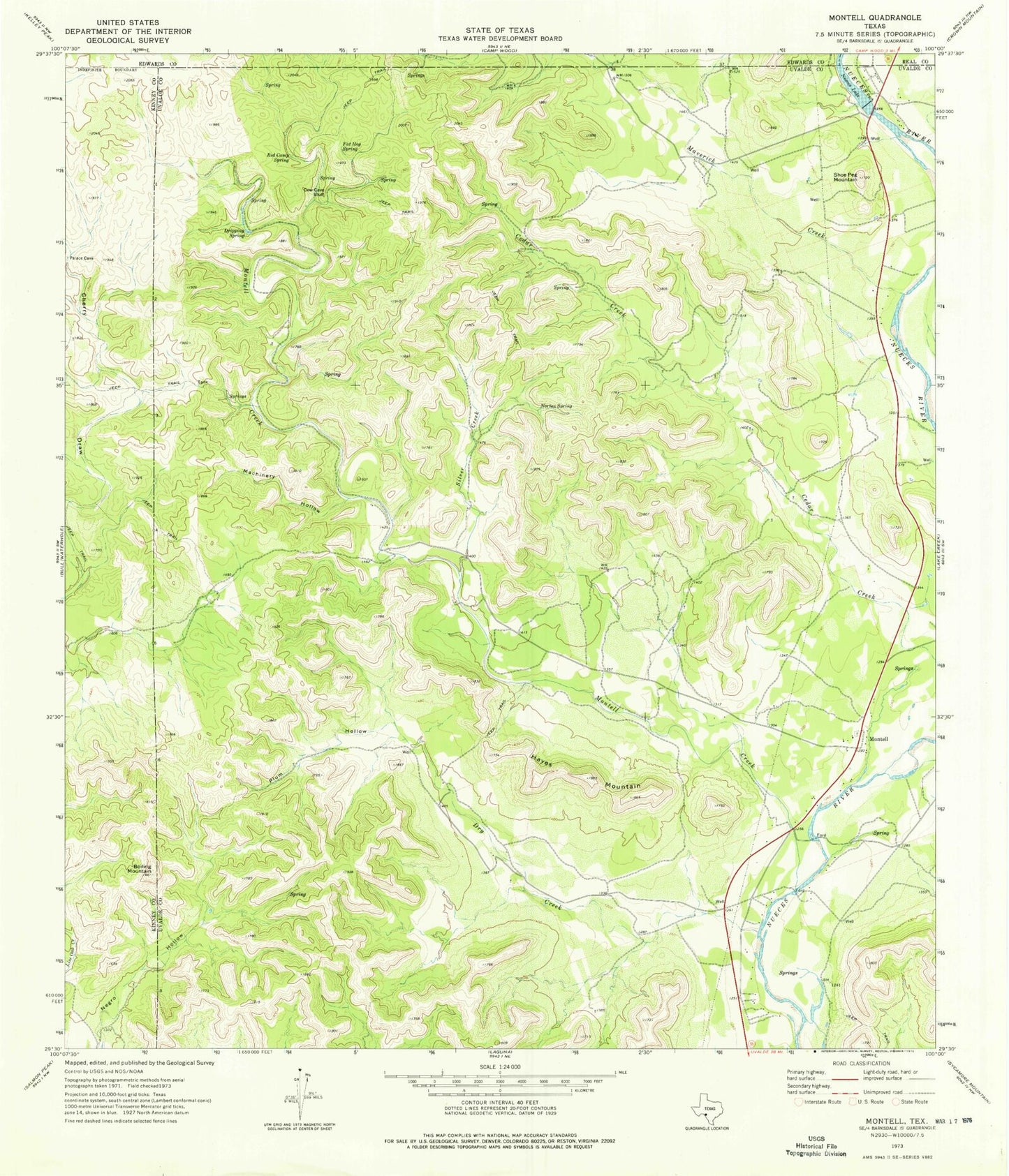
Historical USGS topographic quad map of Montell in the state of Texas. Map scale may vary for some years, but is generally around 1:24,000. Print size is approximately 24" x 27"
This quadrangle is in the following counties: Edwards, Kinney, Real, Uvalde.
The map contains contour lines, roads, rivers, towns, and lakes. Printed on high-quality waterproof paper with UV fade-resistant inks, and shipped rolled.
Contains the following named places: Arnold Crossing Dam, Boiling Mountain, Cow Cave Bluff, Dripping Spring, Dry Creek, Fat Hog Spring, Hayes Mountain, Machinery Hollow, Maverick Creek, Montell, Montell Creek, Norton Spring, Nueces Lake, Plum Hollow, Red Camp Spring, Shoe Peg Mountain, Silver Creek