MyTopo
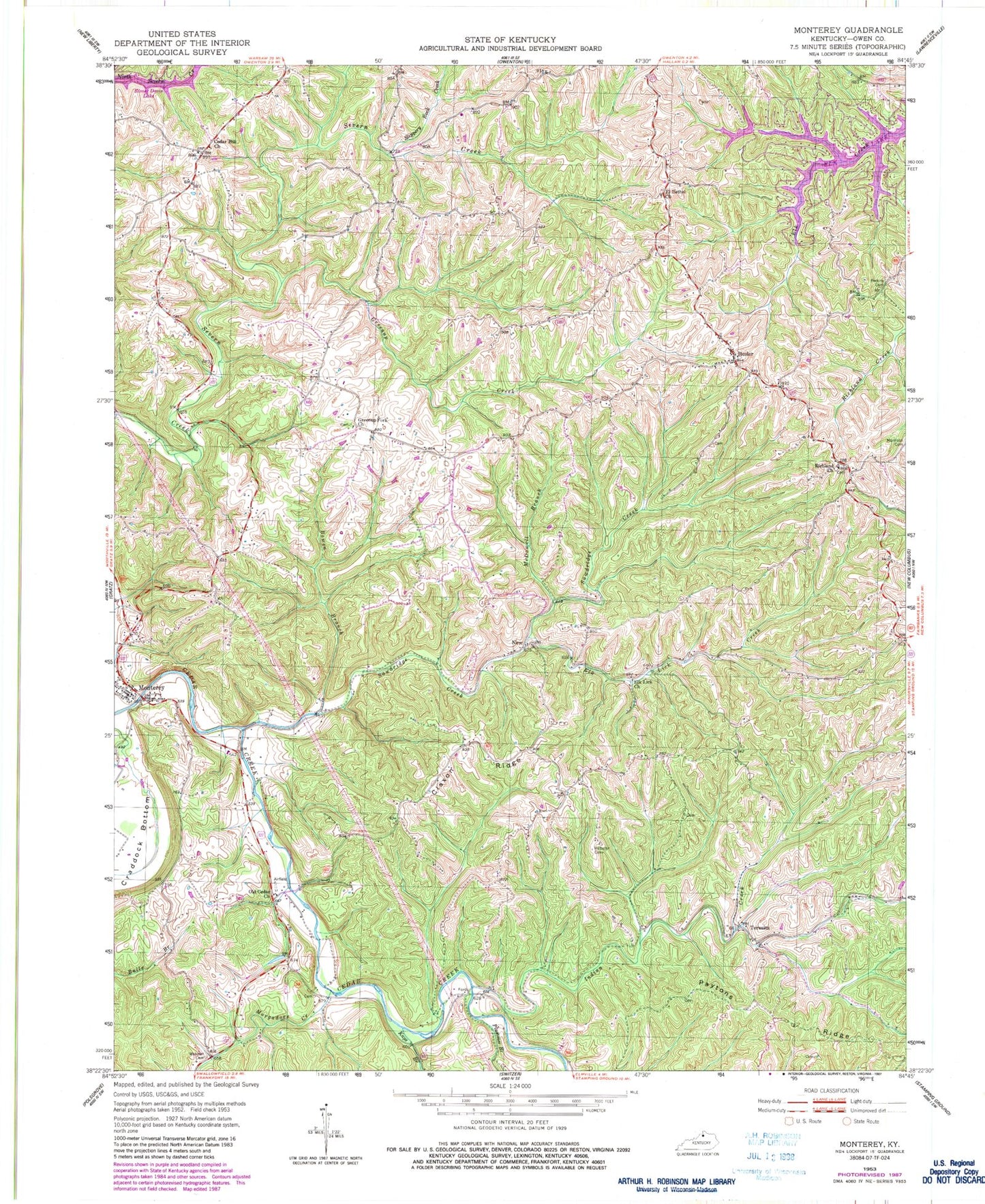
Classic USGS Monterey Kentucky 7.5'x7.5' Topo Map
Couldn't load pickup availability
Historical USGS topographic quad map of Monterey in the state of Kentucky. Typical map scale is 1:24,000, but may vary for certain years, if available. Print size: 24" x 27"
This quadrangle is in the following counties: Owen.
The map contains contour lines, roads, rivers, towns, and lakes. Printed on high-quality waterproof paper with UV fade-resistant inks, and shipped rolled.
Contains the following named places: Bowen Branch, Cedar Hill Church, Claxon Ridge, El Bethel Christian Church, Elk Lick Church, Elk Lick Creek, Greenup Creek, Greenup Fork Church, Hesler, Indian Creek, Kays Branch, McDowell Branch, Monterey, Morgadore Creek, Old Cedar Church, Paytons Ridge, Perkins Cemetery, Plummer Branch, Richland Baptist Church, Sawdridge Creek, Slippery Rock Creek, Webster Cemetery, Webster Cemetery, New, Teresita, El Bethel Christian Church Cemetery, Greenup Fork Baptist Church Cemetery, Monterey Cemetery, Monterey Baptist Church Cemetery, Monterey Baptist Church, Richland Baptist Church Cemetery, Sanders Cemetery, Monterey-New Columbus Division, City of Monterey, East Eagle Post Office (historical), Ep Post Office (historical), Greenup Fork Post Office (historical), Greenup School (historical), Haydons Post Office (historical), Haydons Stand (historical), Hesler Post Office (historical), Honeysuckle Hill, Monterey Post Office (historical), Monterey School (historical), Richland Baptist Church (historical), School Number Eighty-One (historical), School Number Ninety-Eight (historical), Teresita Post Office (historical), Walnut Grove Methodist Church (historical), Wiley Branch, Assembly of God (historical), Cedar Hill School (historical), Claxton School (historical), Monterey Volunteer Fire Department, Cedar Hill (historical), Greenup Fork (historical)