MyTopo
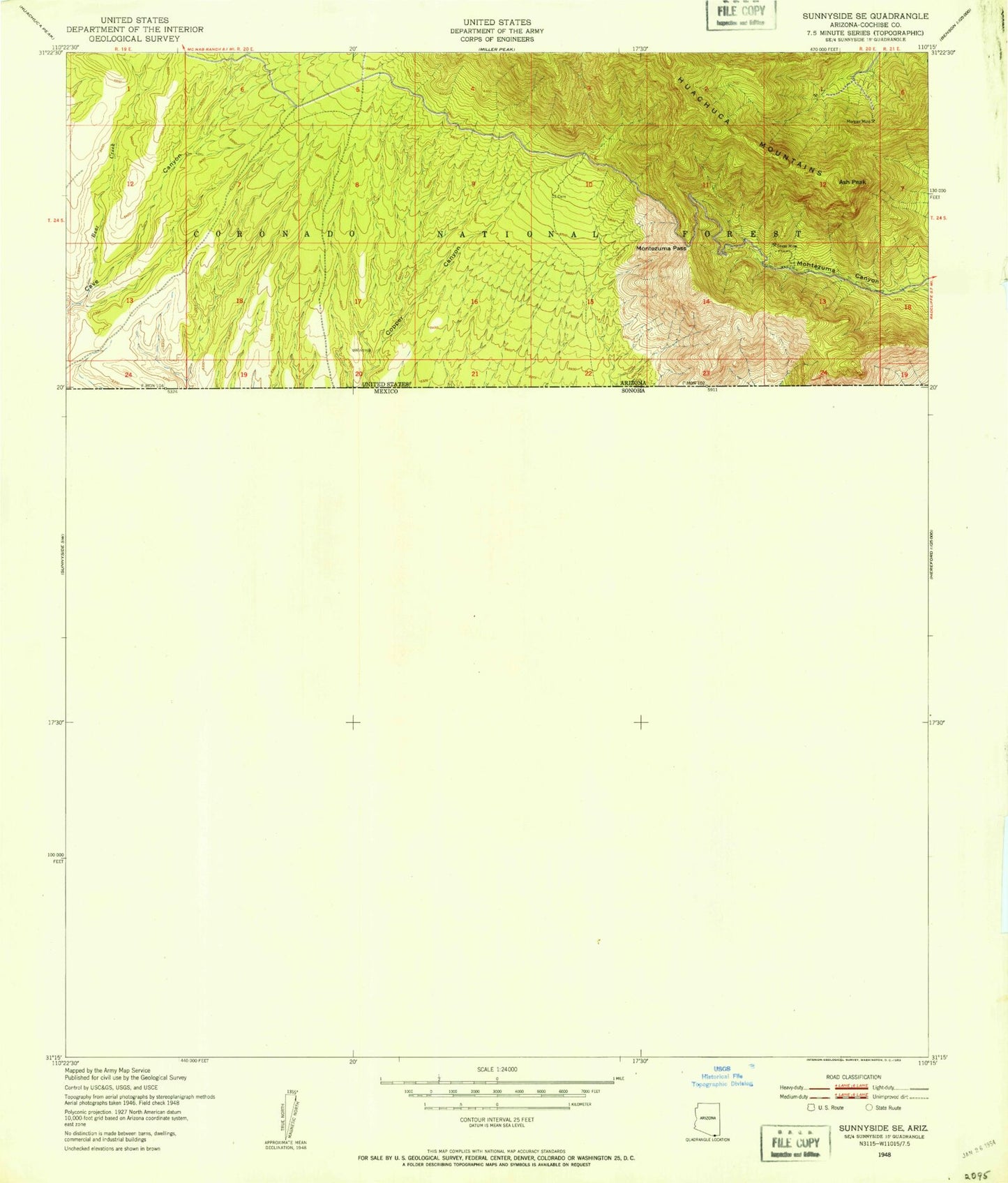
Classic USGS Montezuma Pass Arizona 7.5'x7.5' Topo Map
Couldn't load pickup availability
Historical USGS topographic quad map of Montezuma Pass in the state of Arizona. Map scale may vary for some years, but is generally around 1:24,000. Print size is approximately 24" x 27"
This quadrangle is in the following counties: Cochise.
The map contains contour lines, roads, rivers, towns, and lakes. Printed on high-quality waterproof paper with UV fade-resistant inks, and shipped rolled.
Contains the following named places: Bear Creek, Bob Lucy Corral, Cave Trail, Copper Canyon, Coronado Memorial Headquarters, Coronado National Memorial, Coronado Peak, Coronado Peak Trail, Eighty Spring, Fork Spring, Grubstake Corral, Joaquin Creek, Joes Canyon Trail, Lone Mountain International Airport, Montezuma Pass, Montezuma Pass Trail Head, Montezuma Peak, Morgan Mine, Morgan Spring, Oak Spring, One Hundred Three Mesa, State of Texas Mine, Swallow Spring, Yaqui Canyon, Yaqui Ridge Trail, Yaqui Spring