MyTopo
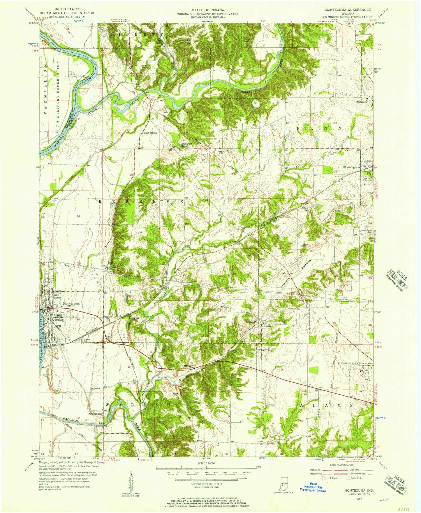
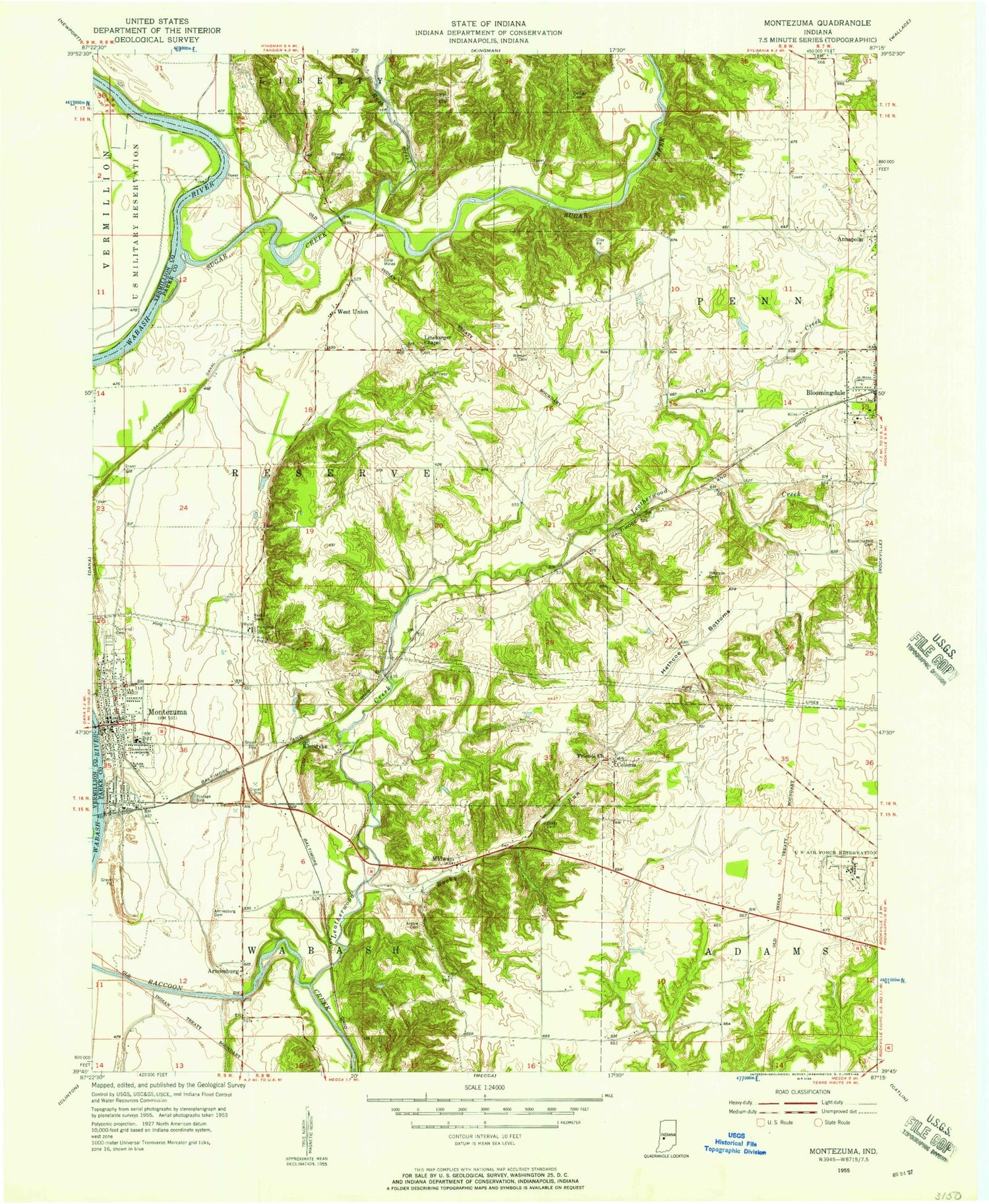
Classic USGS Montezuma Indiana 7.5'x7.5' Topo Map
Couldn't load pickup availability
Historical USGS topographic quad map of Montezuma in the state of Indiana. Map scale may vary for some years, but is generally around 1:24,000. Print size is approximately 24" x 27"
This quadrangle is in the following counties: Parke, Vermillion.
The map contains contour lines, roads, rivers, towns, and lakes. Printed on high-quality waterproof paper with UV fade-resistant inks, and shipped rolled.
Contains the following named places: Annapolis, Annapolis Post Office, Arabia, Arabia Cemetery, Armiesburg, Armiesburg Cemetery, Bloomingdale Fire Department, Bloomingdale Friends Cemetery, Bloomingdale Post Office, Camp Weeapahko, Cat Creek, Causey Cemetery, Coke Oven Hollow, Coloma, DeBaun Cemetery, Friends Church, Hethcoe Bottoms, Hethcoe Cemetery, Klondyke, Leatherwood, Leatherwood Creek, Linebarger Chapel, Little Leatherwood Creek, Melcher, Melcher Bridge, Midway, Montezuma, Montezuma Elementary School, Montezuma Junior High and Senior High School, Montezuma Police Department, Montezuma Post Office, Montezuma Reserve Township Volunteer Fire Department, Oakland Cemetery, Phillips Bridge, Pottertown, Rockville Air Force Station, Rockville Correctional Facility, Rockville Fire Department, Rockville Training Center, Rocky Run, Rush Creek, Sim Smith Bridge, Stumptown, Sugar Creek, Town of Bloomingdale, Town of Montezuma, Township of Penn, Township of Reserve, Warner Cemetery, Watts Cemetery, West Melcher, West Union, West Union Bridge, ZIP Code: 47862