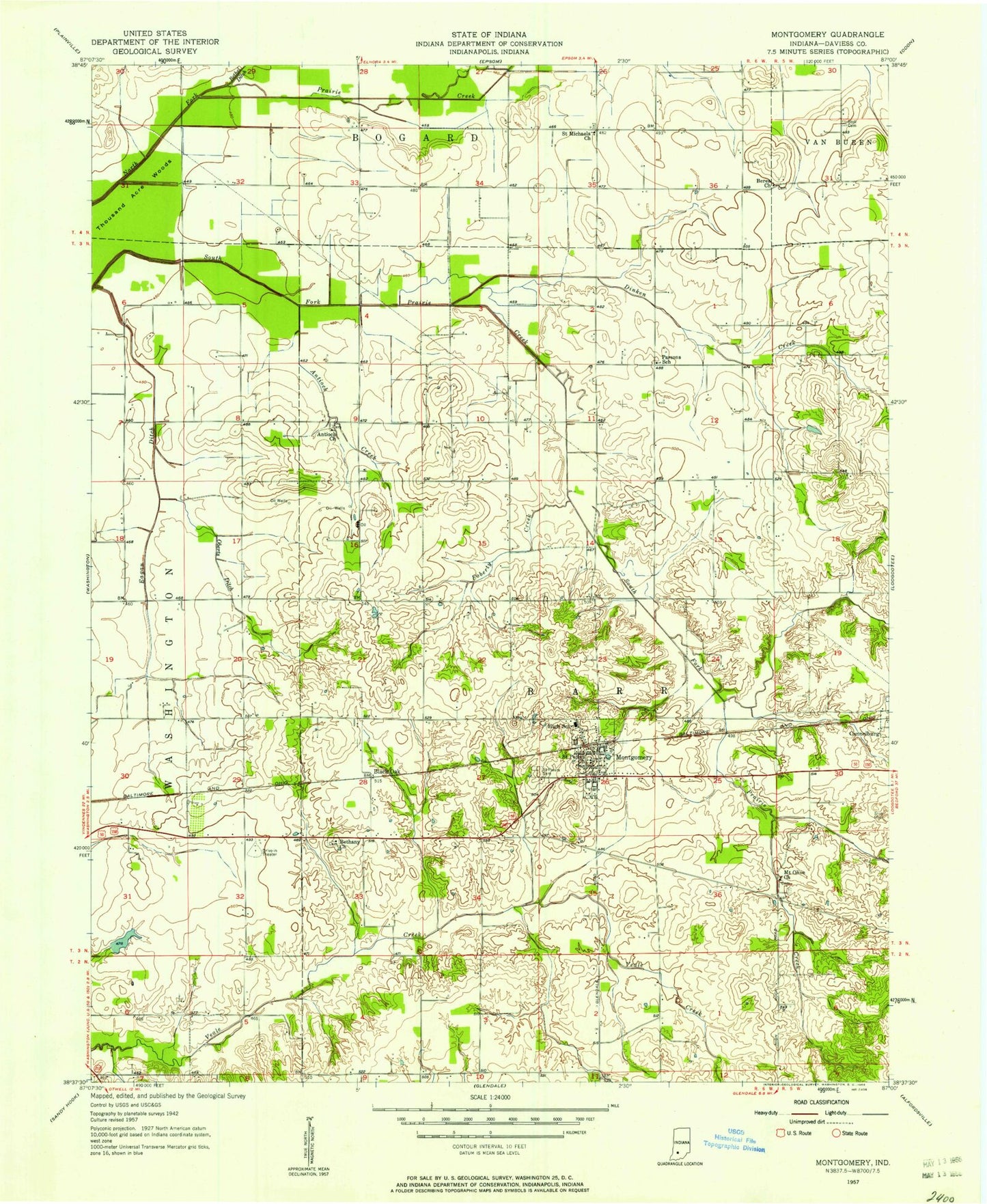
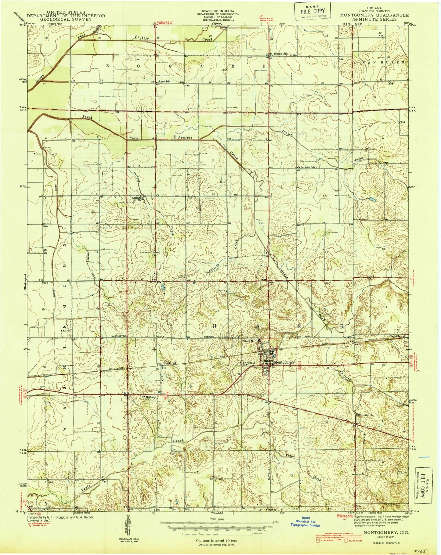
MyTopo
Classic USGS Montgomery Indiana 7.5'x7.5' Topo Map
Couldn't load pickup availability
Historical USGS topographic quad map of Montgomery in the state of Indiana. Map scale may vary for some years, but is generally around 1:24,000. Print size is approximately 24" x 27"
This quadrangle is in the following counties: Daviess.
The map contains contour lines, roads, rivers, towns, and lakes. Printed on high-quality waterproof paper with UV fade-resistant inks, and shipped rolled.
Contains the following named places: Antioch Church, Antioch Creek, Berea Church, Bethany Church, Black Oak, Daviess County, Dinken Creek, Eagan Ditch, Flat Creek, Foberty Creek, Indian Rock Lake, Montgomery, Montgomery Volunteer Fire Department, Mount Olive Church, Oberts Ditch, Parsons School, Prairie Creek Structure Number B-2-1, Prairie Creek Structure Number B-3-1, Prairie Creek Structure Number B-3-2, Prairie Creek Structure Number B-4-7, Saint Michaels Church, Saint Peters Cemetery, Saint Peters Church, Stoll Cemetery, Town of Montgomery, Township of Barr, ZIP Code: 47558