MyTopo
Classic USGS Monticello Dam California 7.5'x7.5' Topo Map
Couldn't load pickup availability
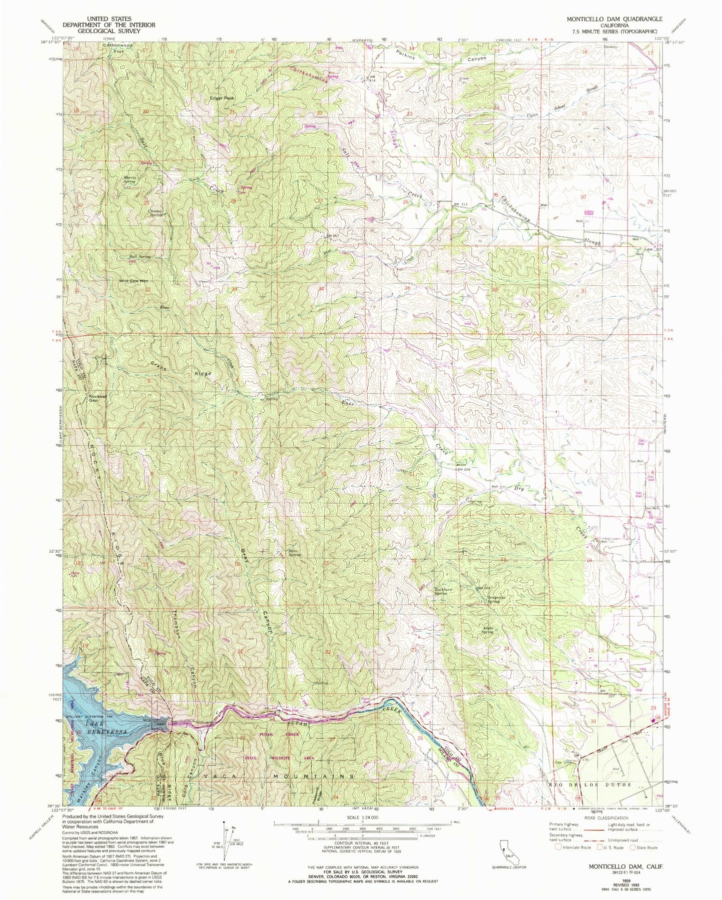
Historical USGS topographic quad map of Monticello Dam in the state of California. Map scale may vary for some years, but is generally around 1:24,000. Print size is approximately 24" x 27"
This quadrangle is in the following counties: Napa, Solano, Yolo.
The map contains contour lines, roads, rivers, towns, and lakes. Printed on high-quality waterproof paper with UV fade-resistant inks, and shipped rolled.
Contains the following named places: Adobe Spring, Apricot School, Bray Canyon, Buckhorn Spring, Bull Spring, Chapmans Upper Ranch, Cold Canyon, Cowell Ranch, Crane Ridge, Crooker Spring, Devils Gate, Edgar Peak, Enos Creek, Grapevine Spring, Markley Canyon, Monticello Dam, Morris Spring, Pine Creek, Putah Creek State Wildlife Area, Rockwell Gap, Salt Creek, Scott Cabin, Scott Ranch, Stove Spring, Thompson Canyon, Wild Cow Mountain, Winters Division, ZIP Code: 95694