MyTopo
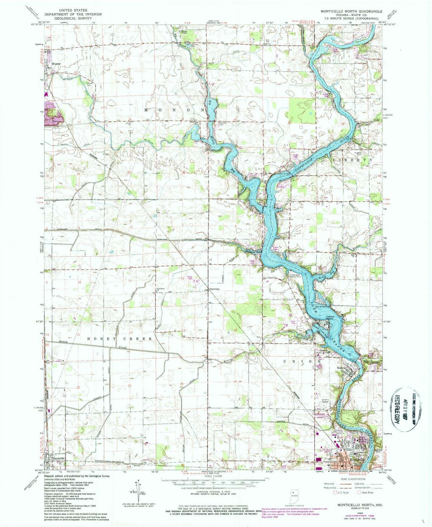
Classic USGS Monticello North Indiana 7.5'x7.5' Topo Map
Couldn't load pickup availability
Historical USGS topographic quad map of Monticello North in the state of Indiana. Typical map scale is 1:24,000, but may vary for certain years, if available. Print size: 24" x 27"
This quadrangle is in the following counties: White.
The map contains contour lines, roads, rivers, towns, and lakes. Printed on high-quality waterproof paper with UV fade-resistant inks, and shipped rolled.
Contains the following named places: Bedford Cemetery, Bedford Church, Beller McCollum Ditch, Big Monon Creek, Carter Ditch, Diener Ditch, Guernsey, Guernsey Church, Hancock Ditch, Hoagland Bay, Honey Creek, Honey Creek Bay, Hughes Cemetery, Indiana Beach, Isle of Homes, Keans Bay, Keans Creek, Lakeview County Home, Lowes Bridge, Martin Ditch, Monon Chapel, Norway, Norway Dam, Pettit Ditch, Pike Creek, Roach Ditch, Ruth Ditch, Lake Shafer, Sills Ditch, Williams Ditch, Wilson Cemetery, Woodlawn Elementary School, Zion Church, Monon Elementary School, Big Monon Bay, Tippecanoe Country Club, Township of Honey Creek, Norway Census Designated Place, Lake Shore Drive-In