MyTopo
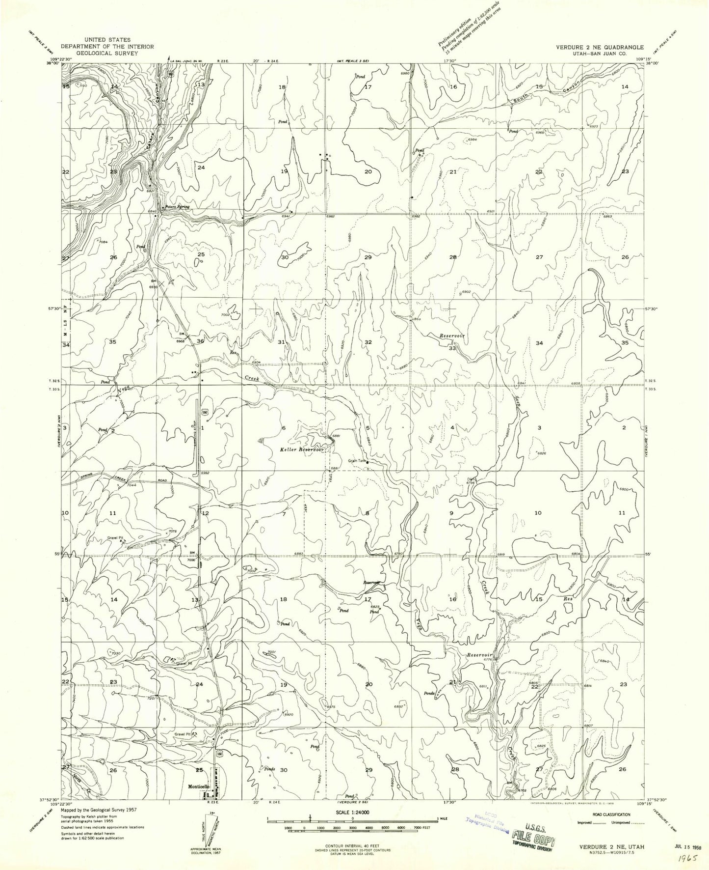
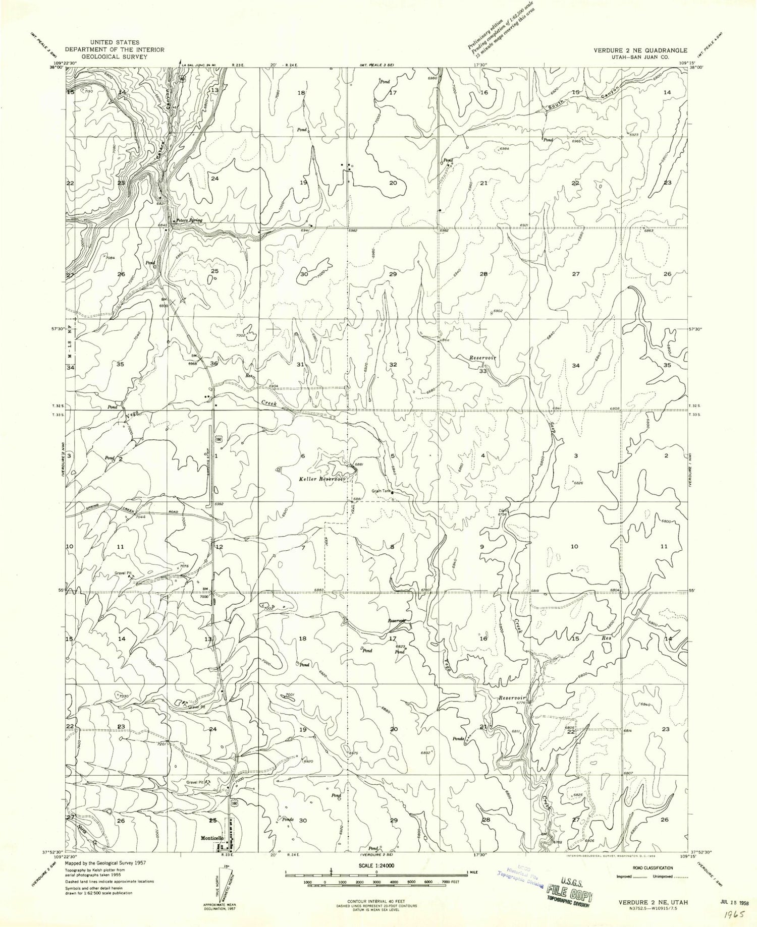
Classic USGS Monticello North Utah 7.5'x7.5' Topo Map
Regular price
$16.95
Regular price
Sale price
$16.95
Unit price
per
Couldn't load pickup availability
Historical USGS topographic quad map of Monticello North in the state of Utah. Map scale may vary for some years, but is generally around 1:24,000. Print size is approximately 24" x 27"
This quadrangle is in the following counties: San Juan.
The map contains contour lines, roads, rivers, towns, and lakes. Printed on high-quality waterproof paper with UV fade-resistant inks, and shipped rolled.
Contains the following named places: Bankhead Creek, First Southern Baptist Church, Keller Dam, Keller Reservoir, Monticello Airport, Monticello Elementary School, Mountain View Trailer Park, Peters Spring, Rowleys Trailer Park, Seep Creek, Spring Creek