MyTopo
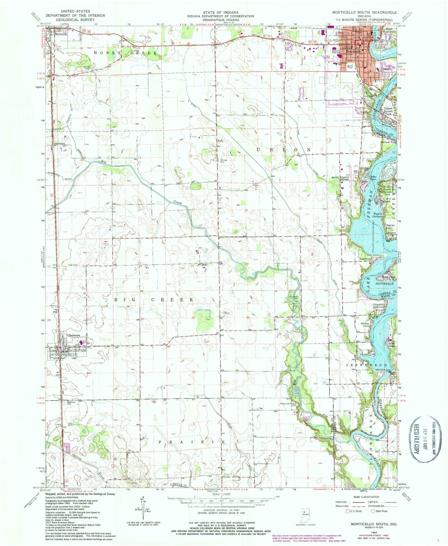
Classic USGS Monticello South Indiana 7.5'x7.5' Topo Map
Couldn't load pickup availability
Historical USGS topographic quad map of Monticello South in the state of Indiana. Typical map scale is 1:24,000, but may vary for certain years, if available. Print size: 24" x 27"
This quadrangle is in the following counties: Carroll, White.
The map contains contour lines, roads, rivers, towns, and lakes. Printed on high-quality waterproof paper with UV fade-resistant inks, and shipped rolled.
Contains the following named places: Big Creek, Breezy Point, Bunnell Cemetery, C and C Beach, Carr Cemetery, Cedar Point, Chalmers, Chalmers Cemetery, Indiana University Health White Memorial Hospital, East Monticello, Emge Ditch, Gingrich Addition, Golden Hill, Harvey and Phebus Cemetery, High Cemetery, Johnson Ditch, Lakewood, Lincoln Junior High School, Lower Sunset Park, Monticello, Oakdale Dam, Oaklawn Elementary School, Reynolds, Richey Park, Roosevelt Junior High School, Roth Park, Sandy Beach, Scarlet Oaks, Smithson, Snow Ditch, Meadowlawn Elementary School, Terrace Bay, Upper Sunset Park, Walnut Gardens, Frontier High School, WVTL-FM (Monticello), White County Airport, White County, Township of Big Creek, Township of Union, City of Monticello, Town of Chalmers, Town of Reynolds, Monticello Fire Department, Chalmers Community Volunteer Fire Department, Honey Creek Township Volunteer Fire Department, White County Memorial Hospital Rehabilitation Center, Honey Creek Township First Responder Team, Chalmers - Brookston First Response, Monticello Police Department, Reynolds Post Office, Chalmers Post Office, Monticello Post Office, Saint Joseph Cemetery