MyTopo
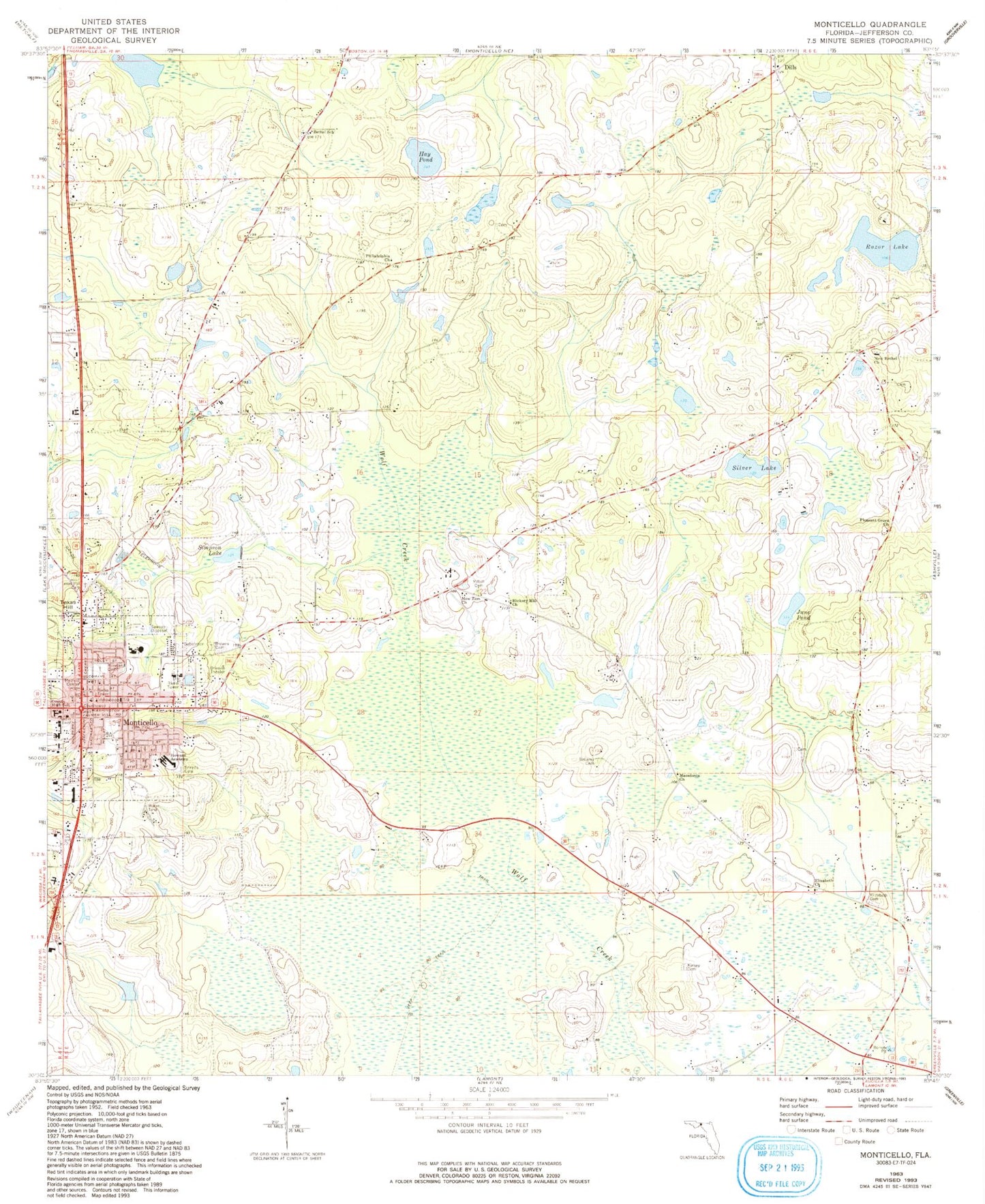
Classic USGS Monticello Florida 7.5'x7.5' Topo Map
Couldn't load pickup availability
Historical USGS topographic quad map of Monticello in the state of Florida. Map scale may vary for some years, but is generally around 1:24,000. Print size is approximately 24" x 27"
This quadrangle is in the following counties: Jefferson.
The map contains contour lines, roads, rivers, towns, and lakes. Printed on high-quality waterproof paper with UV fade-resistant inks, and shipped rolled.
Contains the following named places: Bellamy Cemetery, Bethel African Methodist Episcopal Church, Bethel Church, Bethel School, Browns Cemetery, Calvary Baptist Church, Central Church of Christ, Christ Episcopal Church, Church of Christ, City of Monticello, City of Monticello Sewage Treatment Plant, Dills, Elizabeth Cemetery, Elizabeth Church, Elizabeth Missionary Baptist Church, First Presbyterian Church, First United Methodist Church, Fourth Street Trailer Park, Greater Fellowship Baptist Church, Hay Pond, Hickory Hill Church, Howard Academy, Howard Middle School, Jefferson Correctional Institution, Jefferson Correctional Institution Library, Jefferson County Adult Center, Jefferson County Elementary School-Mamie Scott Annex, Jefferson County Fire Rescue Service, June Pond, Kingdom Hall of Jehovahs Witnesses, Kinsey Cemetery, Lakeview Airstrip, Macedonia Church, Milton Cemetery, Monticello, Monticello Church of God in Christ, Monticello Division, Monticello Opera House, Monticello Police Department, Monticello Post Office, Monticello Volunteer Fire Department, Mount Zion Cemetery, New Bethel Church, New Zion Church, Philadelphia Church, Pleasant Grove Church, Razor Lake, Roseland Cemetery, Silver Lake, Simpson Lake, Simpson Nursery Pond, Sneeds Cemetery, Texas Hill, Texas Hill Cemetery, WJPH-FM (Monticello), WMFL-AM (Monticello)