MyTopo
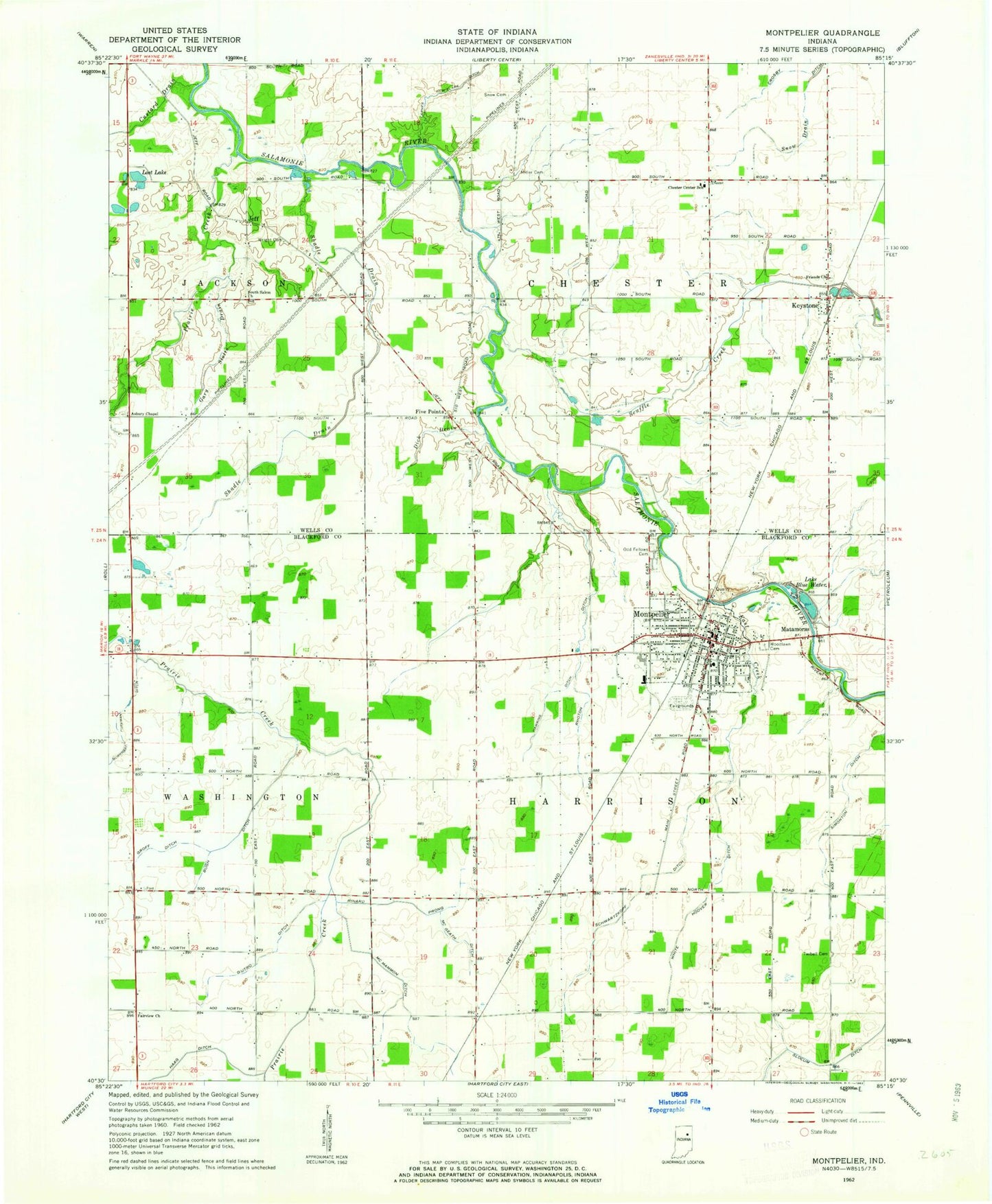
Classic USGS Montpelier Indiana 7.5'x7.5' Topo Map
Couldn't load pickup availability
Historical USGS topographic quad map of Montpelier in the state of Indiana. Map scale may vary for some years, but is generally around 1:24,000. Print size is approximately 24" x 27"
This quadrangle is in the following counties: Blackford, Wells.
The map contains contour lines, roads, rivers, towns, and lakes. Printed on high-quality waterproof paper with UV fade-resistant inks, and shipped rolled.
Contains the following named places: Asbury Chapel, Bugh Ditch, Burchard Foreman Ditch, Chester Center School, Chester Township Volunteer Fire Department, City of Montpelier, Custard Drain, Dick Drain, Dutro Ditch, East Creek, Erie Stone Quarry, Fairview Church, Five Points, Friends Church, Gary Stotts Drain, Groff Ditch, Haag Ditch, Hawkins Ditch, Jeff, Keystone, Keystone Post Office, Lake Blue Water, Lost Lake, Matamoras, McGeath Ditch, McMammon Ditch, Miller Cemetery, Montpelier, Montpelier - Harrison Township Volunteer Fire Department Station 1, Montpelier - Harrison Township Volunteer Fire Department Station 2, Montpelier Elementary School, Montpelier Police Department, Montpelier Post Office, Odd Fellows Cemetery, Prairie Creek, Rhoton Ditch, Rinard Prong, Schwartzkopf Ditch, Scuffle Creek, Shadle Drain, Simonton Ditch, Snow Cemetery, Snow Drain, South Salem Church, Township of Chester, Township of Harrison, Twibell Cemetery, Wells County Emergency Medical Services - South Station, White Hoover Ditch, Woodlawn Cemetery, Wright Cemetery, ZIP Code: 47359