MyTopo
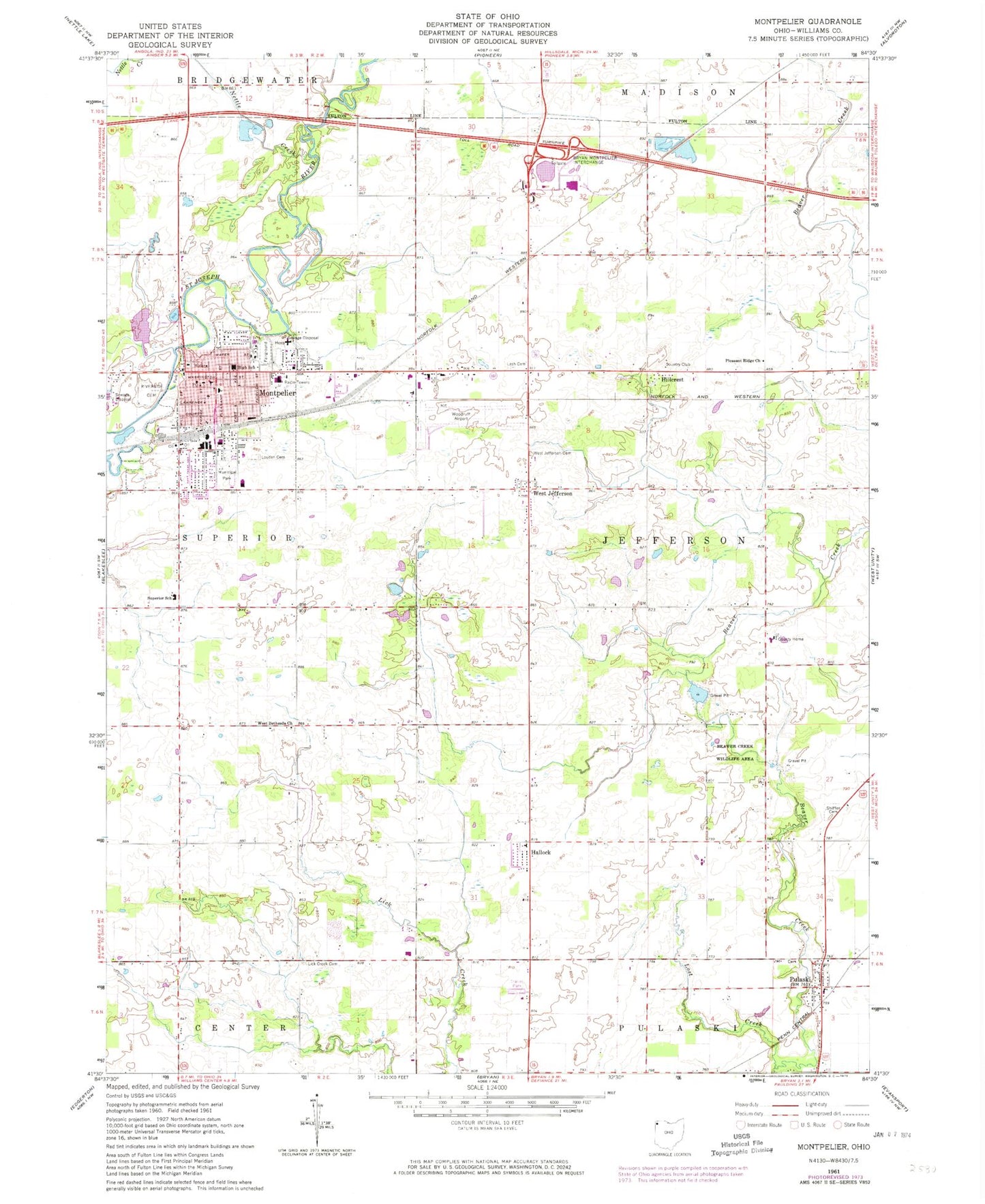
Classic USGS Montpelier Ohio 7.5'x7.5' Topo Map
Couldn't load pickup availability
Historical USGS topographic quad map of Montpelier in the state of Ohio. Map scale may vary for some years, but is generally around 1:24,000. Print size is approximately 24" x 27"
This quadrangle is in the following counties: Williams.
The map contains contour lines, roads, rivers, towns, and lakes. Printed on high-quality waterproof paper with UV fade-resistant inks, and shipped rolled.
Contains the following named places: Beaver Creek Wildlife Area, Bible Park, Boynton Farm, Central United Brethren Church, Community Hospital of Williams County Montpelier Hospital, Davis Woods, Deer Lick, First Presbyterian Church, George Bible Park, Hallock, Hillcrest, Hillcrest Golf Course, Holiday City, Lash Cemetery, Lick Creek Cemetery, Lost Creek, Louden Cemetery, Maneval Farms, Maplecrest, Montpelier, Montpelier Church of Christ, Montpelier Elementary School, Montpelier Fire Department, Montpelier High School, Montpelier Post Office, Montpelier Village Police Department, Nettle Creek, Nu-vision Trailer Park, Old Pulaski Cemetery, Opdyke Park, Pleasant Ridge Church, Pulaski, Pulaski Census Designated Place, Pulaski United Methodist Church, Pulaski-Jefferson Elementary School, Riverside Cemetery, Sacred Heart Catholic Church, Saint Johns Lutheran Church, Saint Pauls United Methodist Church, School Number 1, School Number 11, School Number 2, School Number 3, School Number 4, School Number 5, School Number 7, School Number 8, School Number 9, Shiffler Cemetery, Stoney Ridge Farm and Winery, Suburban Golf Course, Superior Elementary School, Township of Jefferson, Village of Holiday City, Village of Montpelier, West Bethesda Cemetery, West Bethesda Church, West Jefferson, West Jefferson Cemetery, Williams County, Williams County Emergency Medical Services Medic 5, Williams County Home, Williams County Landfill, Woodruff Airport