MyTopo
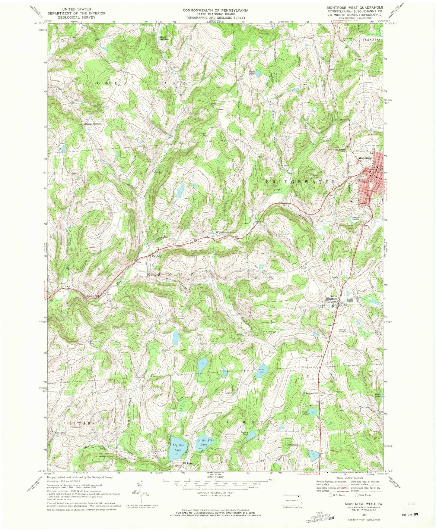
Classic USGS Montrose West Pennsylvania 7.5'x7.5' Topo Map
Couldn't load pickup availability
Historical USGS topographic quad map of Montrose West in the state of Pennsylvania. Map scale may vary for some years, but is generally around 1:24,000. Print size is approximately 24" x 27"
This quadrangle is in the following counties: Susquehanna.
The map contains contour lines, roads, rivers, towns, and lakes. Printed on high-quality waterproof paper with UV fade-resistant inks, and shipped rolled.
Contains the following named places: Beebe Creek, Big Elk Lake, Big Elk Lake Dam, Booth Millpond, Borough of Montrose, Bumps Corners, Bush Pond, Cope Pond, East Rush, Elk Lake, Fair Hill Cemetery, Fair Hill School, Fairdale, Fancher Cemetery, Forest Lake Creek, Hamlin School, Holy Name of Mary Cemetery, Husky Haven Airport, Indian Lake, Indian Lake Dam, Jessup Overlook, Little Elk Lake, Louden Hill, Montrose, Montrose Post Office, Pettis Creek, Prospect Hill Cemetery, Roe Creek, Shelp Creek, Snows Mill, South Branch Wyalusing Creek, South Montrose, South Montrose Post Office, Township of Jessup, Tyler School, United Fire Company, Woodburn, ZIP Codes: 18801, 18816, 18843