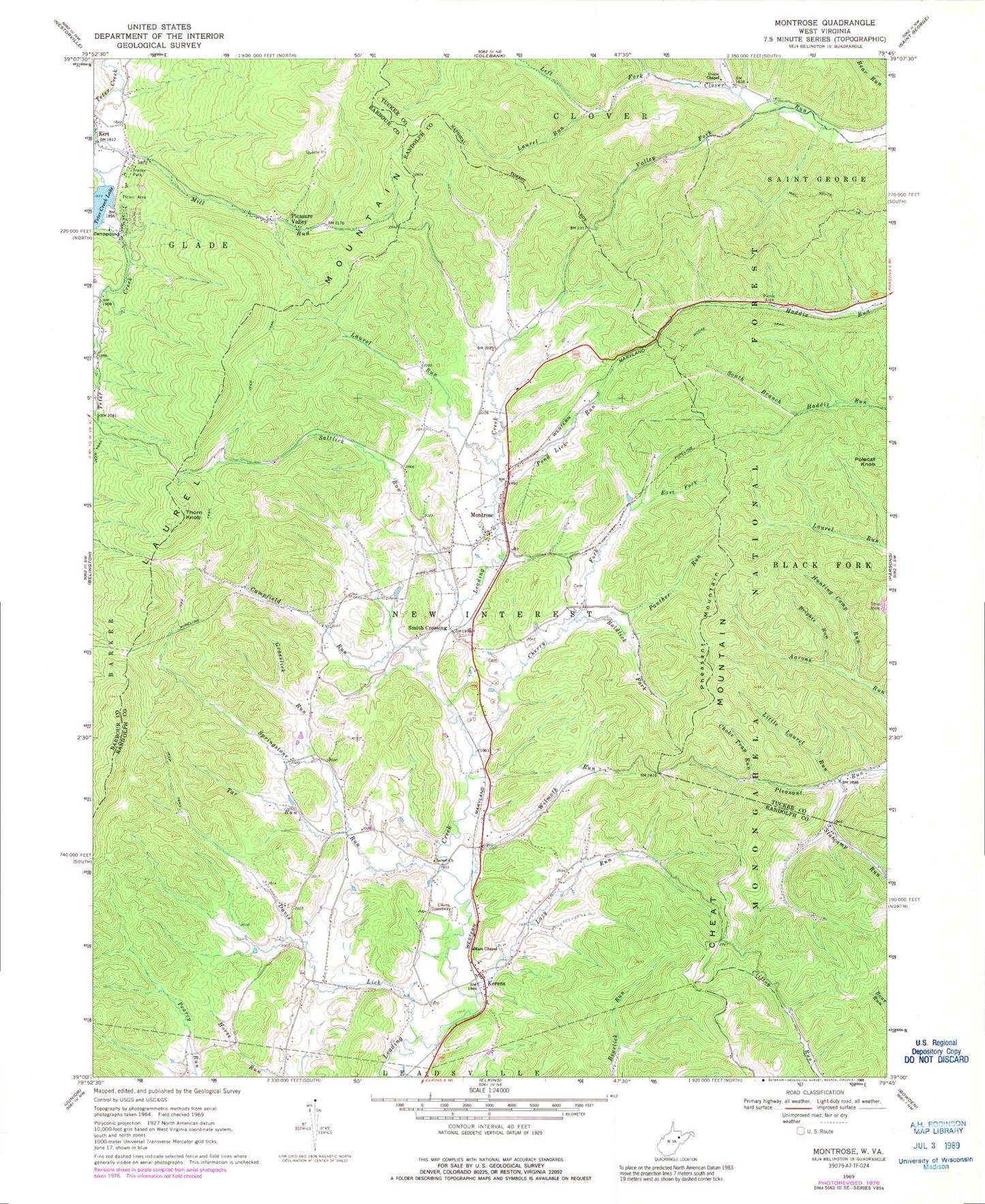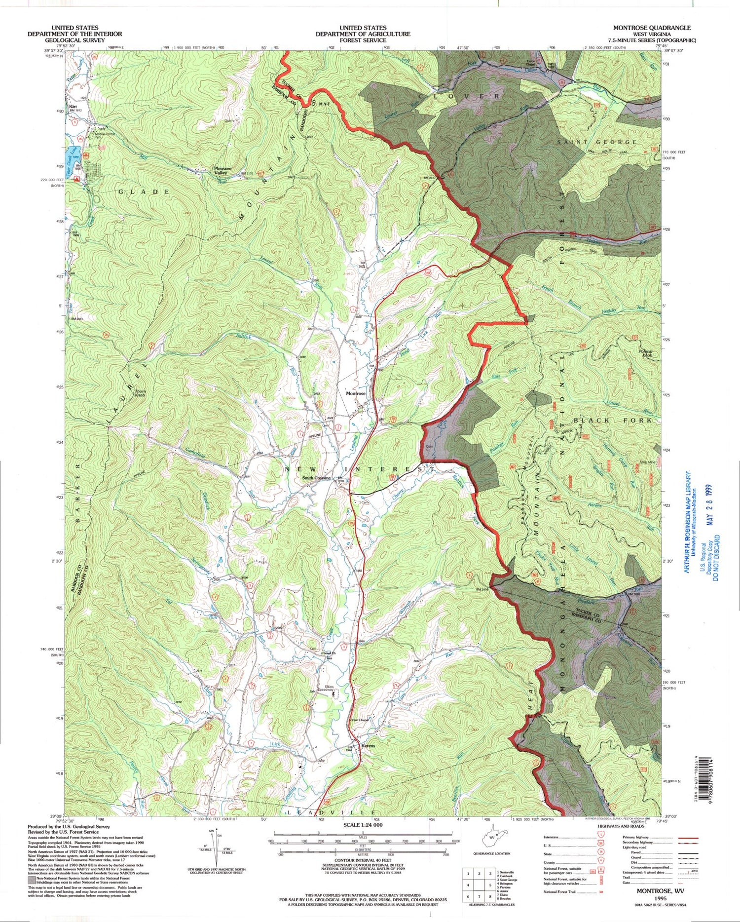
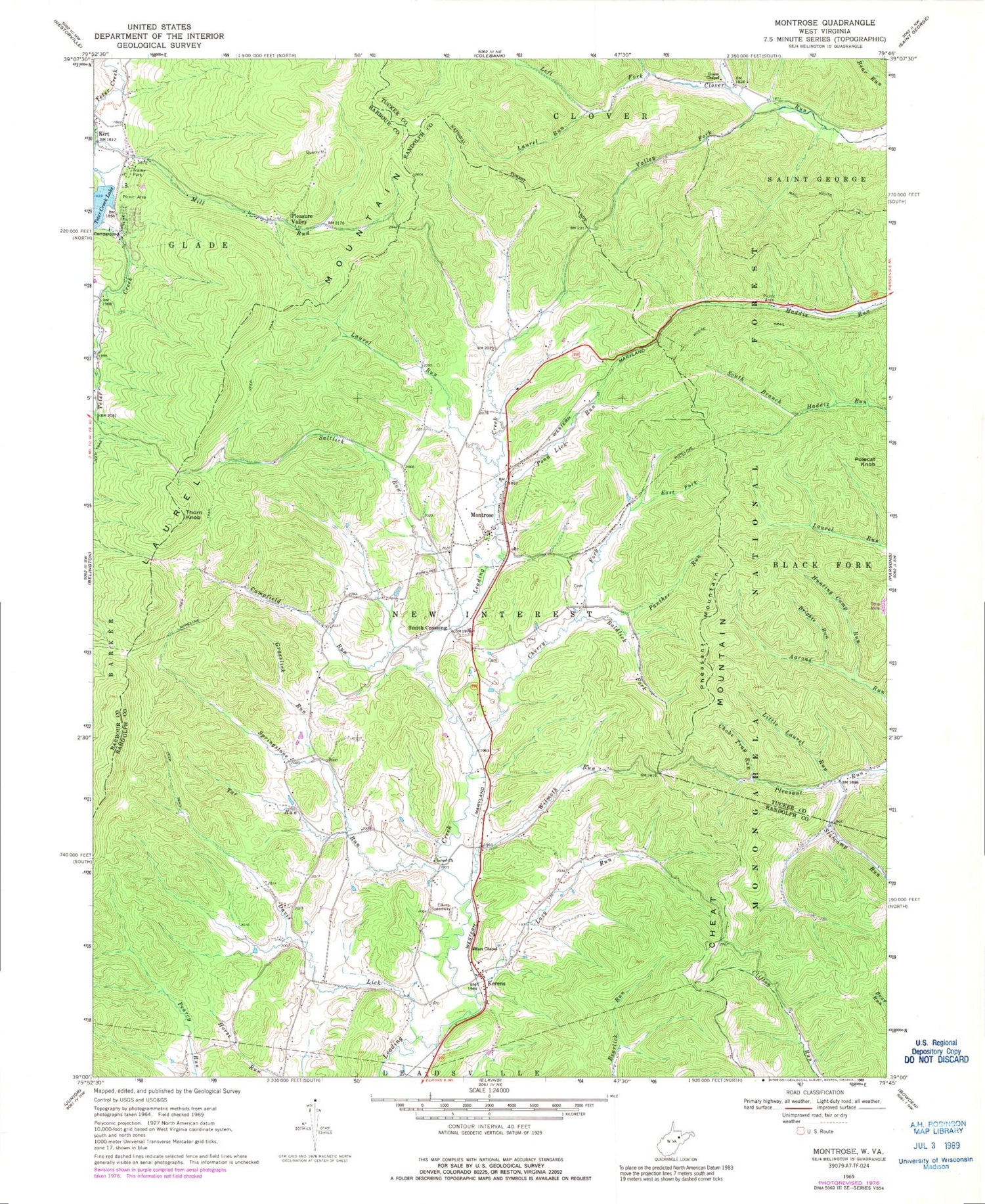
MyTopo
Classic USGS Montrose West Virginia 7.5'x7.5' Topo Map
Couldn't load pickup availability
Historical USGS topographic quad map of Montrose in the state of West Virginia. Typical map scale is 1:24,000, but may vary for certain years, if available. Print size: 24" x 27"
This quadrangle is in the following counties: Barbour, Randolph, Tucker.
The map contains contour lines, roads, rivers, towns, and lakes. Printed on high-quality waterproof paper with UV fade-resistant inks, and shipped rolled.
Contains the following named places: Baldlick Fork, Brights Run, Campfield Run, Cherry Fork, Choke Trap Run, Davis Lick, East Fork Cherry Fork, Grasslick Run, Hart Chapel, Hunting Camp Run, Indian Run, Israel Church, Kirt, Laurel Run, Laurel Run, Lazy Run, Little Laurel Run, Pheasant Mountain Trail, Mill Run, South Haddix Trail, Panther Run, Pond Lick Run, Saltlick Run, Slabcamp Run, Smith Crossing, South Branch, Springstone Run, Tar Run, Teter Creek Lake, Union Chapel, Valley Fork, Wilmoth Run, Thorn Knob, Kerens, Montrose, Pleasant Mountain, Pleasure Valley, Polecat Knob, Elkins Speedway, Bryan Hamilton Spring, Harper Schoolhouse (historical), Laurel Hill School (historical), Teter Creek Lake Wildlife Management Area, Salem School (historical), Central School (historical), Cherry Fork School (historical), Gainer School (historical), Israel School (historical), Ivy Hill School (historical), Kerens Post Office, Montrose Post Office, Oak Grove School (historical), Victory School (historical), New Interest District, Town of Montrose, Leading Creek Volunteer Fire Department, Leading Creek Primitive Baptist Cemetery