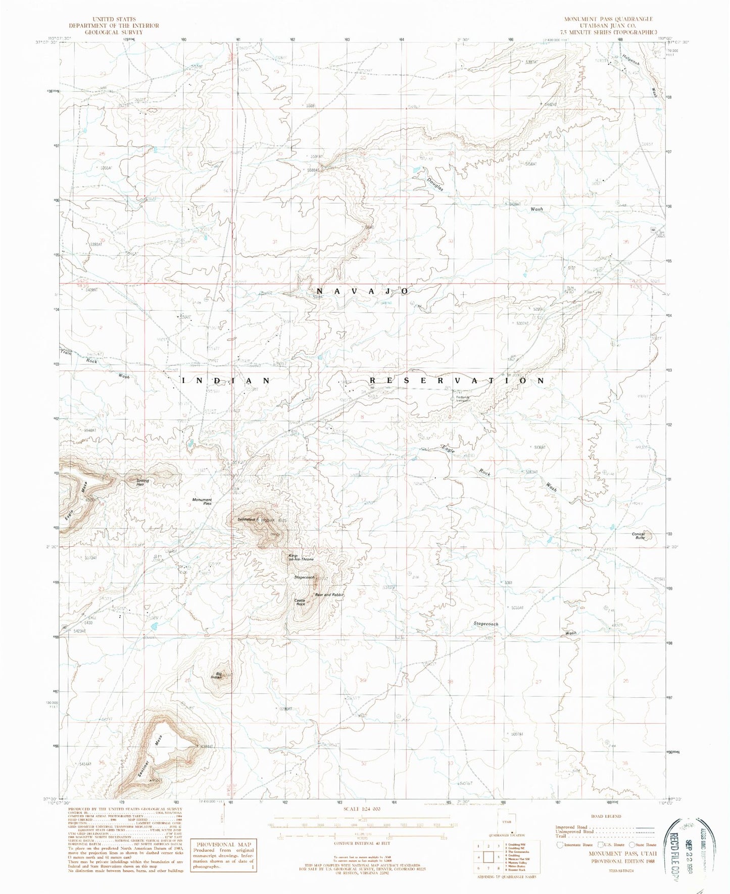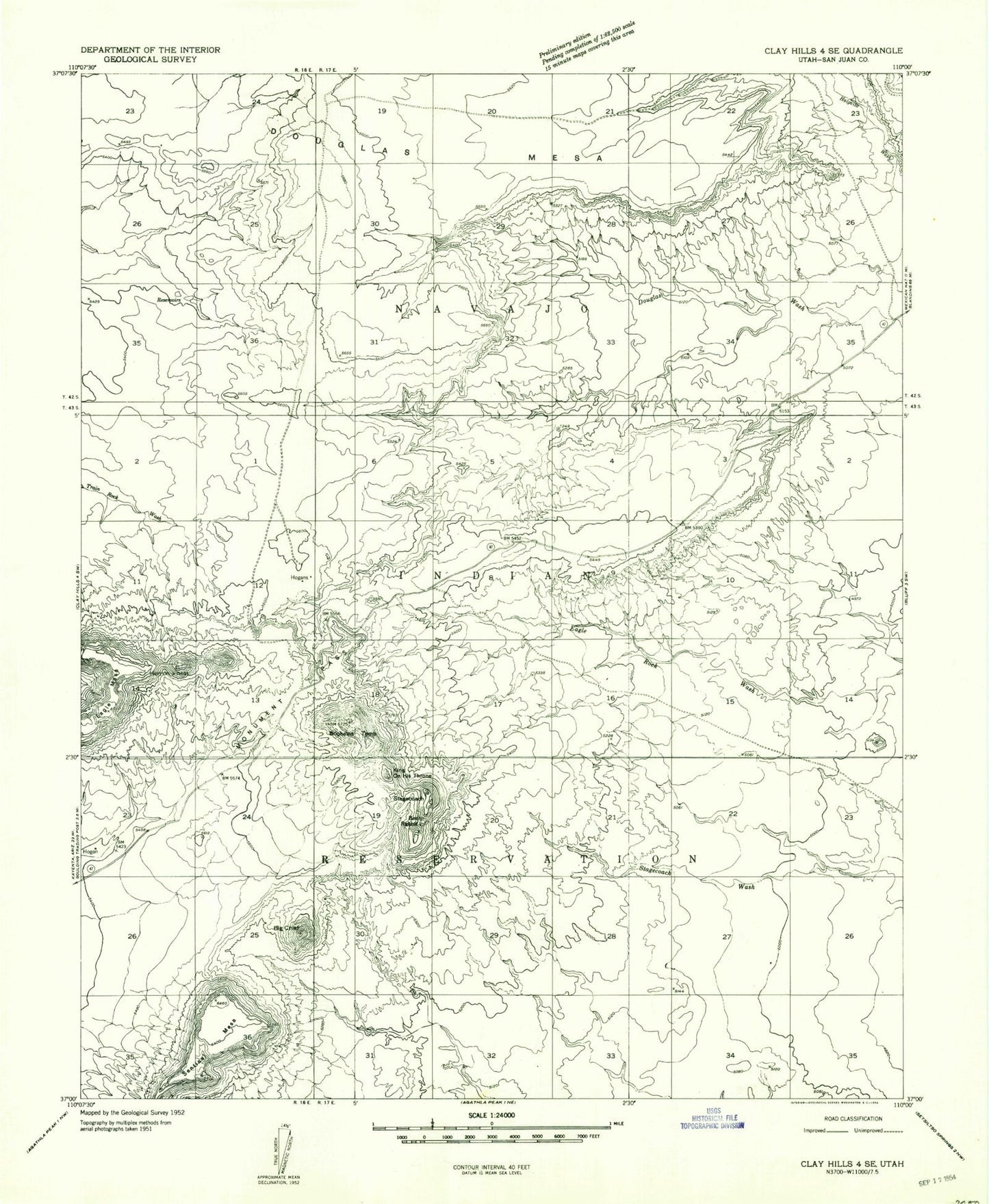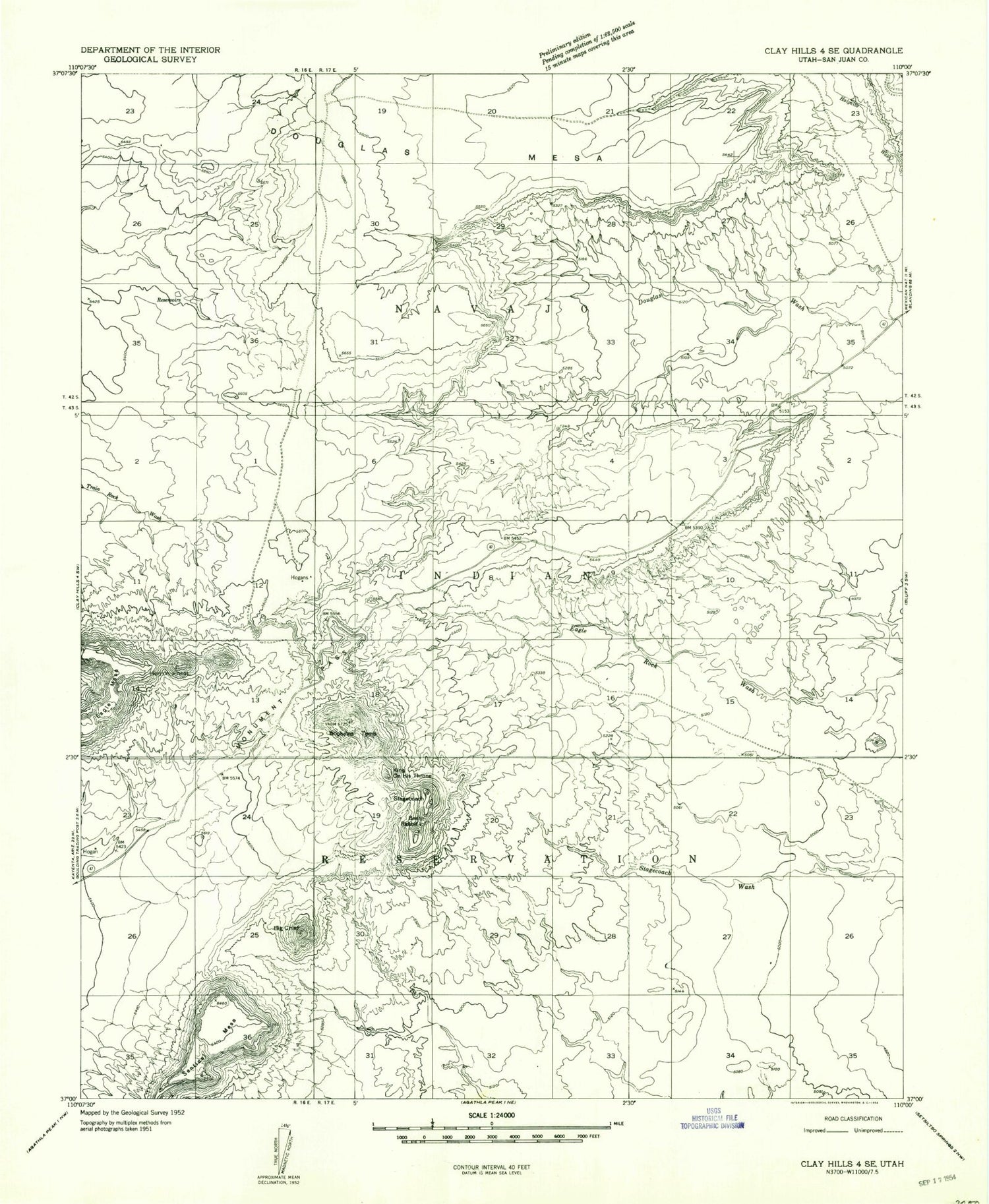
MyTopo
Classic USGS Monument Pass Utah 7.5'x7.5' Topo Map
Regular price
$16.95
Regular price
Sale price
$16.95
Unit price
per
Couldn't load pickup availability
Historical USGS topographic quad map of Monument Pass in the state of Utah. Map scale may vary for some years, but is generally around 1:24,000. Print size is approximately 24" x 27"
This quadrangle is in the following counties: San Juan.
The map contains contour lines, roads, rivers, towns, and lakes. Printed on high-quality waterproof paper with UV fade-resistant inks, and shipped rolled.
Contains the following named places: Bear and Rabbit Summit, Big Indian, Brighams Tomb, Castle Rock, Colorado Plateau, Conical Butte, Eagle Mesa, King-on-his-Throne, Monument Pass, Sentinel Mesa, Setting Hen, Stagecoach