MyTopo
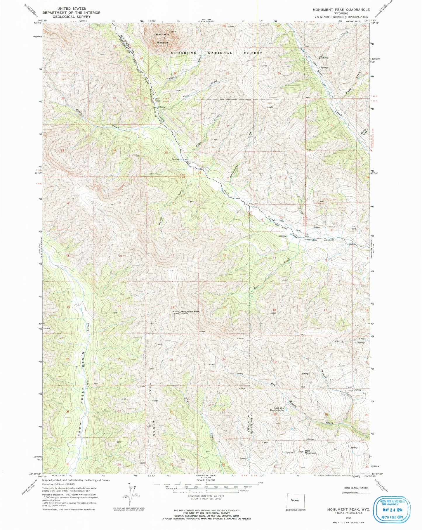
Classic USGS Monument Peak Wyoming 7.5'x7.5' Topo Map
Couldn't load pickup availability
Historical USGS topographic quad map of Monument Peak in the state of Wyoming. Map scale may vary for some years, but is generally around 1:24,000. Print size is approximately 24" x 27"
This quadrangle is in the following counties: Fremont, Hot Springs.
The map contains contour lines, roads, rivers, towns, and lakes. Printed on high-quality waterproof paper with UV fade-resistant inks, and shipped rolled.
Contains the following named places: Additional Creek, Bald Mountain, Bear Creek, Black Draw, Buckle Draw, Cabin Creek, Crow Creek Basin, Devils Hole, Fall Creek, Hulse Creek, Klicker Creek, Little Dry Muddy Spring, Muddy Monument Peak, Needle Creek, Trail Ridge, Vass Creek, Washakie Needles, Willow Creek