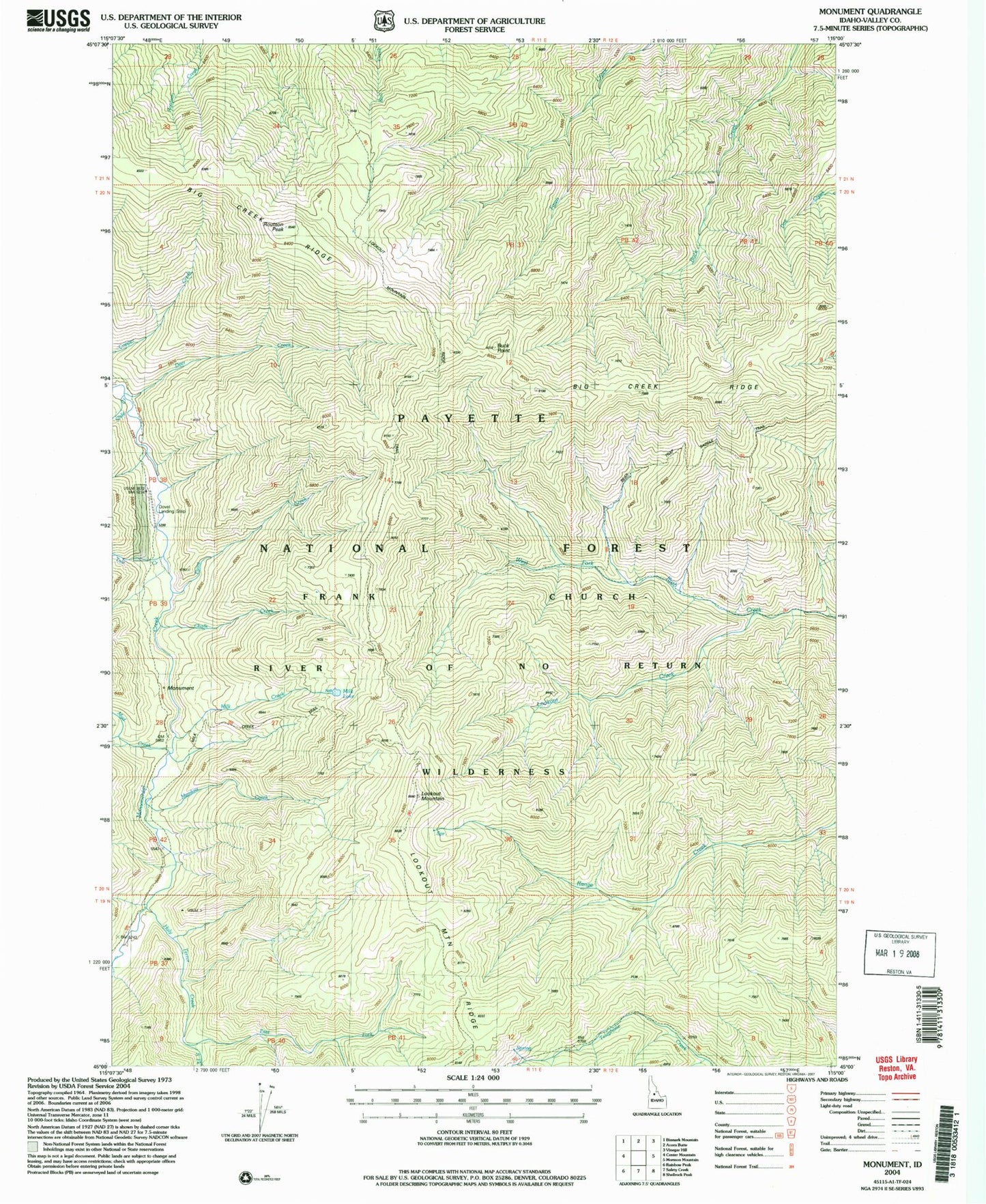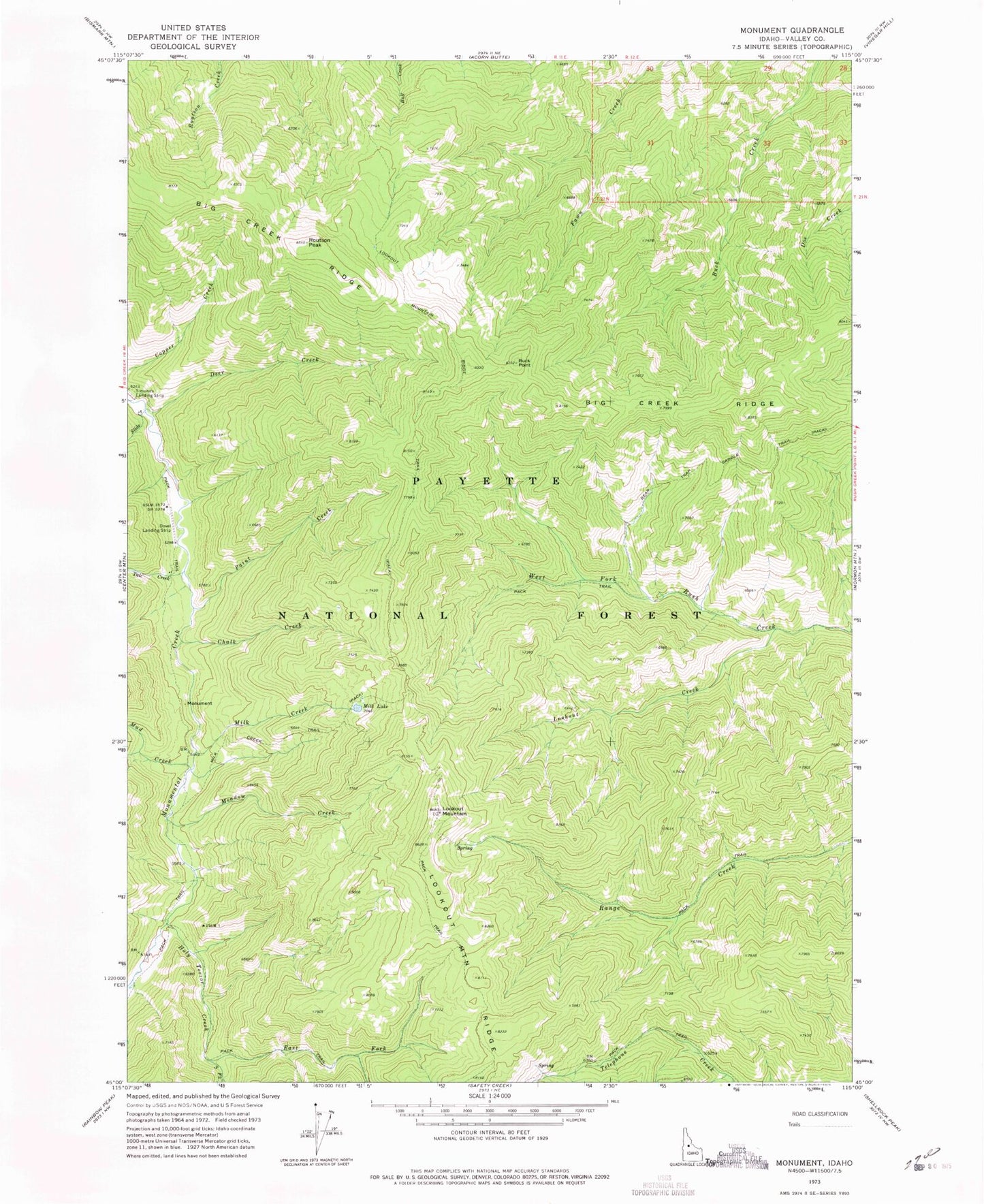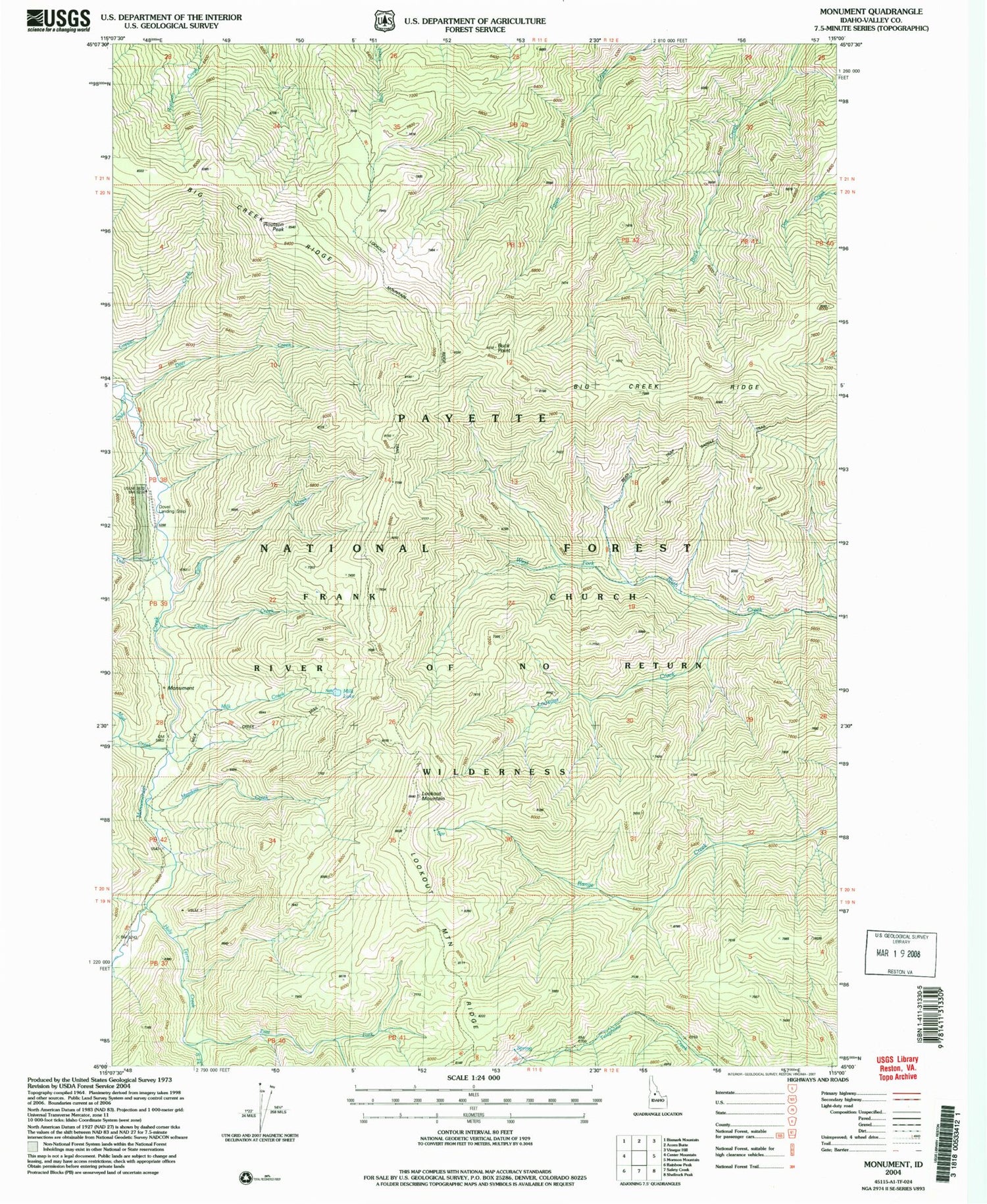
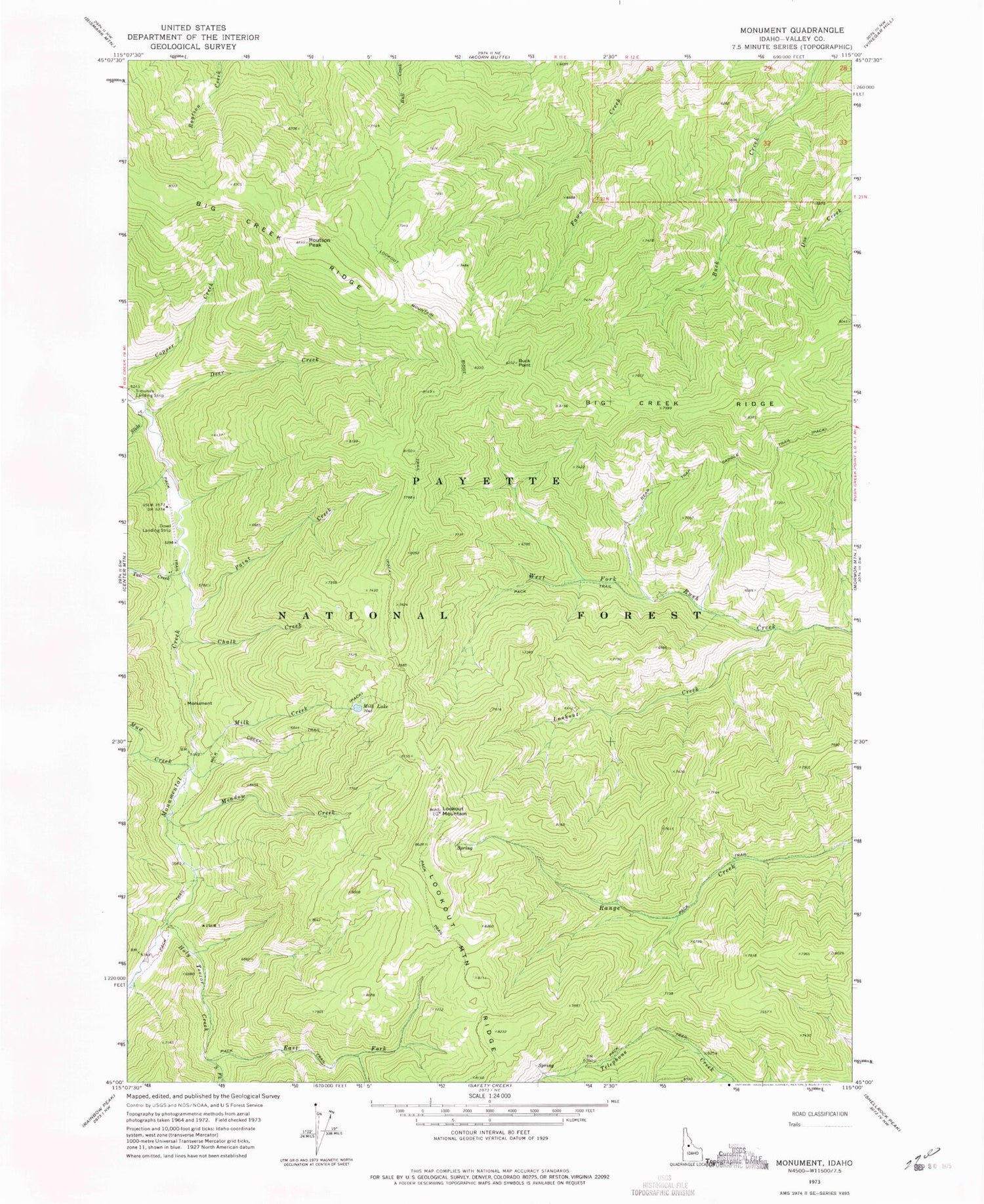
MyTopo
Classic USGS Monument Idaho 7.5'x7.5' Topo Map
Couldn't load pickup availability
Historical USGS topographic quad map of Monument in the state of Idaho. Map scale may vary for some years, but is generally around 1:24,000. Print size is approximately 24" x 27"
This quadrangle is in the following counties: Valley.
The map contains contour lines, roads, rivers, towns, and lakes. Printed on high-quality waterproof paper with UV fade-resistant inks, and shipped rolled.
Contains the following named places: Buck Point, Chalk Creek, Deer Creek, East Fork Holy Terror Creek, Holy Terror Creek, Lookout Creek, Lookout Mountain, Lookout Mountain Ridge, Lookout Mountain Ridge Trail, Meadow Creek, Milk Creek, Milk Creek Trail, Milk Lake, Mud Creek, Paint Creek, Slide Creek, South Fork Holy Terror Creek, Talc Creek