MyTopo
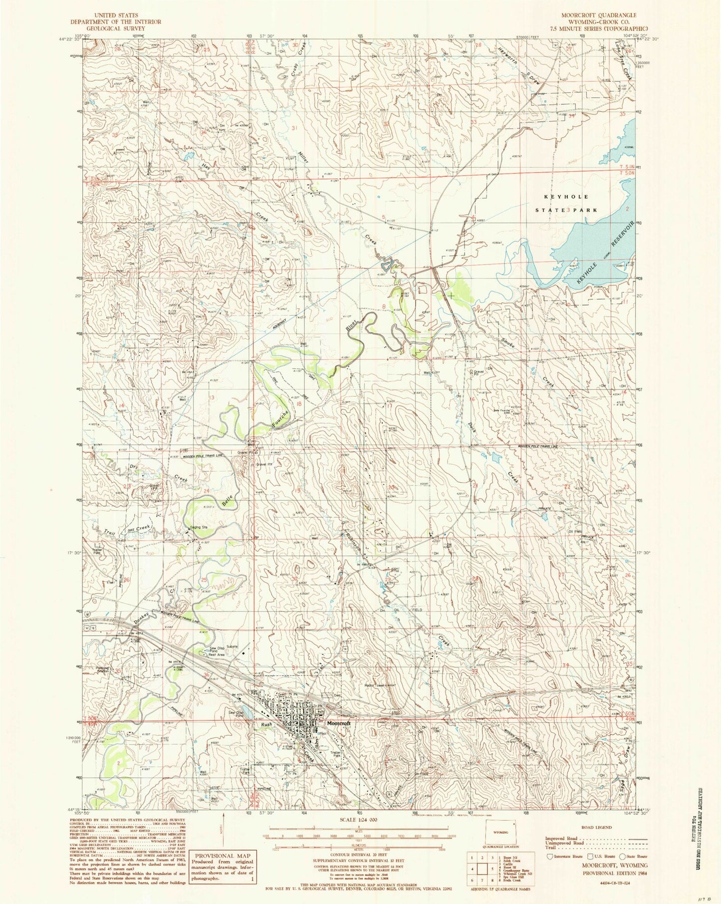
Classic USGS Moorcroft Wyoming 7.5'x7.5' Topo Map
Couldn't load pickup availability
Historical USGS topographic quad map of Moorcroft in the state of Wyoming. Map scale may vary for some years, but is generally around 1:24,000. Print size is approximately 24" x 27"
This quadrangle is in the following counties: Crook.
The map contains contour lines, roads, rivers, towns, and lakes. Printed on high-quality waterproof paper with UV fade-resistant inks, and shipped rolled.
Contains the following named places: Crazy Creek, Donkey Creek, Dry Creek, Duck Creek, Hay Creek, Hayworth Draw, Miller Creek, Moorcroft, Moorcroft Cemetery, Moorcroft High School, Moorcroft Junior High School, Moorcroft Police Department, Moorcroft Post Office, Moorcroft School, Moorcroft Volunteer Fire Department, Robinson Creek, Robinson Ranch, Rush Creek, Schuricht Ranch, Smoke Creek, Town of Moorcroft, Trail Creek