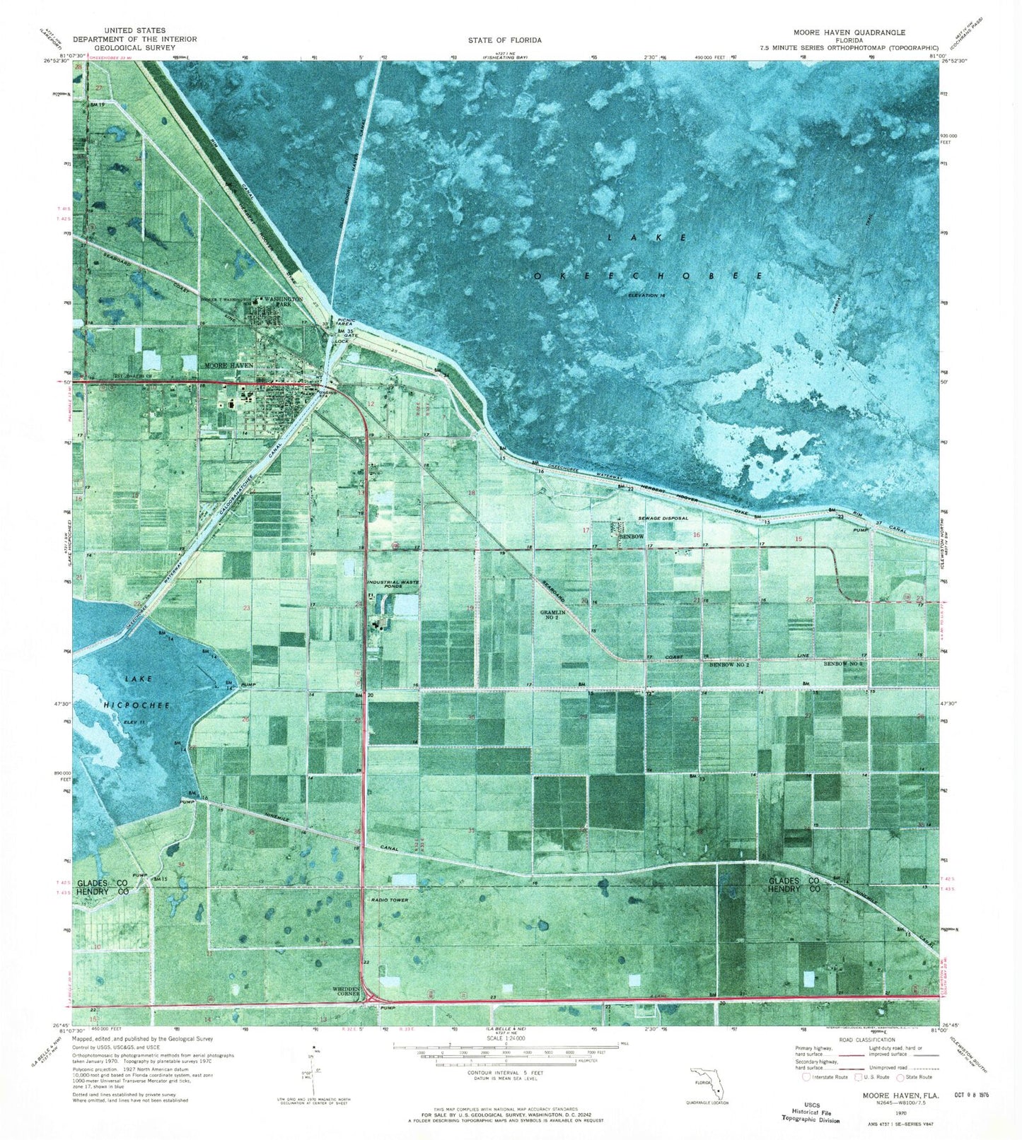
MyTopo
Classic USGS Moore Haven Florida 7.5'x7.5' Topo Map
Couldn't load pickup availability
Historical USGS topographic quad map of Moore Haven in the state of Florida. Map scale may vary for some years, but is generally around 1:24,000. Print size is approximately 24" x 27"
This quadrangle is in the following counties: Glades, Hendry.
The map contains contour lines, roads, rivers, towns, and lakes. Printed on high-quality waterproof paper with UV fade-resistant inks, and shipped rolled.
Contains the following named places: Benbow, Benbow Number Three, Benbow Number Two, Booker T Washington School, Church of God of Moore Haven, City of Moore Haven, First Baptist Church, Glades County Emergency Management, Glades County Jail, Glades County Public Library, Glades County Sheriff's Office, Gramlin Number Two, Hilliard's Private Airport, Holbrook Trailer Park, Moore Haven, Moore Haven Adult Education Center, Moore Haven Bridge, Moore Haven Correctional Facility, Moore Haven Elementary School, Moore Haven Junior - Senior High School, Moore Haven Post Office, Moore Haven Trailer Park, Moore Haven Volunteer Fire Department, New Hope Baptist Church, Ninemile Canal, Okeechobee Waterway, Robert's Trailer Park, Saint Josephs Church, Washington Park, Whidden Corner