MyTopo
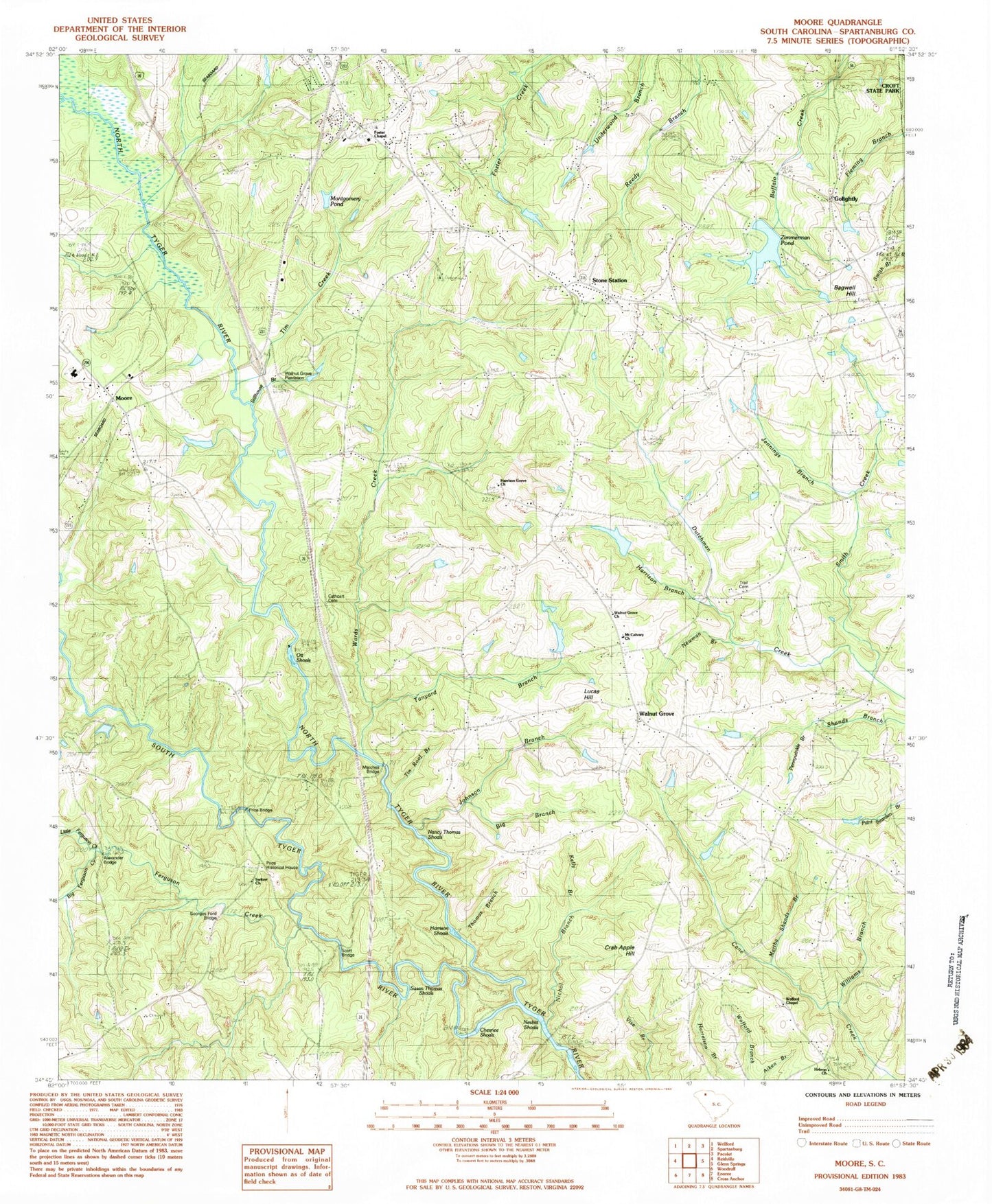
Classic USGS Moore South Carolina 7.5'x7.5' Topo Map
Couldn't load pickup availability
Historical USGS topographic quad map of Moore in the state of South Carolina. Map scale may vary for some years, but is generally around 1:24,000. Print size is approximately 24" x 27"
This quadrangle is in the following counties: Spartanburg.
The map contains contour lines, roads, rivers, towns, and lakes. Printed on high-quality waterproof paper with UV fade-resistant inks, and shipped rolled.
Contains the following named places: Alexander Bridge, Big Branch, Big Ferguson Creek, Cathcart Cemetery, Center Point Baptist Church Graveyard, Chesnee Shoals, Crab Apple Hill, Crooked Fence Farm Airport, Ferguson Creek, Foster Chapel Baptist Church, Foster Chapel Baptist Church Cemetery, Foster School, Gatewood, George Ford Bridge, Golightly, Golightly Church, Golightly Harris Cemetery, Golightly School, Golightly United Methodist Church, Harrison Branch, Harrison Grove Baptist Church, Harrison Grove School, Harrison Shoals, Hebron United Methodist Church, Hebron United Methodist Graveyard, Holiness Church, Jennings Branch, Johnson Branch, Kelly Branch, L E Gable Middle School, Little Ferguson Creek, Lucas Hill, Marches Bridge, Martha Shands Branch, Middle Tyger River, Millville, Montgomery Pond, Moore, Moore Church, Moore School, Moores Bridge, Moores Chapel Baptist Church Cemetery, Mount Calvary Presbyterian Church, Mount Calvary Presbyterian Church Graveyard, Nancy Thomas Shoals, Nesbit Shoals, Nesbitt School, Nesbitts Bridge, Newman Branch, Nichol Branch, North Tyger River, Old Golightly Mill, Ott Shoals, Pauline Division, Pennywinkle Branch, Pine Grove School, Price Bridge, Price Historical House, Prices Post Office, R P Anderson Area Vocational Center, Riverside School, Roebuck Fire Department Station 1, Roebuck Primary School, Rogers Bridge, Scott Bridge, Sherberts Lake, Smith Creek, Smiths Tavern, South Carolina Noname 42009 D-3357 Dam, South Carolina Noname 42021 D-3358 Dam, South Tyger River, Spartanburg County Cemetery, Stillhouse Branch, Stone Station, Stone Station Church, Susan Thomas Shoals, Switzer Church, Switzer Church of God Graveyard, Tanyard Branch, Thomas Branch, Tim Creek, Tin Roof Branch, Trail Cemetery, Underwood School, Walnut Grove, Walnut Grove Plantation, Walnut Grove School, Walnut Grove United Methodist Church, Walnut Grove United Methodist Church Graveyard, Wards Creek, Williams Branch, Wofford Chapel, Zimmerman Pond, ZIP Code: 29376