MyTopo
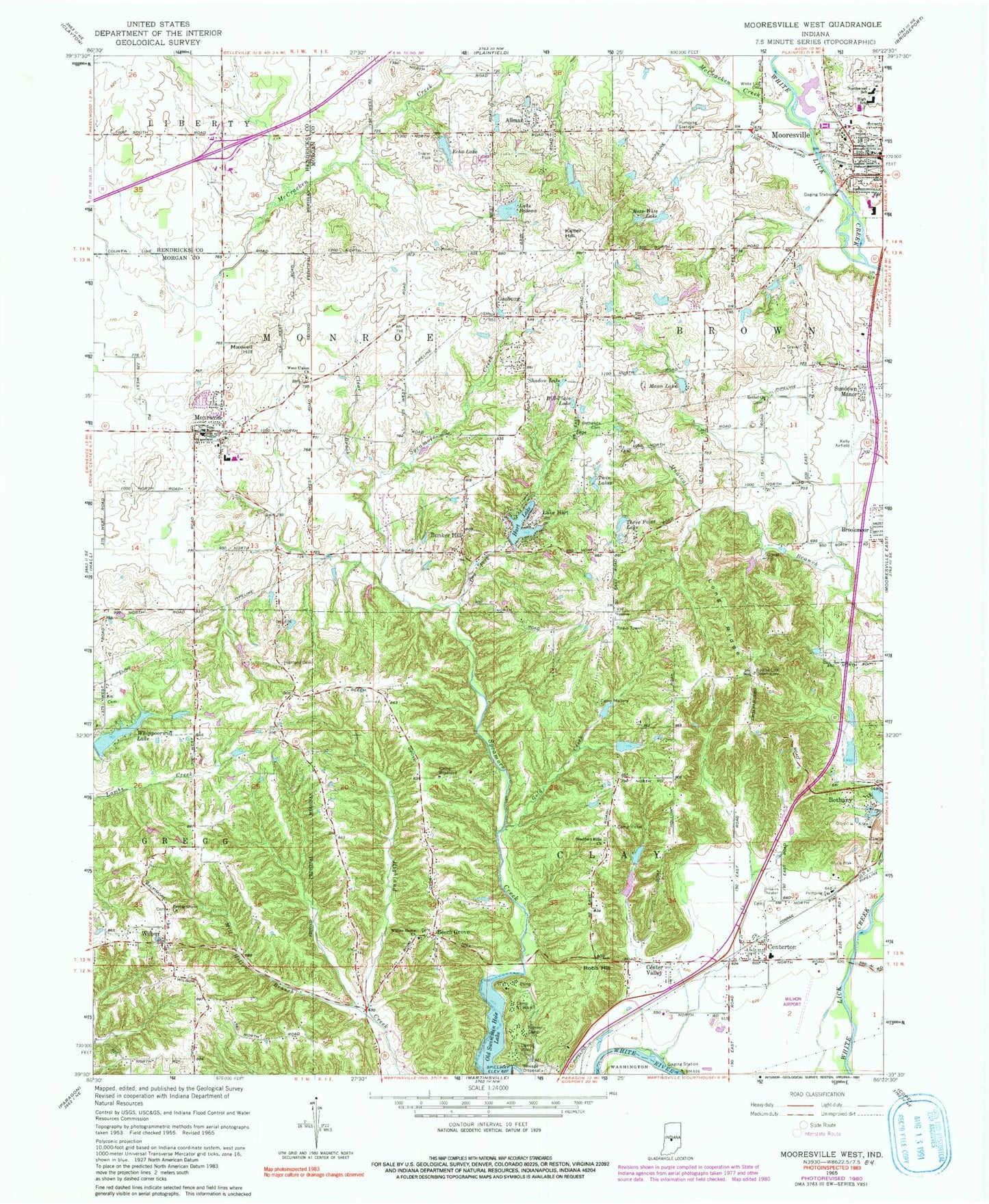
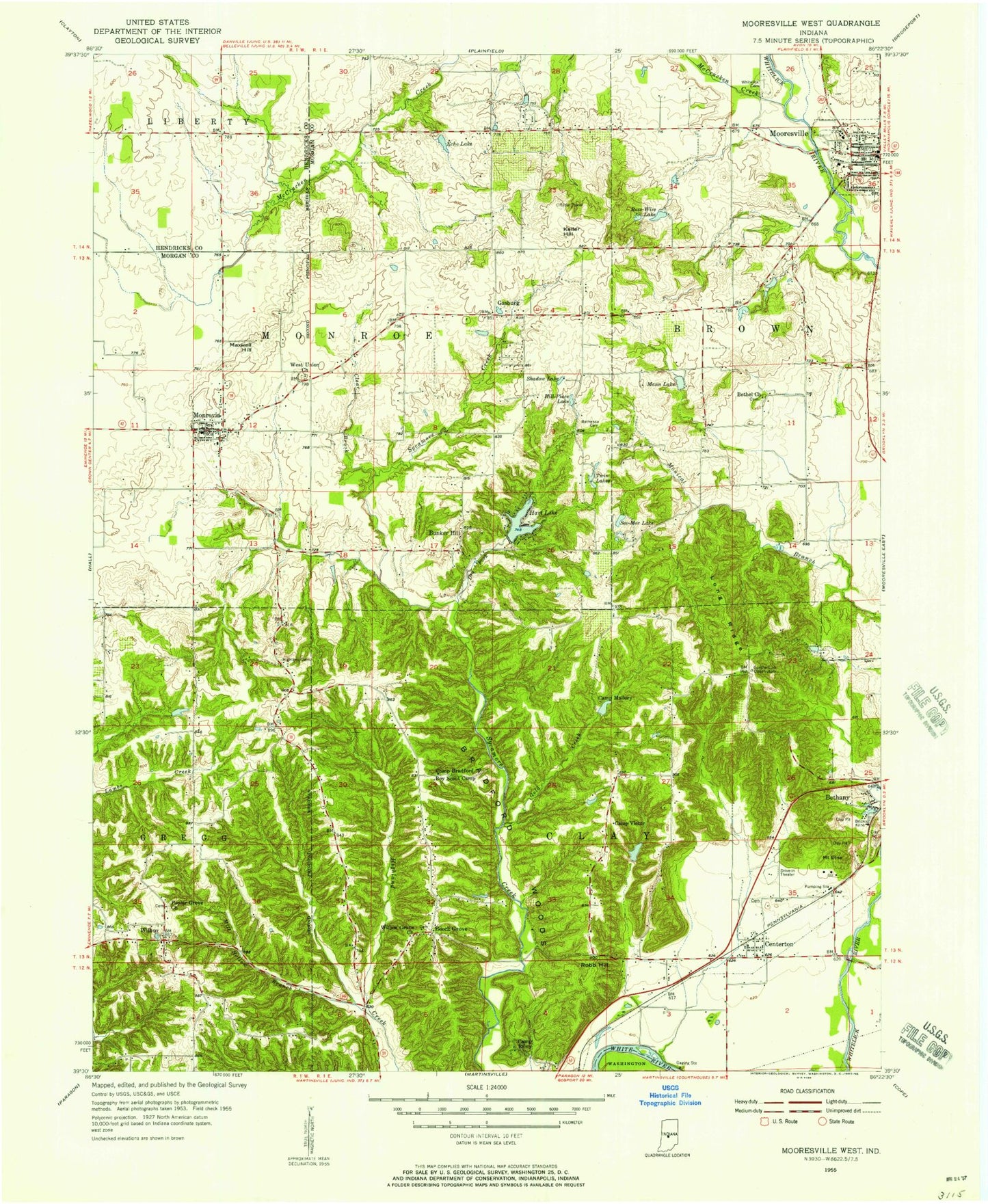
Classic USGS Mooresville West Indiana 7.5'x7.5' Topo Map
Couldn't load pickup availability
Historical USGS topographic quad map of Mooresville West in the state of Indiana. Typical map scale is 1:24,000, but may vary for certain years, if available. Print size: 24" x 27"
This quadrangle is in the following counties: Hendricks, Morgan.
The map contains contour lines, roads, rivers, towns, and lakes. Printed on high-quality waterproof paper with UV fade-resistant inks, and shipped rolled.
Contains the following named places: Allman, Beech Grove, Bethany, Bethel Friends Meetinghouse, Bethesda Cemetery, Lake Bodona, Bradford Hills Church, Bradford Woods State Reservation, Bunker Hill, Camp Bradford, Camp Mallory, Camp Riley, Camp To-Wa-Ki, Camp Victor, Center Valley, Clear Brook, Dry Fork, Echo Lake, Gold Creek, Hart Lake, Highland Cemetery, Hill-Place Lake, Keller Hill, Long Ridge, Mann Lake, McCracken Creek, Mill Hollow Branch, Monrovia, Northwood Elementary School, Old Swimmin Hole Lake, Pioneer Camp, Poplar Grove Church, Robb Hill, Ross-Wise Lake, Shadow Lake, Sundown Manor, Three Point Lake, Saint Mary-of-the-Woods Lake, West Union Church, Whippoorwill Lake, Wilbur, Willow Grove Nazarene Church, Monrovia Elementary School, Monrovia Junior-Senior High School, Mooresville High School, Centerton Elementary School, Gasburg, Whippoorwill Lake Dam, Merrywood Lake, Phil Bright Dam, Echo Lake Dam, Hart Lake Dam, Lake Bodana Dam, Cox Lake Dam, Cox Lake, Three Point Lake Dam, Armstrong Lake, Armstrong Lake Dam, Monical Lake Dam, Monical Lake, Arnold Lake Dam, Arnold Lake, Bray Lake, Milhon Airport, Kellys Airfield (historical), Berling Airport (historical), Centerton, Goethe Link Observatory, Township of Brown, Township of Clay, Township of Monroe, Lake Hart, White Lick Friends Cemetery, Community Church of Christ, Monrovia Church of the Nazarene, Monrovia United Methodist Church, First Baptist Church, Gasburg Baptist Church, Mooresville Friends Church, Town of Bethany, Town of Monrovia, Country Manor Estates, Four J's Mobile Home Park, Mooresville Fire Department, Gregg Township Fire Department, Brooklyn Volunteer Fire Department Station 2, Monroe Township Volunteer Fire Department, Adams Pit, Centerbrook Drive-In, Pegasus Farms Airfield, Monroe Township Fire Station 2, Mooresville Fire Station 1, Monrovia Police Department, Mooresville Post Office, Monrovia Post Office