MyTopo
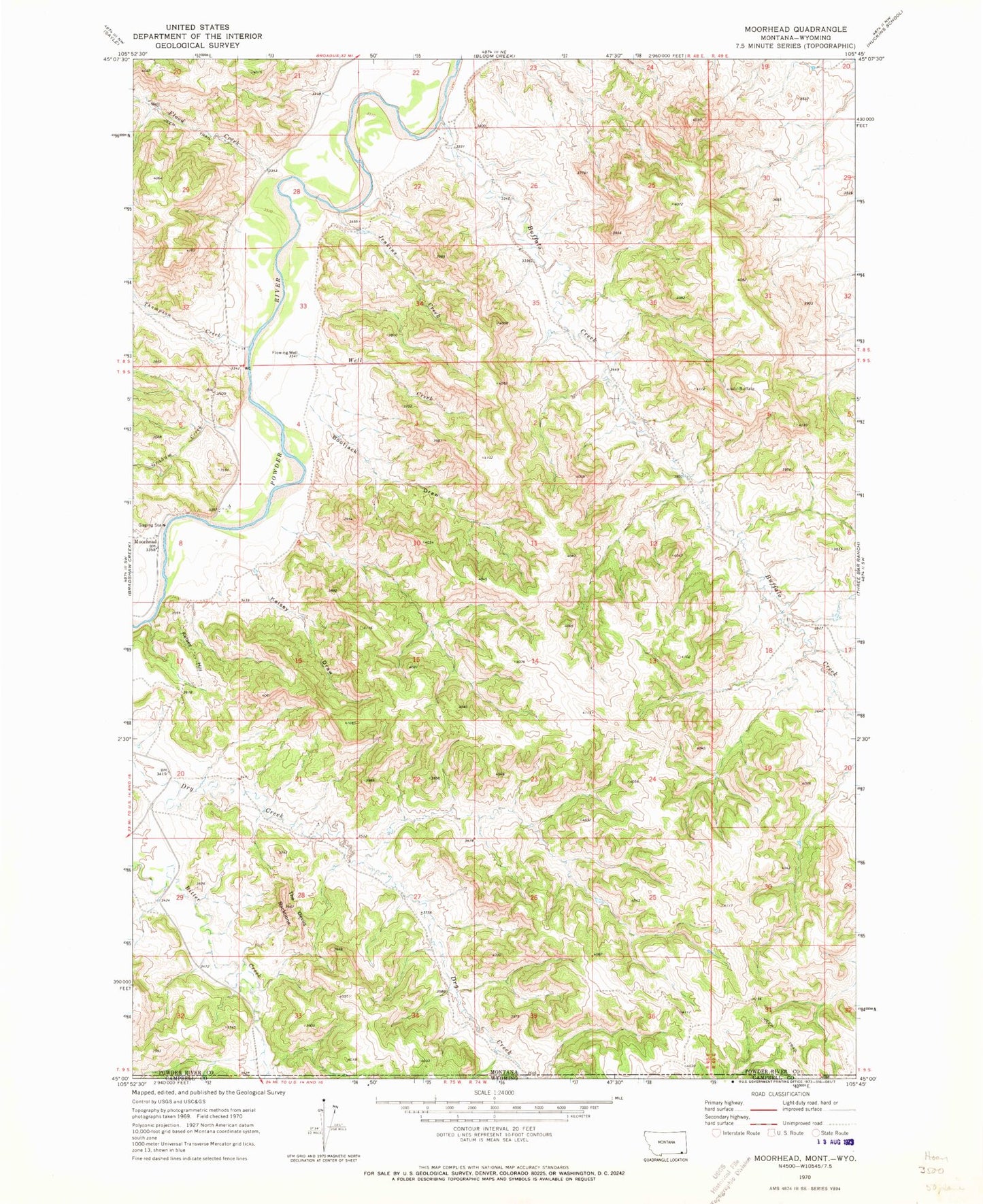
Classic USGS Moorhead Montana 7.5'x7.5' Topo Map
Couldn't load pickup availability
Historical USGS topographic quad map of Moorhead in the state of Montana. Typical map scale is 1:24,000, but may vary for certain years, if available. Print size: 24" x 27"
This quadrangle is in the following counties: Campbell, Powder River.
The map contains contour lines, roads, rivers, towns, and lakes. Printed on high-quality waterproof paper with UV fade-resistant inks, and shipped rolled.
Contains the following named places: Bootjack Draw, Buffalo Creek, Jenkins Creek, Kelsey Draw, Kelsey Hill, Moorhead, The Devils Backbone, Thompson Creek, Well Creek, Flood Creek, Graham Creek, 09S48E27DBCB01 Well, 09S48E08CDB_01 Well, 09S48E08CABC01 Well, 09S48E12AC__01 Well, 09S48E05ACDC01 Well, 09S48E05AC__01 Well, 09S48E05ACDD01 Well, 09S48E01BBDB01 Well, 08S49E32CB__01 Well, East Thompson Creek, Cliff Creek