MyTopo
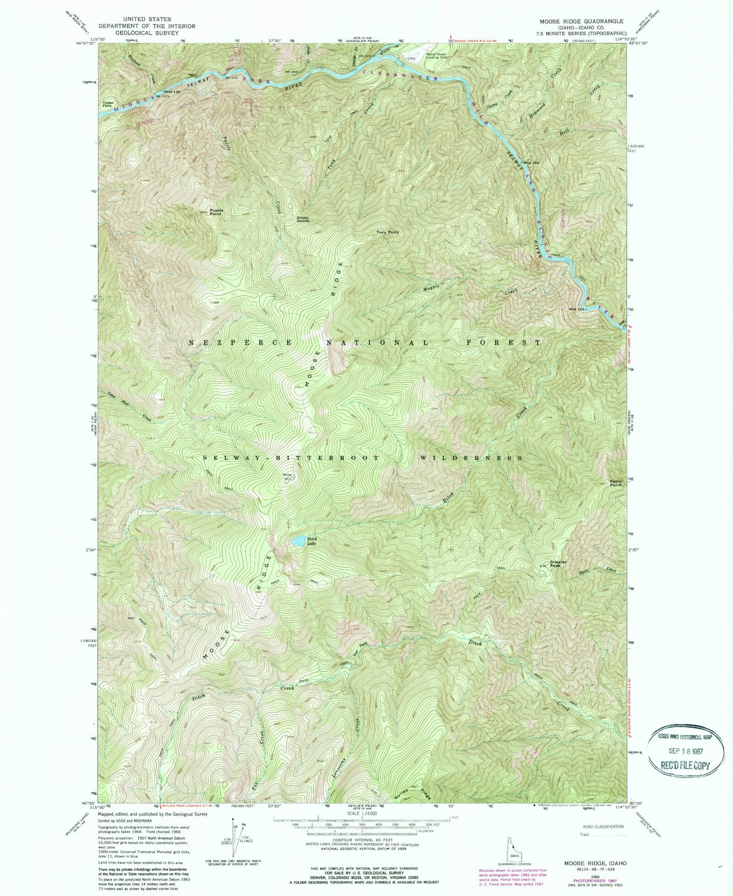
Classic USGS Moose Ridge Idaho 7.5'x7.5' Topo Map
Couldn't load pickup availability
Historical USGS topographic quad map of Moose Ridge in the state of Idaho. Typical map scale is 1:24,000, but may vary for certain years, if available. Print size: 24" x 27"
This quadrangle is in the following counties: Idaho.
The map contains contour lines, roads, rivers, towns, and lakes. Printed on high-quality waterproof paper with UV fade-resistant inks, and shipped rolled.
Contains the following named places: Shearer Peak, Bitch Creek, Bitch Lake, Cedar Flats, Clamp Creek, Dog Creek, Fox Creek, Fox Park, Grizzly Saddle, Halfway Creek, Hell Creek, Hopwood Creek, Jake Creek, Lonesome Creek, Magpie Creek, Moose Creek, Moose Ridge, Puzzle Creek, Parsell Point, Tony Creek, Tony Point, Patrol Point, Cedar Flats Campground, Divide Creek, Double Drop Rapids