MyTopo
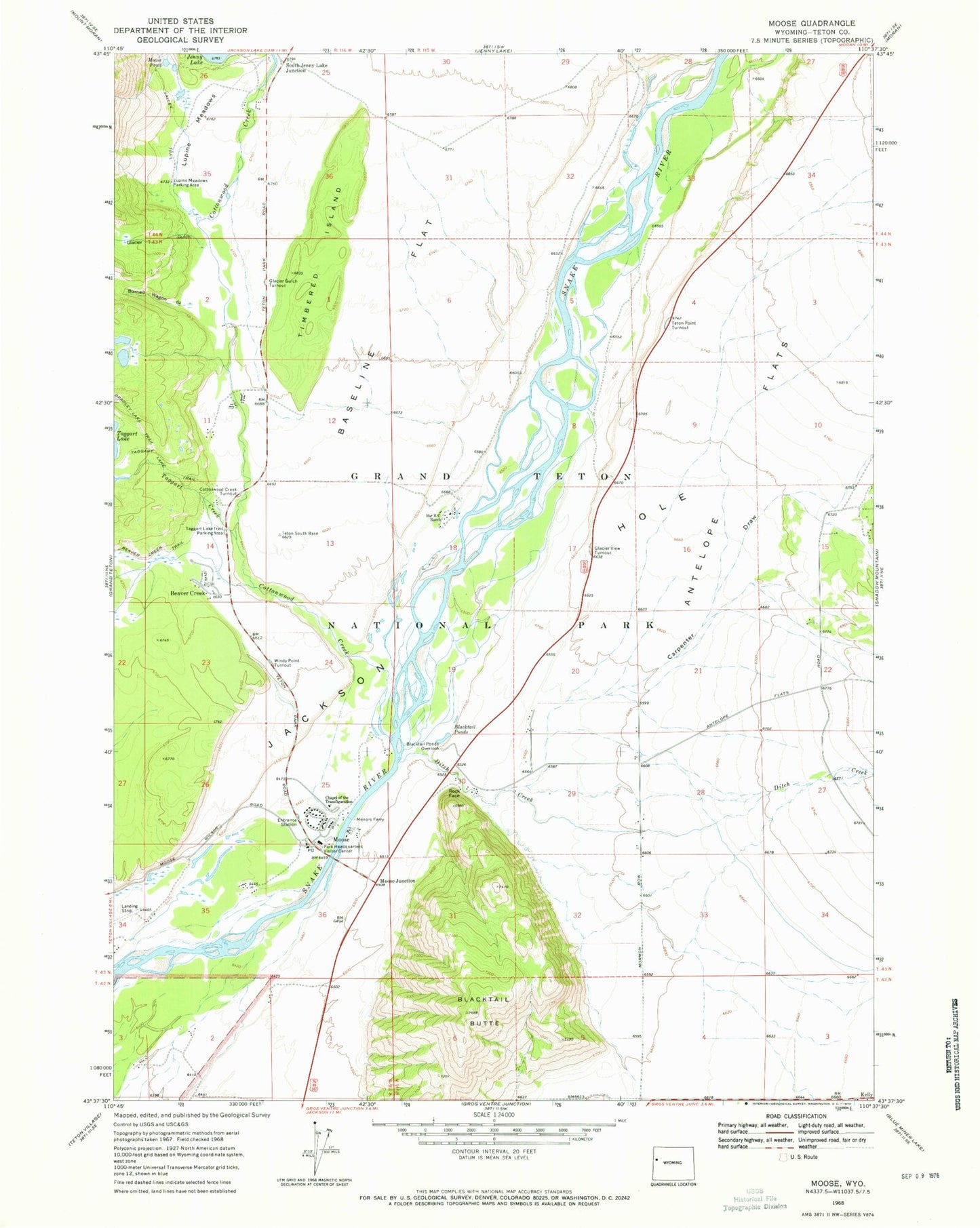
Classic USGS Moose Wyoming 7.5'x7.5' Topo Map
Couldn't load pickup availability
Historical USGS topographic quad map of Moose in the state of Wyoming. Typical map scale is 1:24,000, but may vary for certain years, if available. Print size: 24" x 27"
This quadrangle is in the following counties: Teton.
The map contains contour lines, roads, rivers, towns, and lakes. Printed on high-quality waterproof paper with UV fade-resistant inks, and shipped rolled.
Contains the following named places: Bar B C Ranch, Baseline Flat, Blacktail Ponds, Blacktail Ponds Overlook, Bradley Lake Trail, Burned Wagon Gulch, Chapel of the Transfiguration, Cottonwood Creek, Cottonwood Creek Turnout, Glacier Gulch Turnout, Glacier View Turnout, Lupine Meadows, Menors Ferry, Moose, Moose Pond, Rock Face, Taggart Lake Trail, Teton Point Turnout, Timbered Island, Valley Trail, Windy Point Turnout, Grovont, Glacier Creek, Beaver Creek, Moose Junction, South Jenny Lake Junction, Antelope Flats, Beaver Creek Trail, Blacktail Butte, Carpenter Draw, Ditch Creek, Glacier Gulch, Taggart Creek, Jackson Hole, Grand Teton National Park / Moose and Colter Bay Fire Department, Moose Post Office, Snake River Headwaters Wild and Scenic River