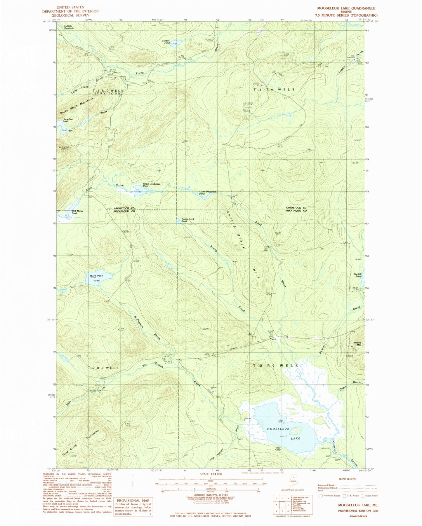
MyTopo
Classic USGS Mooseleuk Lake Maine 7.5'x7.5' Topo Map
Couldn't load pickup availability
Historical USGS topographic quad map of Mooseleuk Lake in the state of Maine. Map scale may vary for some years, but is generally around 1:24,000. Print size is approximately 24" x 27"
This quadrangle is in the following counties: Aroostook, Piscataquis.
The map contains contour lines, roads, rivers, towns, and lakes. Printed on high-quality waterproof paper with UV fade-resistant inks, and shipped rolled.
Contains the following named places: Bartlett Brook, Big Hudson Brook, Blind Brook, Caribou Pond, Chase Brook, Horseshoe Mountain Lookout Tower, Horseshoe Pond, Little Hudson Brook, Little Rocky Brook, Lower Deadwater Pond, McNally Deadwater, McPherson Brook, McPherson Pond, Mink Marsh Pond, Mooseleuk Lake, Mule Brook, Number One Brook, Shaw Camp, Spring Brook, Spring Brook Hill, Spring Brook Pond, T10 R9 WELS, T11 R9 WELS, Upper Deadwater Pond