MyTopo
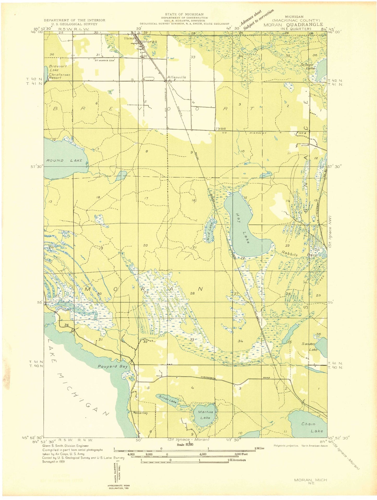
Classic USGS Moran Michigan 7.5'x7.5' Topo Map
Couldn't load pickup availability
Historical USGS topographic quad map of Moran in the state of Michigan. Map scale may vary for some years, but is generally around 1:24,000. Print size is approximately 24" x 27"
This quadrangle is in the following counties: Mackinac.
The map contains contour lines, roads, rivers, towns, and lakes. Printed on high-quality waterproof paper with UV fade-resistant inks, and shipped rolled.
Contains the following named places: Allenville, Allenville Post Office, Allenville Station, Brevort Township Cemetery, Brevort Township Community Recreation Area, Brevort Township Fairground, Brevort Township Fire Department, Chain Lake, Cranberry Lake, Foley Creek Campground, Gamble Lake, Gros Cap Roadside Park, Hay Lake, Immaculate Conception Cemetery, Kitchens Creek, Lant Lake, Martin Lake, Massey Lake, Moran, Moran Post Office, Moran Station, Moran Work Station, Mud Lake, Pointe aux Chenes Marshes, Poupard Bay, Round Lake, Satago Lake, Silver Lake, Silver Mountain Downhill Ski/Tubing Hill, Sprinkler Lake, Summerby Creek, Summerby Swamp, Trinity Lutheran Church, United States Forest Service Saint Ignace Ranger District, Zion Church, ZIP Code: 49781