
MyTopo
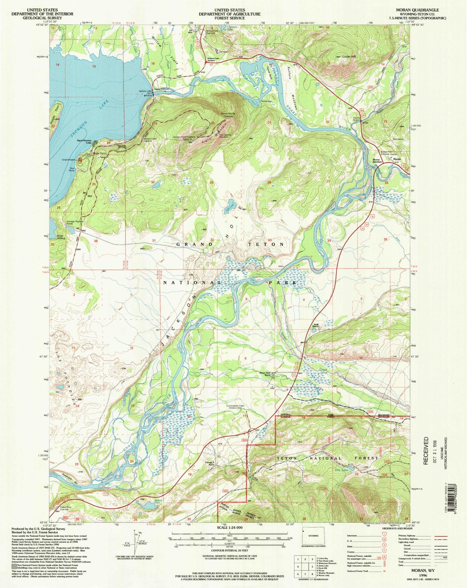
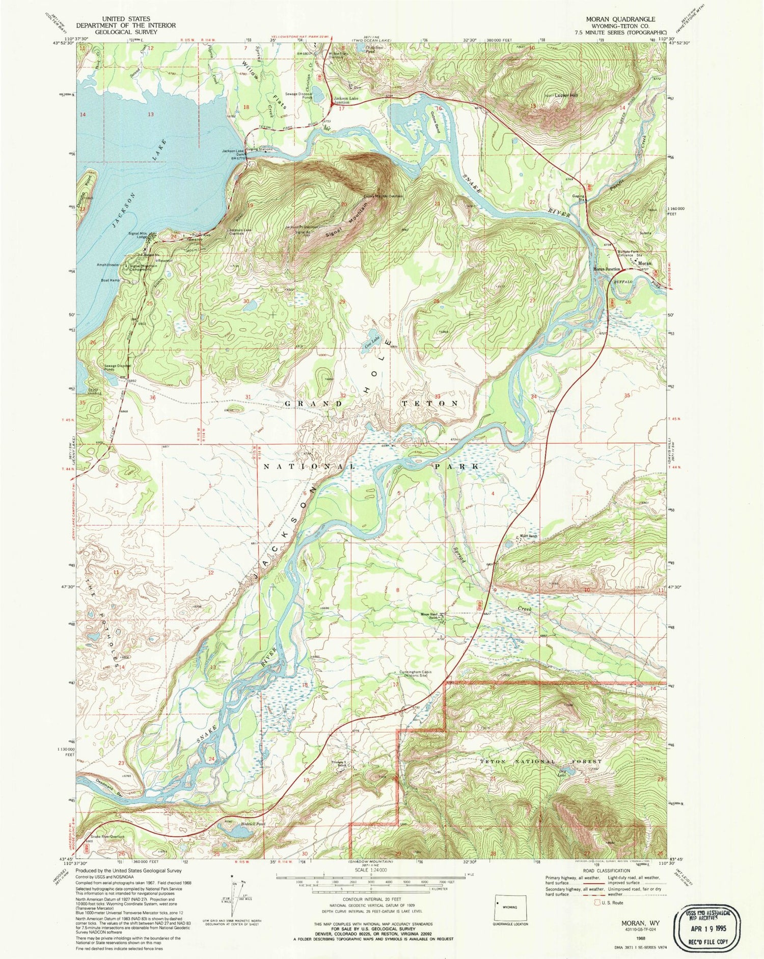
Classic USGS Moran Wyoming 7.5'x7.5' Topo Map
Couldn't load pickup availability
Historical USGS topographic quad map of Moran in the state of Wyoming. Map scale may vary for some years, but is generally around 1:24,000. Print size is approximately 24" x 27"
This quadrangle is in the following counties: Teton.
The map contains contour lines, roads, rivers, towns, and lakes. Printed on high-quality waterproof paper with UV fade-resistant inks, and shipped rolled.
Contains the following named places: Brush Creek, Buffalo Fork, Buffalo Fork Entrance Station, Buffalo Meadow, Christian Creek, Cow Lake, Cowboy Lode Mine, Cunningham Cabin, Deadmans Bar, Dry Lake, Elk, Emma Matilda Overlook, Hedrick Pond, Jackson Hole Fire and Emergency Medical Services - Firehouse 4 Moran, Jackson Lake Dam, Jackson Lake Junction, Jackson Lake Overlook, Jackson Point Overlook, Lozier Hill, Moose Head Ranch, Moran, Moran Cemetery, Moran Junction, Moran Post Office, Moran School, Oxbow Bend, Pacific Creek, Pilgrim Creek, Second Creek, Signal Mountain, Signal Mountain Campground, Signal Mountain Lodge, Snake River Overlook, South Landing, Spread Creek, Spring Creek, The Potholes, Third Creek, Triangle X Ranch, Willow Flats Overlook, Wolff Ranch


