MyTopo
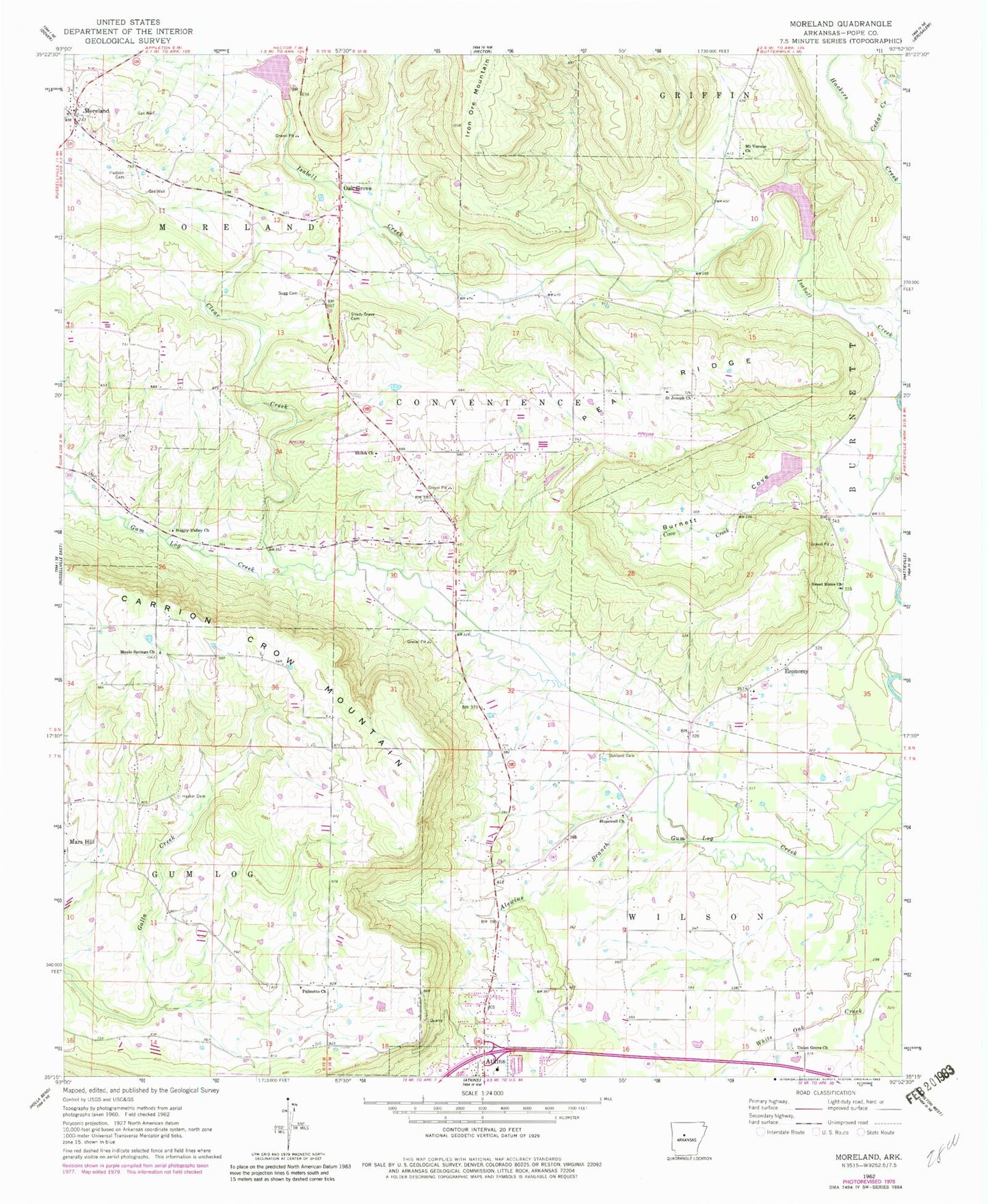
Classic USGS Moreland Arkansas 7.5'x7.5' Topo Map
Couldn't load pickup availability
Historical USGS topographic quad map of Moreland in the state of Arkansas. Map scale may vary for some years, but is generally around 1:24,000. Print size is approximately 24" x 27"
This quadrangle is in the following counties: Pope.
The map contains contour lines, roads, rivers, towns, and lakes. Printed on high-quality waterproof paper with UV fade-resistant inks, and shipped rolled.
Contains the following named places: Alewine Branch, Burnett Cove, Burris Church, Carrion Crow Mountain, Cedar Creek, Clear Creek, Cove Creek, Cove School, Economy, Economy Cumberland Presbyterian Church, Fords Chapel Methodist Episcopal Church, Happy Valley Assembly of God Church, Haskin Cemetery, Hopewell Baptist Church, Hudson Cemetery, Maple Spring School, Maple Springs Freewill Baptist Church, Mars Hill, Mars Hill Cumberland Presbyterian Church, Moreland, Moreland Fire Department, Moreland Post Office, Mount Vernon Church, Oak Grove, Oak Grove Census Designated Place, Oak Grove School, Oakland Cemetery, Oakland School, Palmetto Church, Palmetto School, Pea Ridge, Pea Ridge Rural Fire Department, Saint Joe Cemetery, Saint Joe Freewill Baptist Church, Shady Grove Cemetery, Shiloh Cemetery, Shiloh Church, Shiloh School, Steep Hollow, Sugg Cemetery, Sweet Home Freewill Baptist Church, Township of Burnett, Township of Convenience, Township of Gum Log, Township of Moreland, Union Grove Church, West Fork Point Remove Creek Site 17 Dam, West Fork Point Remove Creek Site 17 Reservoir, West Fork Point Remove Creek Site 18 Dam, West Fork Point Remove Creek Site 18 Reservoir, West Fork Point Remove Creek Site 19 Dam, West Fork Point Remove Creek Site 19 Reservoir, White Oak Creek, ZIP Code: 72823