MyTopo
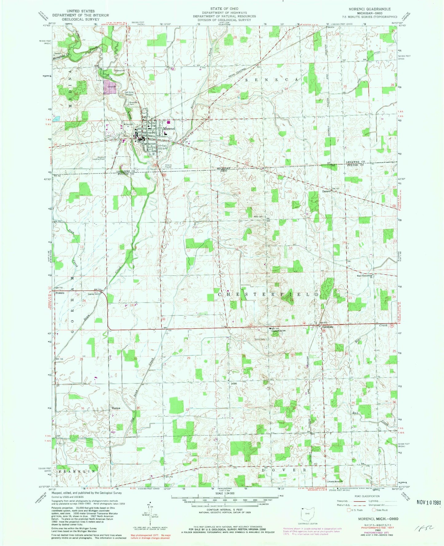
Classic USGS Morenci Michigan 7.5'x7.5' Topo Map
Couldn't load pickup availability
Historical USGS topographic quad map of Morenci in the states of Michigan, Ohio. Map scale may vary for some years, but is generally around 1:24,000. Print size is approximately 24" x 27"
This quadrangle is in the following counties: Fulton, Lenawee.
The map contains contour lines, roads, rivers, towns, and lakes. Printed on high-quality waterproof paper with UV fade-resistant inks, and shipped rolled.
Contains the following named places: Abbot School, Bimo Post Office, Bimo Station, Butler Cemetery, Carter Drain, Chesterfield Dairy, Chesterfield School, Church of the Nazarene, City of Morenci, Clark School, Denson, Denson Post Office, East Chesterfield Christian Church, Emmons Farms, First Baptist Church, First Congregational United Church, Fountain School, Fulton County Health Center, Green Valley Campground, Hochstetler Airport, Inlet, Inlet Mennonite Church, Inlet Post Office, Inlet School, Lime Creek, Mansfield Creek, Morenci, Morenci Area Elementary School, Morenci Area Emergency Medical Services, Morenci Area Middle School, Morenci Bible Fellowship, Morenci City Hall, Morenci Fire Department, Morenci High School, Morenci Police Department, Morenci Post Office, Morenci Station, Morenci United Methodist Church, Murray D Van Wagoner Memorial Bridge Historical Marker, North Dover School, North Dover United Methodist Church, Oak Grove Cemetery, Oakshade, Oakshade Post Office, Patterson School, Pennington Farm Orchards, Powers, Powers School, Prairie School, Riverside Park, Rose Cemetery, Silver Creek, Stair Public Library, Stephenson Park, Stites School, Taft Memorial Highway Historical Marker, Thelma, Thelma Post Office, Township of Chesterfield, Trinity Lutheran Church, Union School, Wakefield Park, ZIP Code: 49256