MyTopo
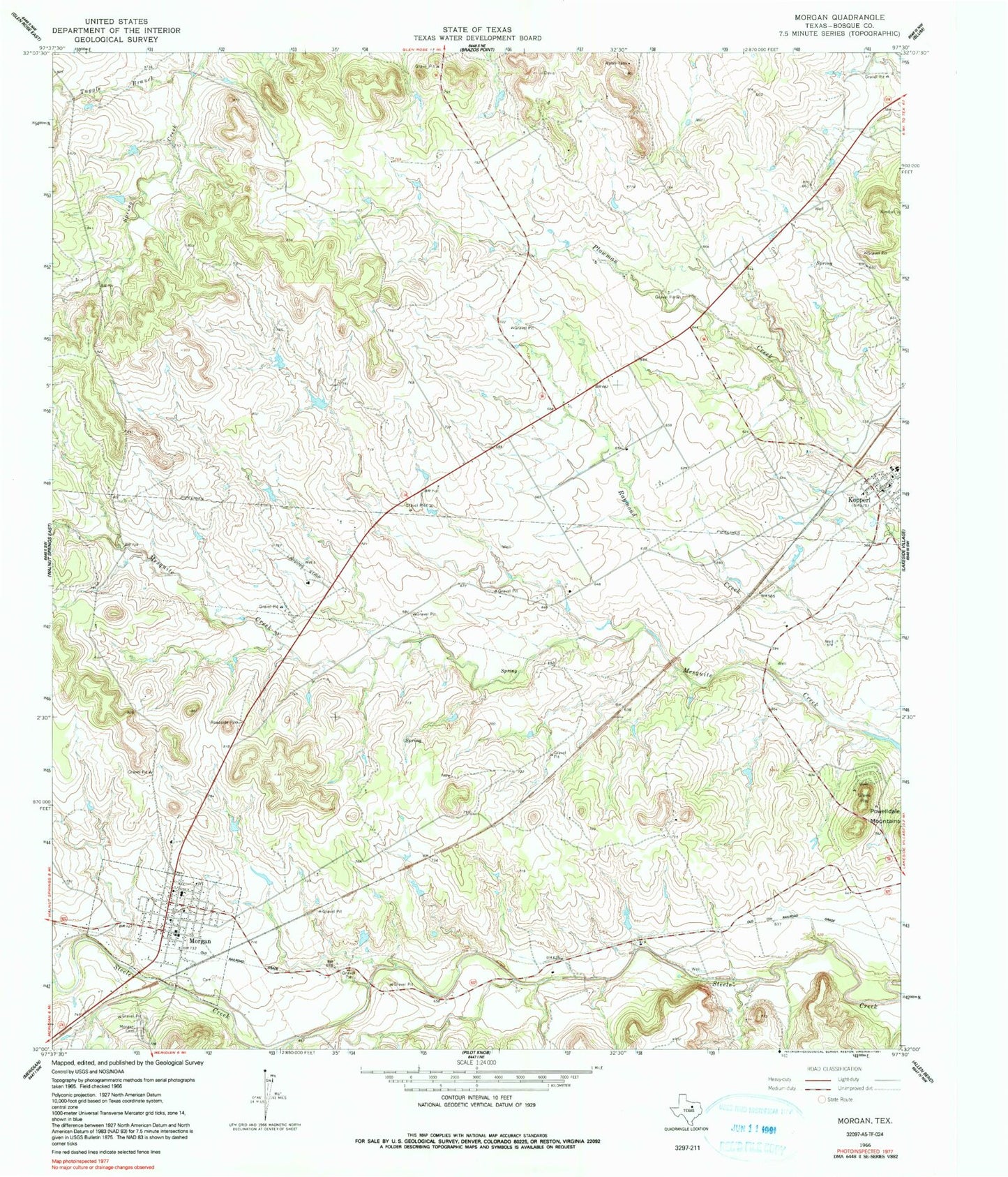
Classic USGS Morgan Texas 7.5'x7.5' Topo Map
Couldn't load pickup availability
Historical USGS topographic quad map of Morgan in the state of Texas. Map scale may vary for some years, but is generally around 1:24,000. Print size is approximately 24" x 27"
This quadrangle is in the following counties: Bosque.
The map contains contour lines, roads, rivers, towns, and lakes. Printed on high-quality waterproof paper with UV fade-resistant inks, and shipped rolled.
Contains the following named places: Boyd Airport, City of Morgan, Diamond Seven Ranch Airport, El Colina Lake Number 5, El Colina Lake Number 5 Dam, El Colina Lake Number 6, El Colina Lake Number 6 Dam, El Colina Lake Number 7, El Colina Lake Number 7 Dam, Kopperl, Kopperl Post Office, Kopperl Volunteer Fire Department, Morgan, Morgan Cemetery, Morgan Post Office, Morgan Volunteer Fire Department, Steele Creek, Tuggle Branch, ZIP Code: 76652