
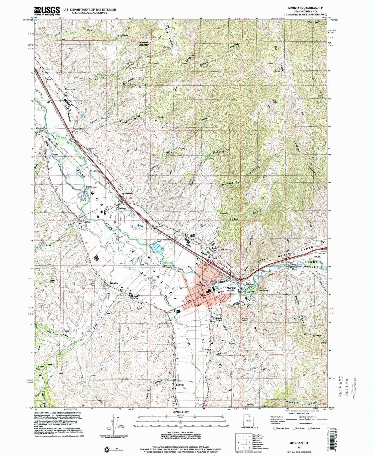
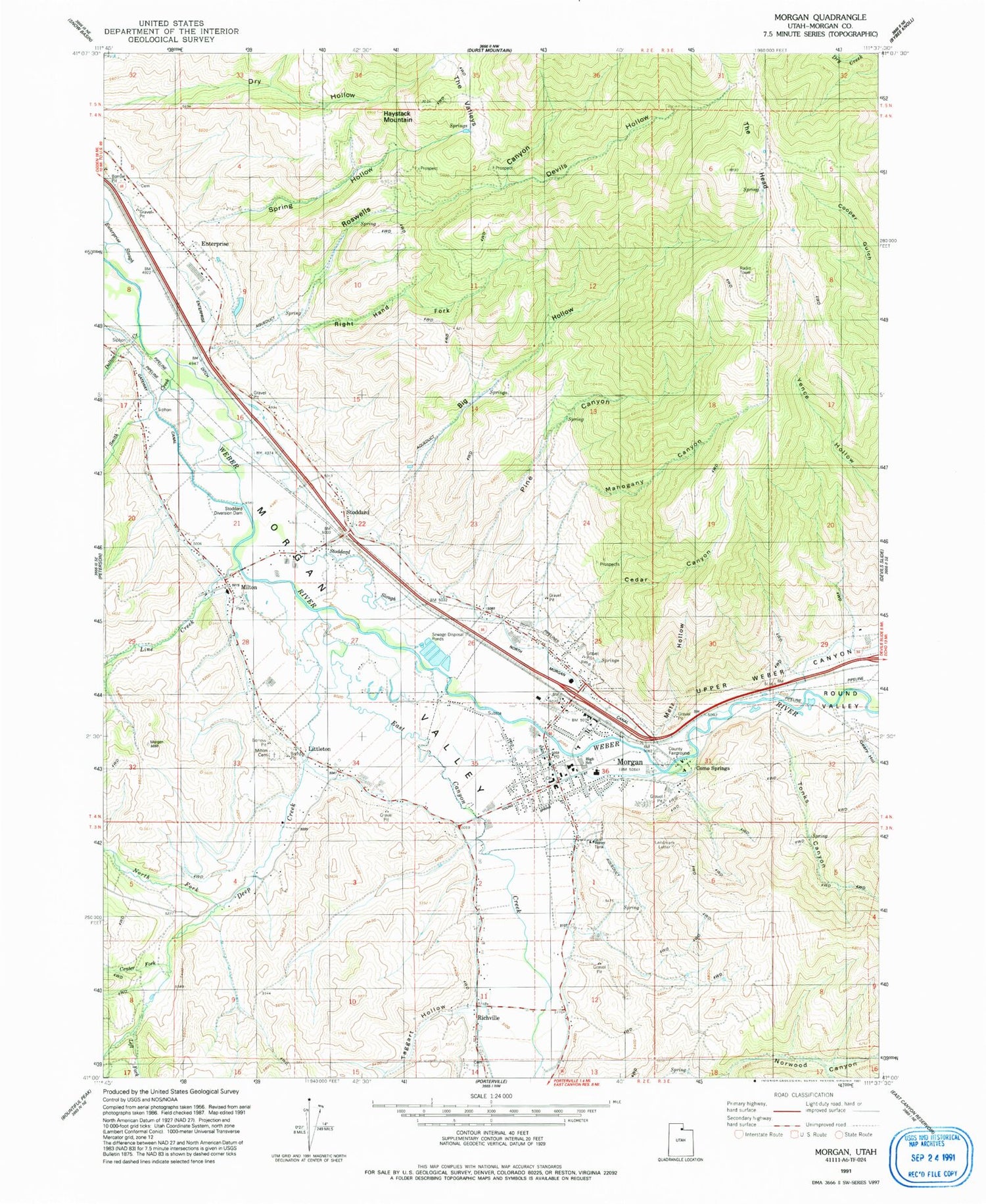
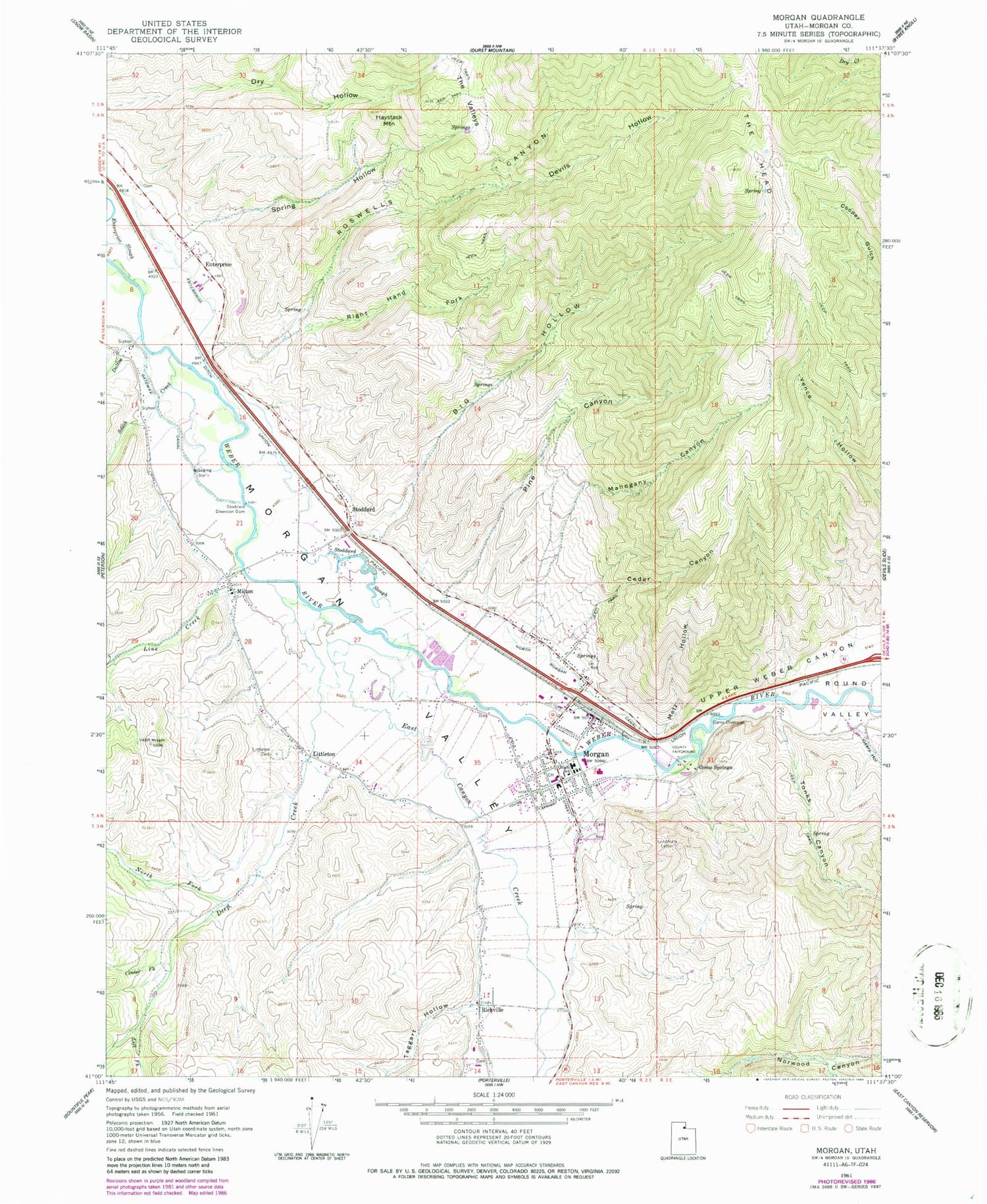
MyTopo
Classic USGS Morgan Utah 7.5'x7.5' Topo Map
Couldn't load pickup availability
Historical USGS topographic quad map of Morgan in the state of Utah. Map scale may vary for some years, but is generally around 1:24,000. Print size is approximately 24" x 27"
This quadrangle is in the following counties: Morgan.
The map contains contour lines, roads, rivers, towns, and lakes. Printed on high-quality waterproof paper with UV fade-resistant inks, and shipped rolled.
Contains the following named places: Big Hollow, Cedar Canyon, Center Fork Deep Creek, City of Morgan, Como Diversion, Como Springs, Dalton Creek, Deep Creek, Devils Hollow, East Canyon Creek, Enterprise, Enterprise Census Designated Place, Enterprise Ditch, Geary Hollow, Haystack Mountain, Left Fork Deep Creek, Line Creek, Littleton, Mahogany Canyon, Metz Hollow, Milton, Milton Cemetery, Morgan, Morgan County Ambulance, Morgan County Fire Department, Morgan County Sheriff Department, Morgan Elementary School, Morgan High School, Morgan Middle School, Morgan Post Office, North Fork Deep Creek, North Morgan Canal, North Morgan Cemetery, Pine Canyon, Richville, Richville Cemetery, Right Hand Fork Norwood Canyon, Right Hand Fork Roswells Canyon, Roswells Canyon, Round Valley, Round Valley Wildlife Management Area, Smith Creek, South Morgan Cemetery, Spring Hollow, Stoddard, Stoddard Diversion Dam, Stoddard Slough, Taggart Hollow, The Church of Jesus Christ of Latter Day Saints, The Head, The Valleys, Tonks Canyon, Upper Weber Canyon, ZIP Code: 84050


