MyTopo
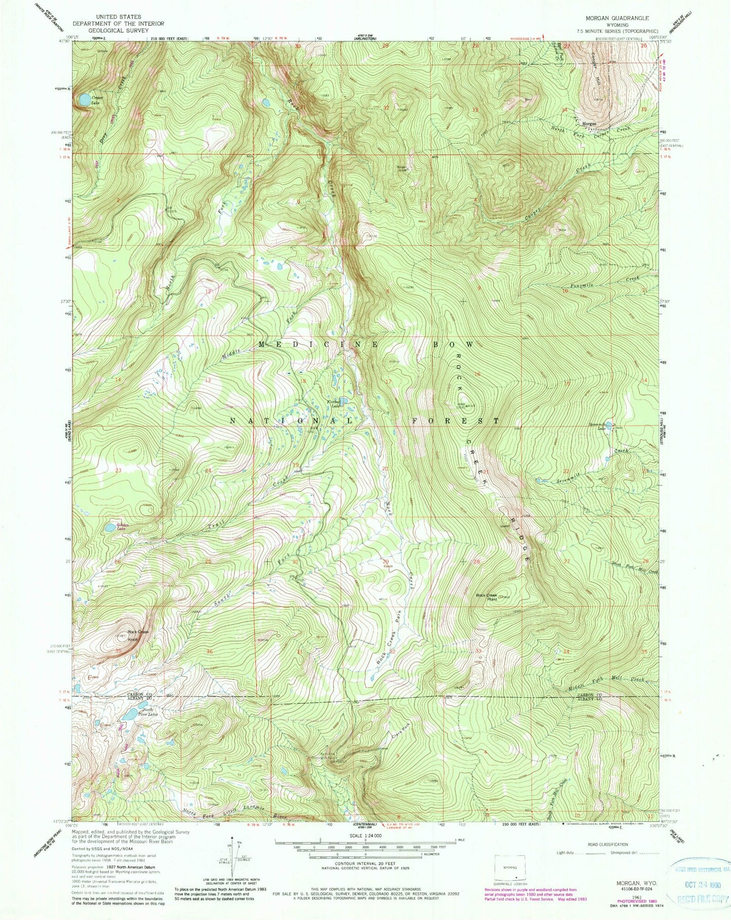
Classic USGS Morgan Wyoming 7.5'x7.5' Topo Map
Couldn't load pickup availability
Historical USGS topographic quad map of Morgan in the state of Wyoming. Typical map scale is 1:24,000, but may vary for certain years, if available. Print size: 24" x 27"
This quadrangle is in the following counties: Albany, Carbon.
The map contains contour lines, roads, rivers, towns, and lakes. Printed on high-quality waterproof paper with UV fade-resistant inks, and shipped rolled.
Contains the following named places: Arlington Pack Trail, Clark Park, Cooper Hill, Crater Lake, Middle Fork Rock Creek, Morrisey (historical), North Fork Observation Point, North Fork Rock Creek, North Twin Lakes, Rock Creek Knoll, Rock Creek Park, Rock Creek Point, Rock Creek Ridge, Sevenmile Lake, South Fork Rock Creek, Trail Creek, Firebox Lake, Golden Lake, Rat Lake, Lulu Ridge, Snow Bank Lake