MyTopo
Classic USGS Morgans Point Texas 7.5'x7.5' Topo Map
Couldn't load pickup availability
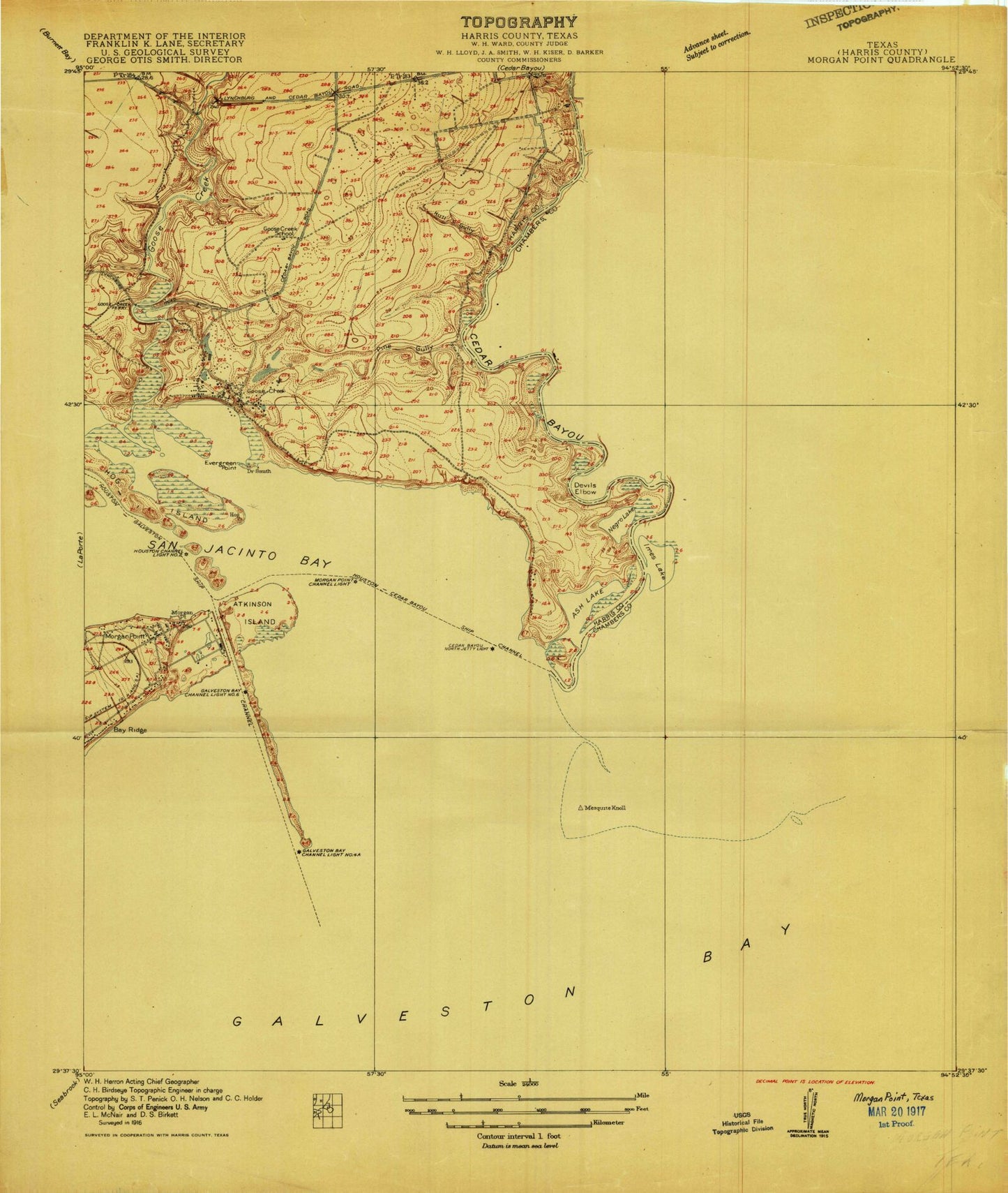
Historical USGS topographic quad map of Morgans Point in the state of Texas. Map scale may vary for some years, but is generally around 1:24,000. Print size is approximately 24" x 27"
This quadrangle is in the following counties: Chambers, Harris.
The map contains contour lines, roads, rivers, towns, and lakes. Printed on high-quality waterproof paper with UV fade-resistant inks, and shipped rolled.
Contains the following named places: Ash Lake, Ash Point, Ashbel Smith Elementary School, Atkinson Island, Atkinson Island Wildlife Management Area, Barbours Cut, Bay Plaza Shopping Center, Baytown, Baytown City Hall, Baytown Fire and Rescue Station 2, Baytown Fire and Rescue Station 4, Baytown Health Center, Baytown Health Department Emergency Medical Service, Baytown Historical Museum, Baytown Marina, Baytown Memorial Stadium, Baytown Police Department Community Services Bureau, Baytown Shopping Center, Baytown United Seventh Day Adventist Church, Beach City, Camp Allen, Camp Sterling, Casa del Alfarero Independent Church, Cedar Bayou, Cedar Bayou Channel, Cedar Point Oil Field, Center for Psychiatric Information, Church of Christ South Main, Church of the Nazarene, Devils Elbow, Dow Reef, Evergreen Point, Faith Temple United Pentecostal Church, First Church of the Nazarene, Fisher Marsh, G W Carver School, Gaillard-Mitchell Cemetery, Goose Creek, Goose Creek Oil Field, Grace United Methodist Church, Greater Saint Johns Baptist Church, Hill of Rest Cemetery, Hog Island, Horace Mann Junior High School, Horace Mann School, Houston Methodist Baytown Hospital Alexander Campus, Houston Point, Houston School, Houston Ship Channel, Houston/Galveston Navigation Channel, Hull Gully, Iglesia Bautista Central, Iglesia Metodista Unida San Marcos Church, Ijams Gully, Ijams Lake, James Bowie Elementary School, Jergins Oil Field, Kindred Hospital Baytown, Lake Henry Doyle, Lamar Elementary School, Lamar School, Lee College, Lee High School - Goosecreek, Lorenzo De Zavala Elementary School, Marrow Marsh, Memorial Baptist Church, Mesquite Knoll, Morgans Point, N C Foote Park, New Home Missionary Baptist Church, New Life Assembly of God Church, Northside Baptist Church, Pelly, Pelly Park, Pine Gully, Port of Houston Authority Fire Department Station 3, Redeemer Lutheran Church, Robert E Lee High School, Robert Lee High School Baseball Field, Roseland Manor, Roseland Park, Ross S Sterling House, Saint Pauls Lutheran Church, Saintjohns United Methodist Church, San Jacinto Methodist Hospital Heliport, San Jacinto River, Second Baptist Church, Seventh Day Adventist Church, Shell Point, Smith School, Southern Congregational Methodist Church, Sterling Municipal Library, Sutton Gully, Swan Marsh, Tabbs Bay, Tejas Park, Templo Horeb Assembly of God Church, Trinity Tabernacle Assembly of God Church, Water Oak Gully, Word of Faith Fellowship Church, ZIP Code: 77520