MyTopo
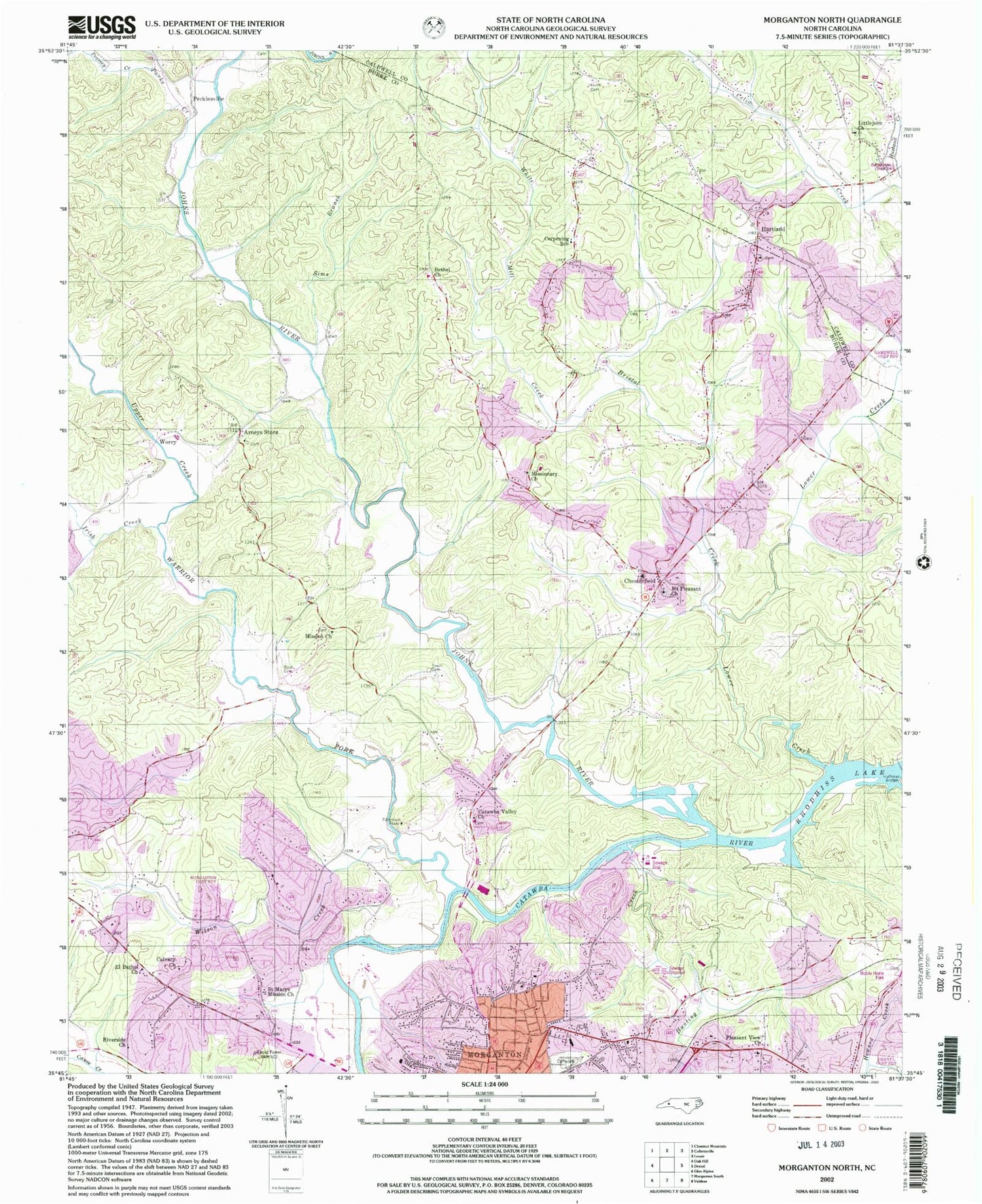
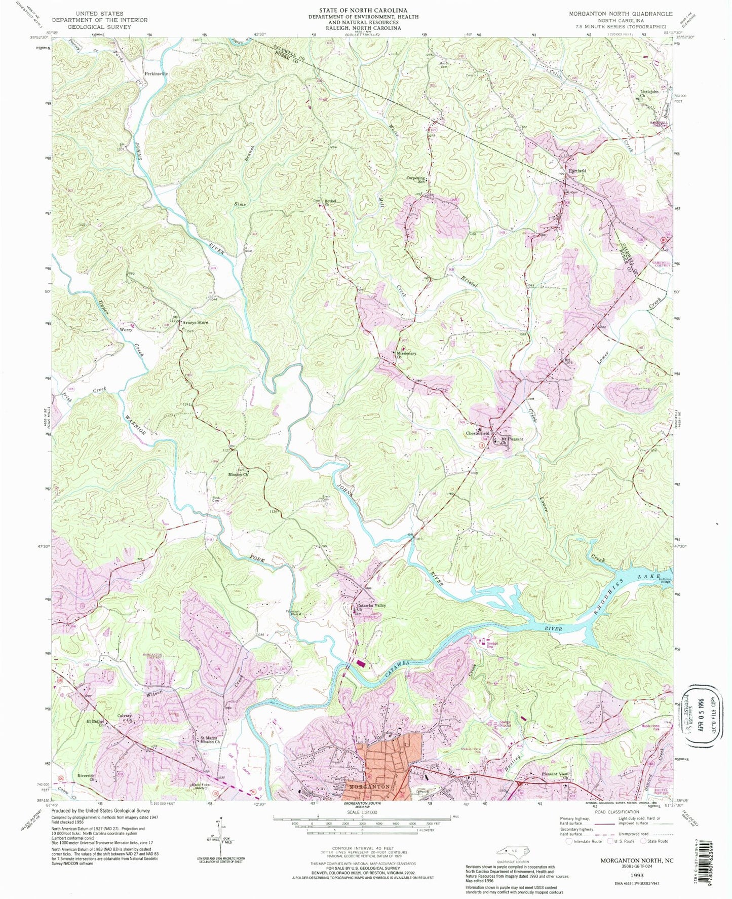
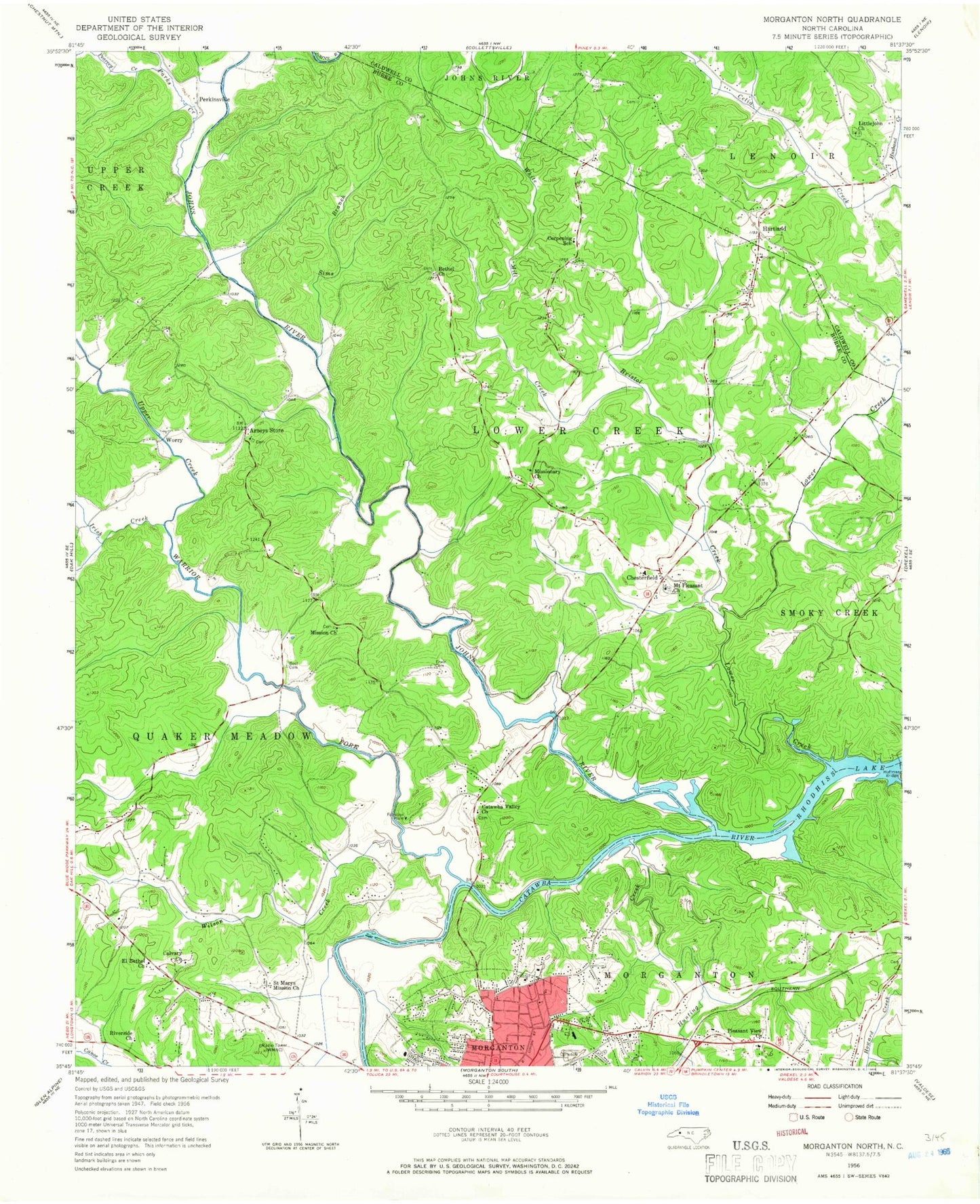
Classic USGS Morganton North North Carolina 7.5'x7.5' Topo Map
Couldn't load pickup availability
Historical USGS topographic quad map of Morganton North in the state of North Carolina. Map scale may vary for some years, but is generally around 1:24,000. Print size is approximately 24" x 27"
This quadrangle is in the following counties: Burke, Caldwell.
The map contains contour lines, roads, rivers, towns, and lakes. Printed on high-quality waterproof paper with UV fade-resistant inks, and shipped rolled.
Contains the following named places: Amherst Baptist Church, Arneys Chapel Methodist Church, Arneys Store, Bethel Church, Bost Cemetery, Bristol Creek, Burke County Rescue Squad, Calvary Church, Cascade Park, Catawba Valley Baptist Church Cemetery, Catawba Valley Church, Causby Quarry, Chesterfield, Chesterfield Fire and Rescue, Chesterfield School, Collins, Corpening School, El Bethel Church, Erwin Cemetery, Forest Hill Cemetery, Hartland, Hartland Baptist Church, Hillcrest Elementary School, Houck Cemetery, Hunting Creek, Irish Creek, Johns River, Littlejohn Church, Lower Creek, M L King Park, Mission Church, Missionary Church, Morganton Fire Station 70 - 1, Mount Pleasant Church, Mountain View Elementary School, Mountain View Recreation Center, Parks Creek, Pearcey Creek, Perkinsville, Pleasant View Church, Quaker Meadows Golf Club, Riverside Church, Saint Marys Mission Church, Shadow Line Park, Sims Branch, Spencer Heights, Township of Lower Creek, Township of Quaker Meadows, Upper Creek, Wards Creek, Warrior Fork, White Mill Creek, Wilson Creek, WMNC-AM (Morganton), Worry, WQXX-FM (Morganton), ZIP Code: 28655