
MyTopo
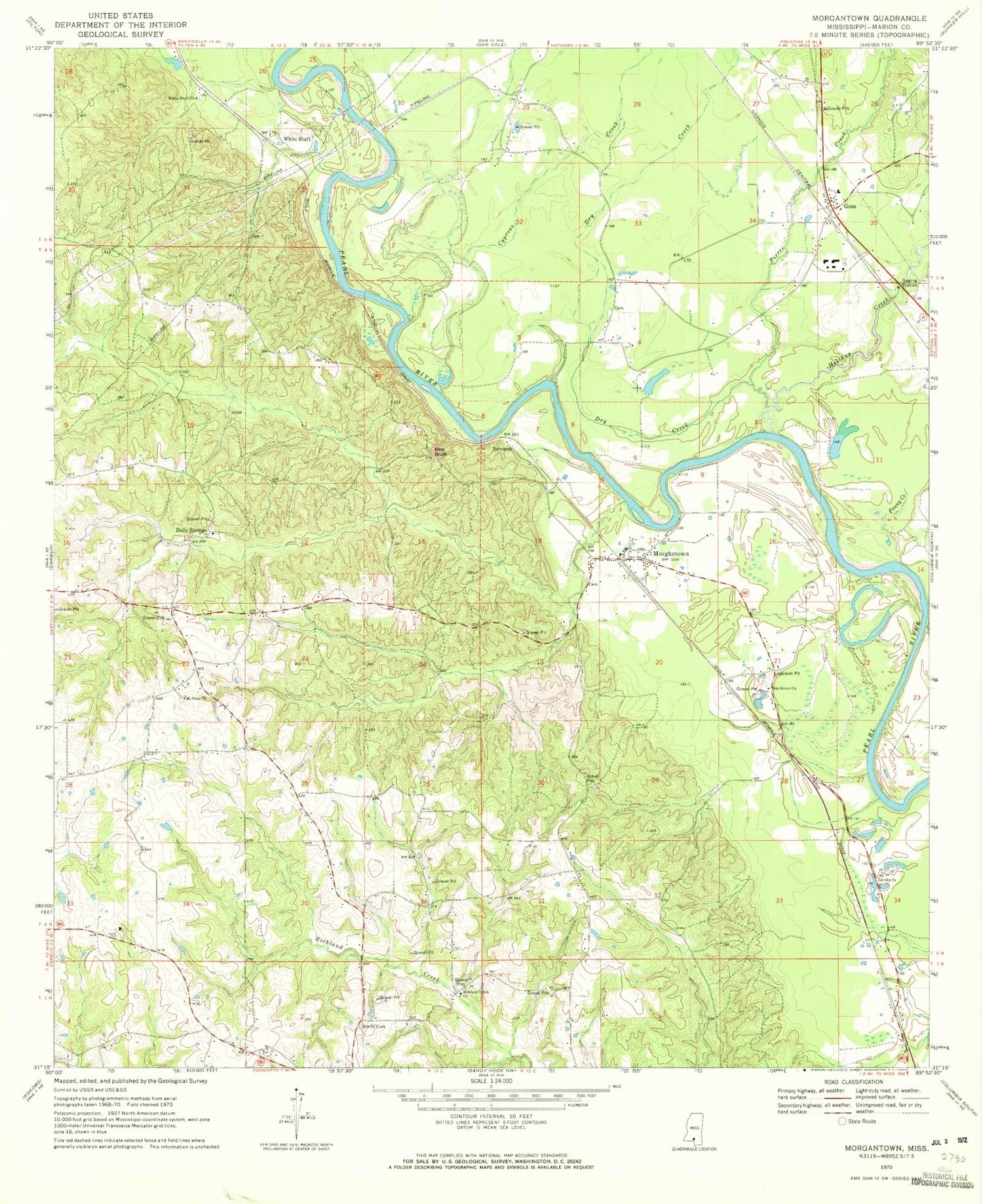
Classic USGS Morgantown Mississippi 7.5'x7.5' Topo Map
Couldn't load pickup availability
Historical USGS topographic quad map of Morgantown in the state of Mississippi. Map scale may vary for some years, but is generally around 1:24,000. Print size is approximately 24" x 27"
This quadrangle is in the following counties: Marion.
The map contains contour lines, roads, rivers, towns, and lakes. Printed on high-quality waterproof paper with UV fade-resistant inks, and shipped rolled.
Contains the following named places: Buford Consolidated School, Circle Bar Ranch Airport, Cypress Creek, Dry Creek, Fenny Creek, Goss, Goss Baptist Church, Goss School, Greens Creek Oil Field, Holiday Creek, Holly Springs, Holly Springs Cemetery, Holly Springs Church, Lightville, Morgantown, Morgantown Cemetery, Morgantown Church of God, Morgantown High School, Morgantown Oil Field, Mount Sinai Cemetery, Mount Sinai Church, Newsom, Newson Oil Field, Oak Grove Cemetery, Oak Grove Church, Pierce Creek, Red Bluff, Richland Creek Cemetery, Richland Creek Church, Smith Cemetery, Supervisor District 3, Tri Community Volunteer Fire Department Station 2, Twitty Creek, White Bluff, White Bluff Church


