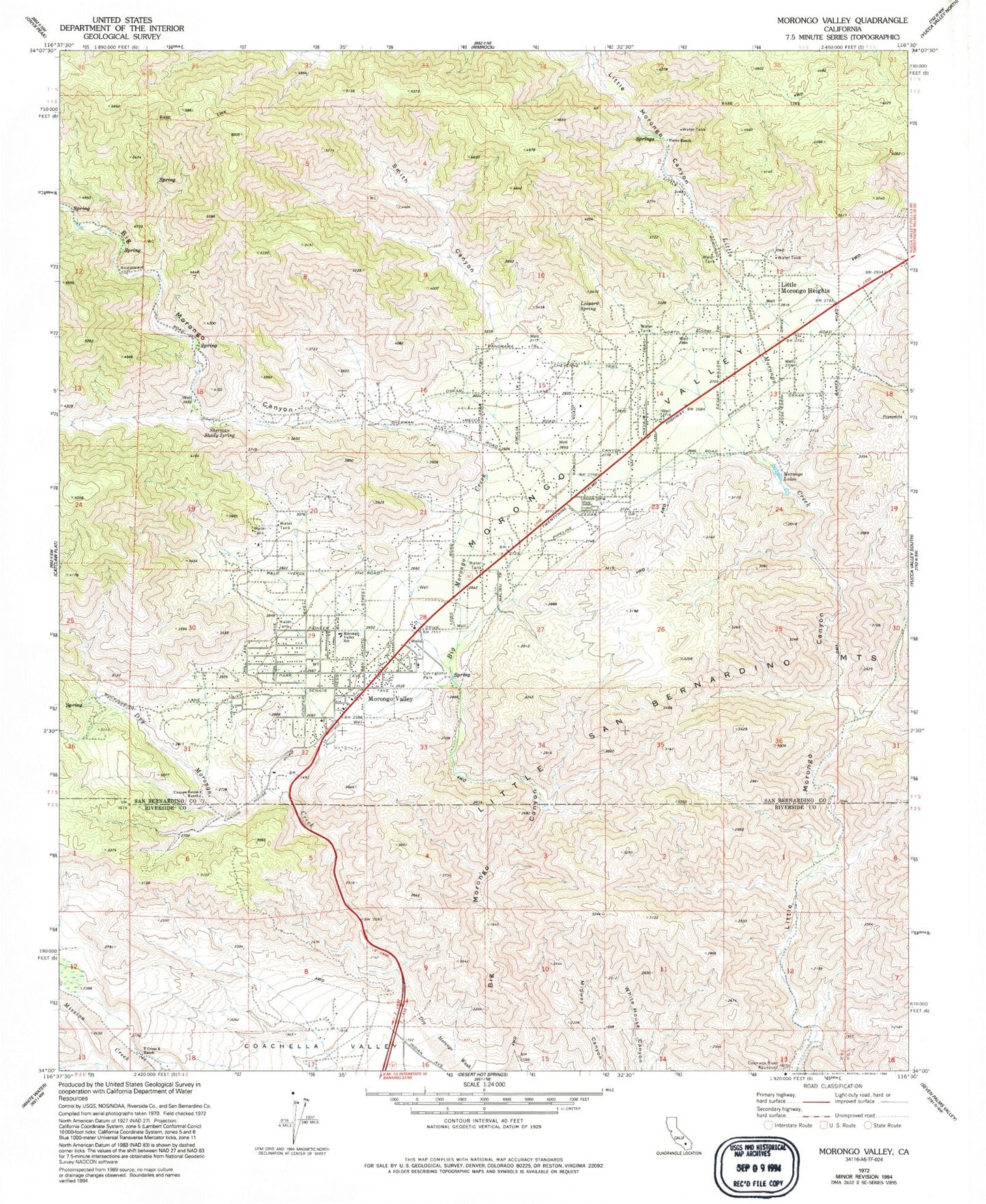
MyTopo
Classic USGS Morongo Valley California 7.5'x7.5' Topo Map
Couldn't load pickup availability
Historical USGS topographic quad map of Morongo Valley in the state of California. Map scale may vary for some years, but is generally around 1:24,000. Print size is approximately 24" x 27"
This quadrangle is in the following counties: Riverside, San Bernardino.
The map contains contour lines, roads, rivers, towns, and lakes. Printed on high-quality waterproof paper with UV fade-resistant inks, and shipped rolled.
Contains the following named places: Big Morongo Canyon, Big Morongo Creek, Canyon House Ranch, Covington Park, Dry Morongo Creek, Leopard Spring, Little Morongo Heights, Morongo Lakes, Morongo Valley, Morongo Valley Census Designated Place, Morongo Valley Elementary School, Morongo Valley Fire Department Station 461, Morongo Valley Post Office, Palm Wells, Pierce Ranch, Sherman Shady Spring, Smith Canyon, T Cross K Ranch, ZIP Code: 92256