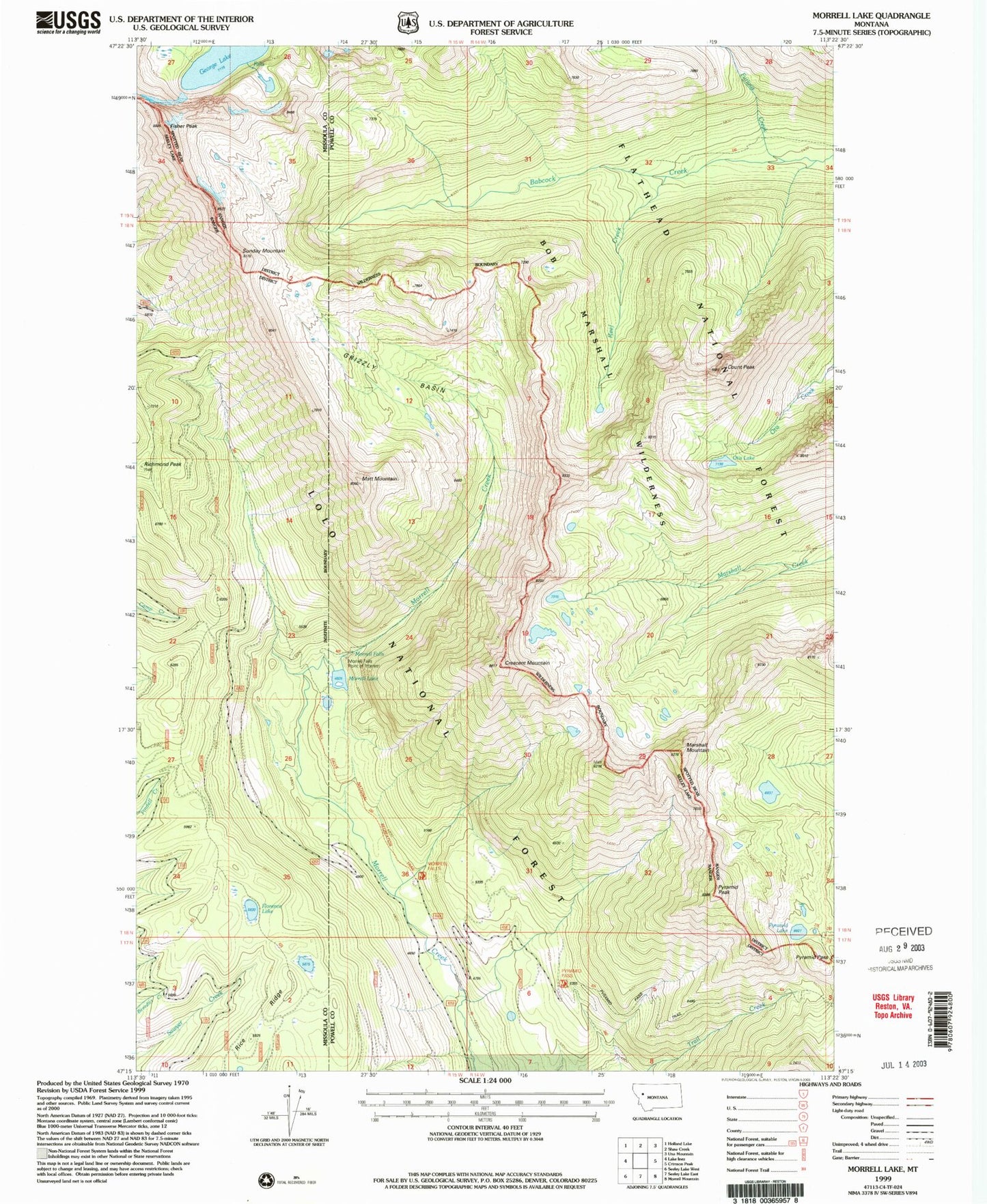
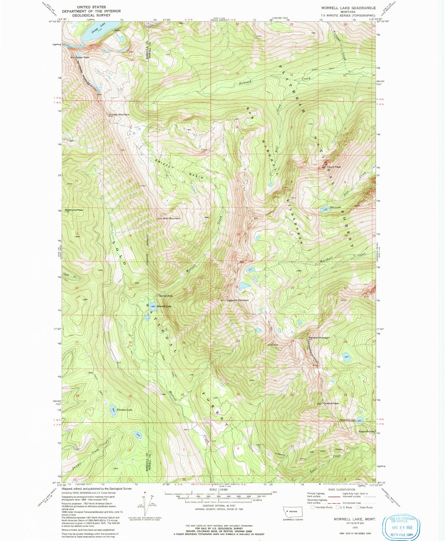
MyTopo
Classic USGS Morrell Lake Montana 7.5'x7.5' Topo Map
Couldn't load pickup availability
Historical USGS topographic quad map of Morrell Lake in the state of Montana. Map scale may vary for some years, but is generally around 1:24,000. Print size is approximately 24" x 27"
This quadrangle is in the following counties: Missoula, Powell.
The map contains contour lines, roads, rivers, towns, and lakes. Printed on high-quality waterproof paper with UV fade-resistant inks, and shipped rolled.
Contains the following named places: Count Peak, Crescent Mountain, Fisher Peak, Florence Lake, Furious Creek, George Lake, Grizzly Basin, Marshall Mountain, Matt Mountain, Morrell Falls, Morrell Falls National Recreation Trail, Morrell Lake, Otis Lake, Pyramid Lake, Pyramid Pass, Pyramid Pass Trail, Pyramid Peak, Reef Creek, Richmond Peak, Sunday Mountain