MyTopo
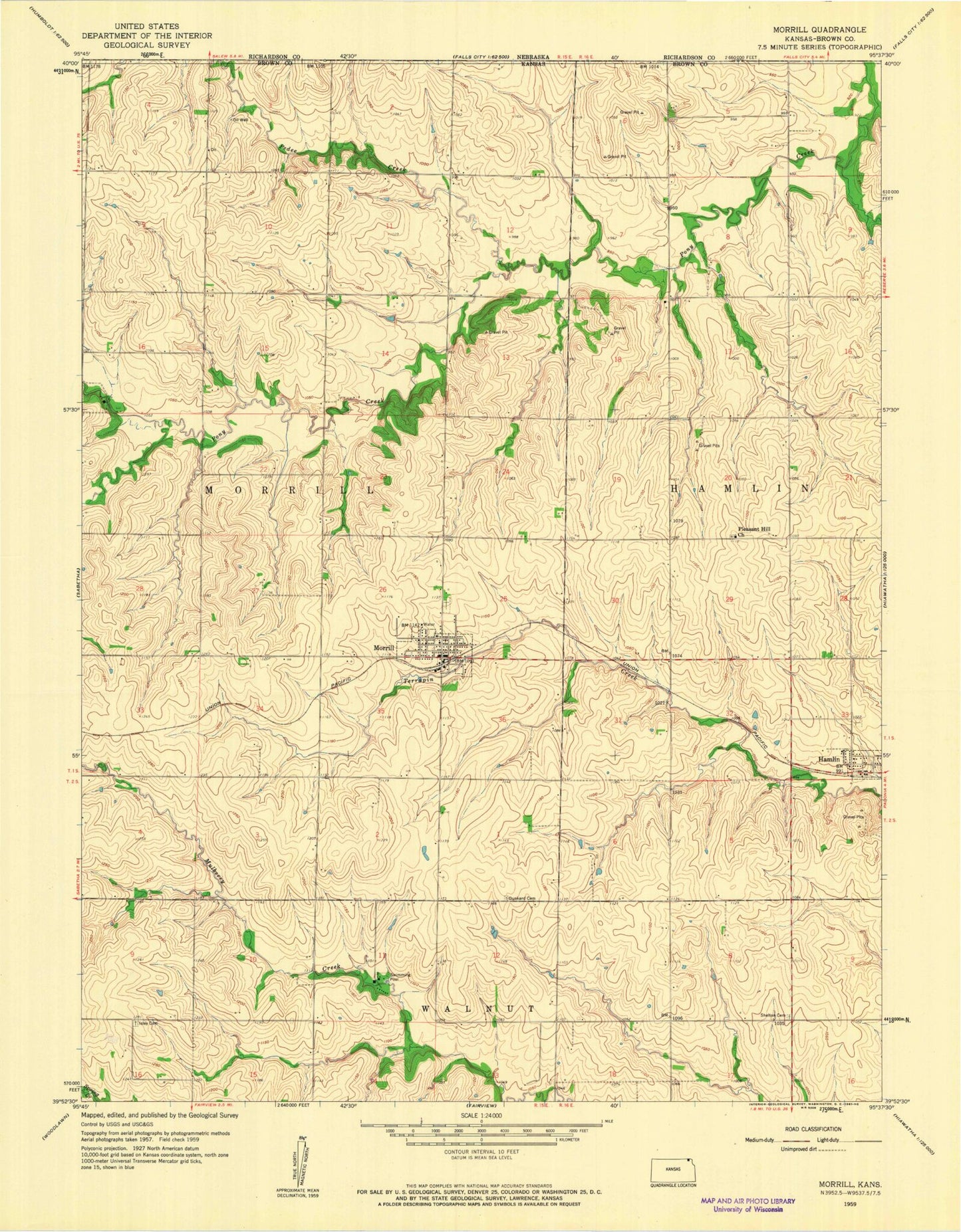
Classic USGS Morrill Kansas 7.5'x7.5' Topo Map
Couldn't load pickup availability
Historical USGS topographic quad map of Morrill in the state of Kansas. Map scale may vary for some years, but is generally around 1:24,000. Print size is approximately 24" x 27"
This quadrangle is in the following counties: Brown.
The map contains contour lines, roads, rivers, towns, and lakes. Printed on high-quality waterproof paper with UV fade-resistant inks, and shipped rolled.
Contains the following named places: Agricultural Partners Co - Operative Grain Elevator Number 3, City of Hamlin, City of Morrill, Cornerstone Bible Church, Dunkard Cemetery, First Baptist Church, Hamlin, Hamlin Cemetery, Isley Cemetery, Morrill, Morrill Cemetery, Morrill Elevator Grain Elevator Number 1, Morrill Fire Department, Morrill Post Office, Morrill Wastewater Treatment Facility, Mulberry Creek Resort Recreational Vehicle Park, Pedee Creek, Pleasant Hill Cemetery, Pleasant Hill Church, Shelton Cemetery, Sun Springs, Sycamore Springs Recreational Vehicle Resort, The Ayore Church, Township of Morrill, ZIP Code: 66515