MyTopo
Classic USGS Morrill Maine 7.5'x7.5' Topo Map
Couldn't load pickup availability
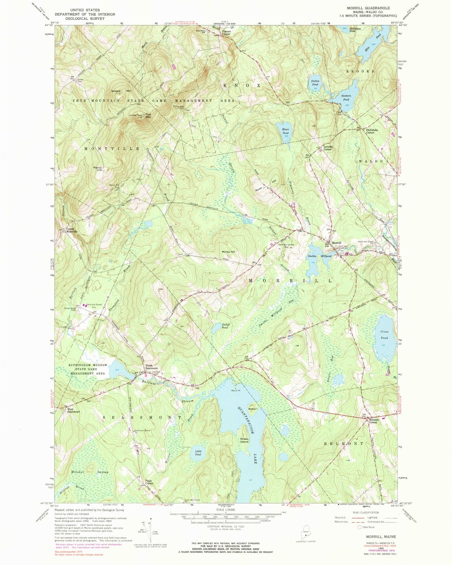
Historical USGS topographic quad map of Morrill in the state of Maine. Typical map scale is 1:24,000, but may vary for certain years, if available. Print size: 24" x 27"
This quadrangle is in the following counties: Waldo.
The map contains contour lines, roads, rivers, towns, and lakes. Printed on high-quality waterproof paper with UV fade-resistant inks, and shipped rolled.
Contains the following named places: Bartlett Stream, Belmont Corner, Belmont School, Foster Carter Cemetery, Cross Pond, Dolliff Pond, Dutton Pond, East Knox School, Ellis Pond, Fosters Corner, Frye Mountain, Frye Mountain State Game Management Area, Greenwood Cemetery, Greers Bog, Hillcrest Cemetery, Little Pond, Merrill Point, Mixer Pond, Morey Hill, Morrill, North Searsmont, Pierce Hill, Pierce Hill Cemetery, Poland Stream, Quantabacook Lake, Rowe Hill, Ruffingham Meadow State Game Management Area, Sanborn Pond, Sheep Island, Simmons Brook, Smiths Millpond, Smiths Millpond Bog, Spears Mountain, Sunny Side Cemetery, Thompson Brook, Wilson Brook, Witcher Swamp, Wood Island, Center Montville, Pauls Corner, West Searsmont, Town of Morrill, Ellis Pond Dam, Ruffingham Meadows Dam, Bartlett Stream Reservoir, Sanborn Pond Dam, Smiths Millpond Dam, Morrill Volunteer Fire Station, Belmont Volunteer Fire Department, Gladys Weymouth Elementary School, Ironwood School, Morrill Post Office