MyTopo
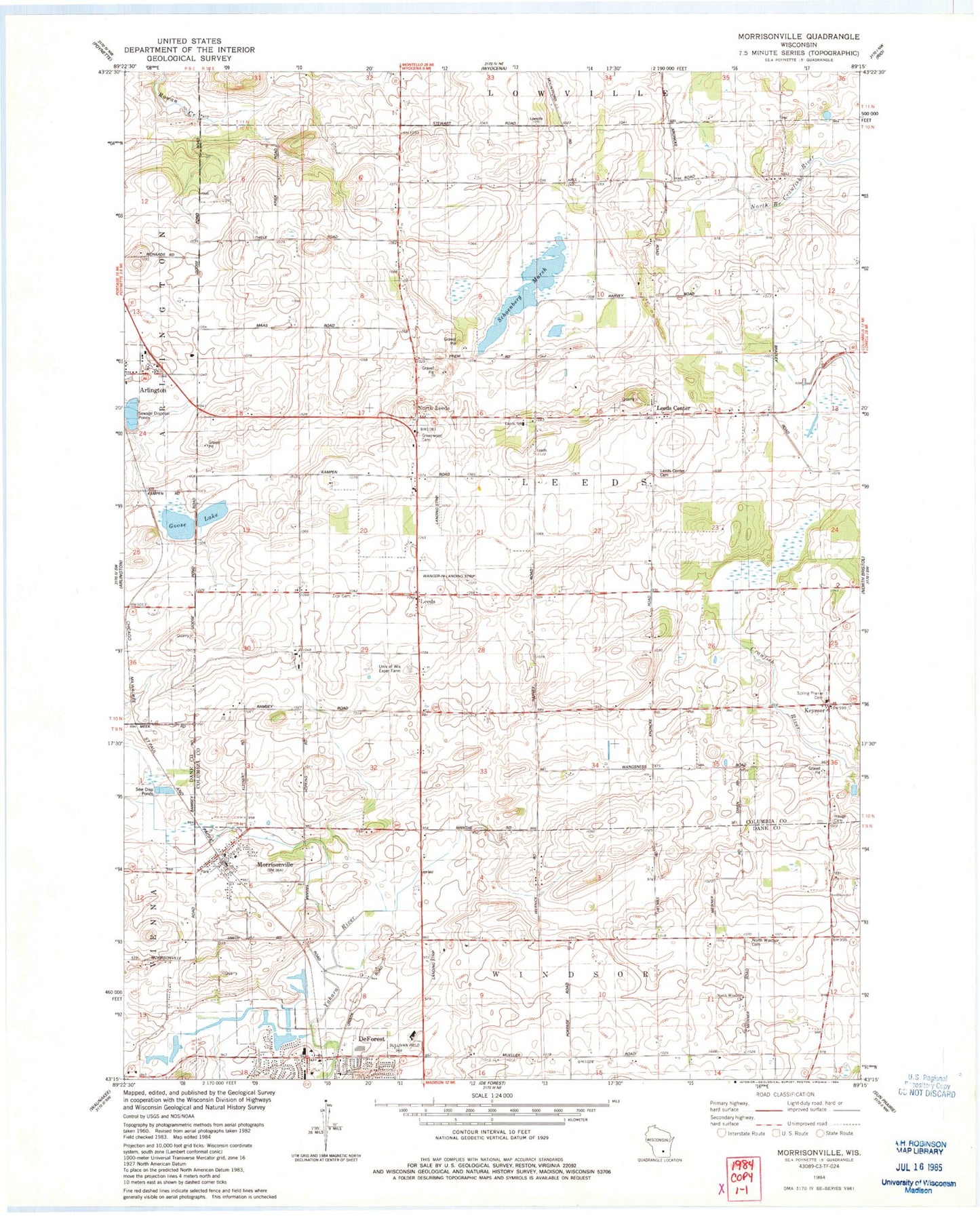
Classic USGS Morrisonville Wisconsin 7.5'x7.5' Topo Map
Couldn't load pickup availability
Historical USGS topographic quad map of Morrisonville in the state of Wisconsin. Map scale may vary for some years, but is generally around 1:24,000. Print size is approximately 24" x 27"
This quadrangle is in the following counties: Columbia, Dane.
The map contains contour lines, roads, rivers, towns, and lakes. Printed on high-quality waterproof paper with UV fade-resistant inks, and shipped rolled.
Contains the following named places: Audubon Goose Pond State Natural Area, Dane County Sheriff's Office - Northeast Precinct, De Forest Area Community Center, Del Monte Airport, Elert Airport, Empire Prairie School, Goose Lake, Greenwood Cemetery, Happy Hour School, Keyeser, LaFollette School, Leeds, Leeds Center, Leeds Center Cemetery, Leeds Elementary School, Lord of Love Lutheran Church, Morrisonville, Morrisonville Elementary School, Morrisonville International Airport, Morrisonville Post Office, North Leeds, North Windsor Cemetery, North Windsor School, North Windsor United Methodist Church, Schoeneberg Marsh, Spring Prairie - Hauge Cemetery, Spring Prairie Lutheran Cemetery, Spring Prairie Lutheran Church, Sullivan Field, Town of Leeds, United in Christ Lutheran Cemetery, University of Wisconsin Experimental Farm, Village of Arlington, Wanger-In Airport, Zion Cemetery, ZIP Codes: 53532, 53571, 53911