MyTopo
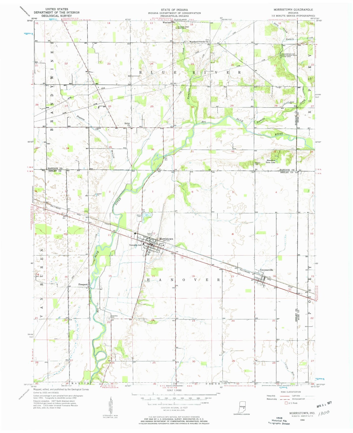
Classic USGS Morristown Indiana 7.5'x7.5' Topo Map
Couldn't load pickup availability
Historical USGS topographic quad map of Morristown in the state of Indiana. Typical map scale is 1:24,000, but may vary for certain years, if available. Print size: 24" x 27"
This quadrangle is in the following counties: Hancock, Rush, Shelby.
The map contains contour lines, roads, rivers, towns, and lakes. Printed on high-quality waterproof paper with UV fade-resistant inks, and shipped rolled.
Contains the following named places: Asbury Cemetery, Davis Cemetery, Dilly Creek, Freeport, Gwynneville, Hamilton Twin Lake, Haskett Cemetery, Indiana Soldiers and Sailors Children Camp, Morristown, Nameless Creek, Nameless Creek Youth Camp, Prairie Branch, Ridge Run, Shiloh Church, Sixmile Creek, Union Church, Westland Friends Church, Hog Back, Westland Post Office (historical), Township of Blue River, Township of Hanover, Town of Morristown, Morristown Volunteer Fire Department, Hillcrest Tree Farm, Willis Airport, Willis Airport Site Number 2, Gwynneville Post Office, Morristown Post Office