MyTopo
Classic USGS Morrisville Missouri 7.5'x7.5' Topo Map
Couldn't load pickup availability
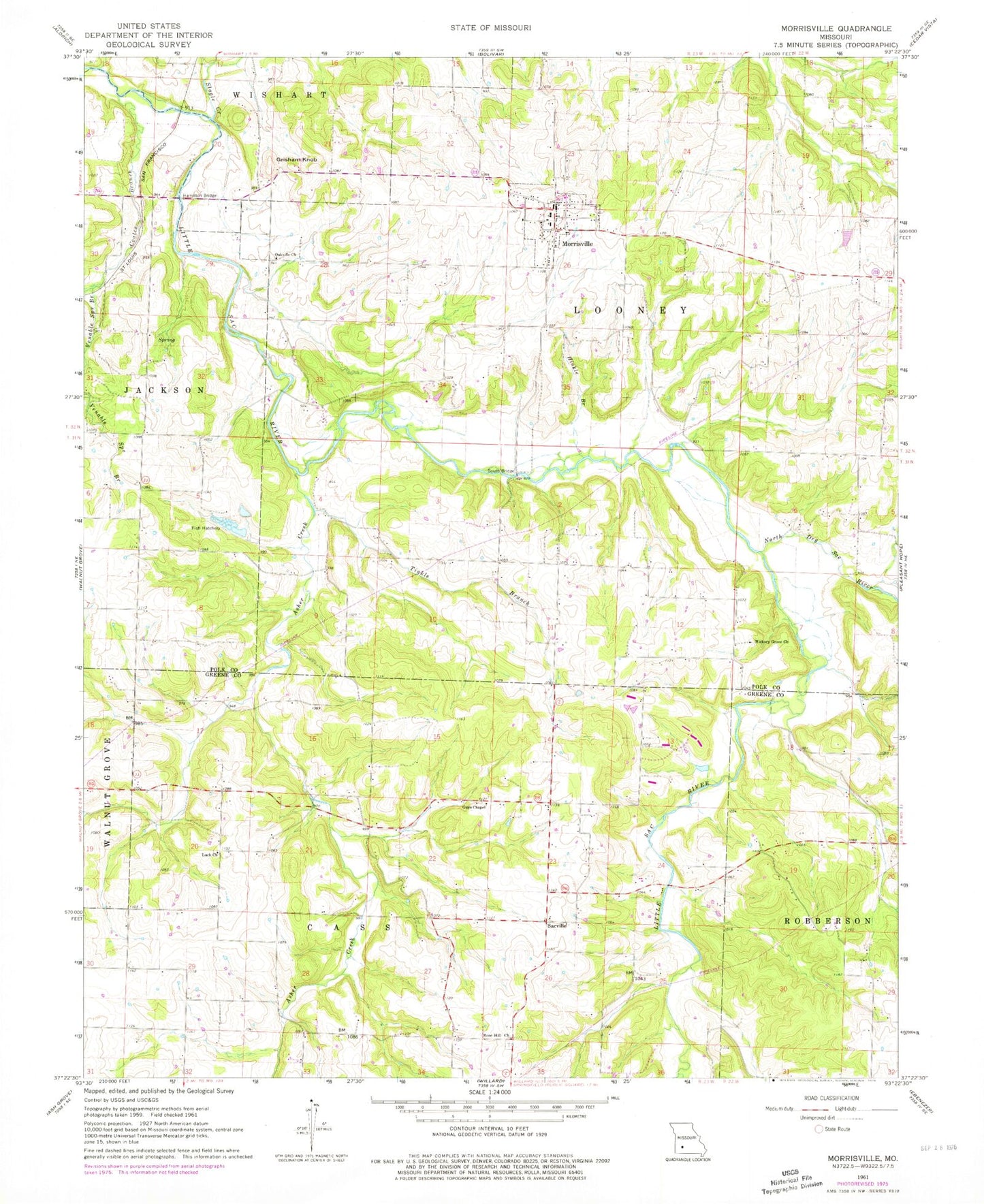
Historical USGS topographic quad map of Morrisville in the state of Missouri. Typical map scale is 1:24,000, but may vary for certain years, if available. Print size: 24" x 27"
This quadrangle is in the following counties: Greene, Polk.
The map contains contour lines, roads, rivers, towns, and lakes. Printed on high-quality waterproof paper with UV fade-resistant inks, and shipped rolled.
Contains the following named places: Asher Creek, Browns Branch, Coates Branch, Grisham Knob, Guys Chapel, Hickory Grove Church, Hinkle Branch, Luck Church, North Dry Sac River, Oakville Church, Rose Hill Church, Slagle Creek, Tinkle Branch, Luck School (historical), Persimmon Grove School (historical), Rose Hill Church (historical), Eagle School, Birdseye School (historical), Scrougeout School (historical), Tuck School (historical), Consolidated School Number 5, Morrisville, Gresham (historical), Sacville, Hamilton Bridge, South Bridge, West Bend, Thieme Lake Dam, James Estes Dam, Township of Cass, Township of West Looney, Township of Robberson Number 1A, Town of Morrisville, Walnut Grove Fire Protection District Station 3, Morrisville Fire and Rescue Station 1, Morrisville Cemetery, Morrisville Post Office