MyTopo
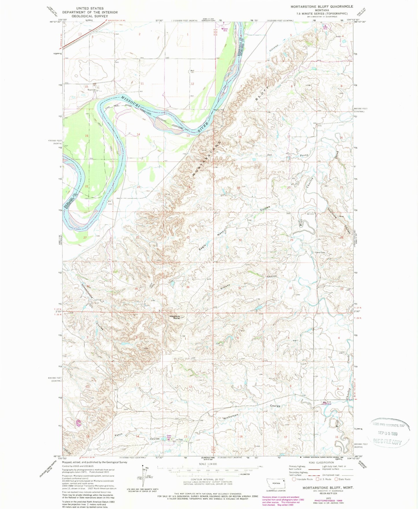
Classic USGS Mortarstone Bluff Montana 7.5'x7.5' Topo Map
Couldn't load pickup availability
Historical USGS topographic quad map of Mortarstone Bluff in the state of Montana. Map scale may vary for some years, but is generally around 1:24,000. Print size is approximately 24" x 27"
This quadrangle is in the following counties: Richland, Roosevelt.
The map contains contour lines, roads, rivers, towns, and lakes. Printed on high-quality waterproof paper with UV fade-resistant inks, and shipped rolled.
Contains the following named places: 26N53E07DACC01 Well, 27N52E02CA__01 Well, 27N52E02DA__01 Well, 27N52E02DD__01 Well, 27N52E10BC__01 Well, 27N52E10CC__01 Well, 27N52E10DA__01 Well, 27N52E10DC__01 Well, 27N52E11BA__01 Well, 27N52E11BC__01 Well, 27N52E11BD__01 Well, 27N52E11CA__01 Well, 27N52E15BB__01 Well, 27N53E07AA__01 Well, 27N53E20CCDC01 Well, Atkinson, Big Basin Coulee, Coalmine Coulee, Eagles Nest Coulee, Fisher Cemetery, Haystack Butte, Mortarstone Bluff, Nicholson Coulee, Patch Coulee, Riverside Church, Riverside School, Schoolhouse Coulee, Simons Coulee, Soo Prong