MyTopo
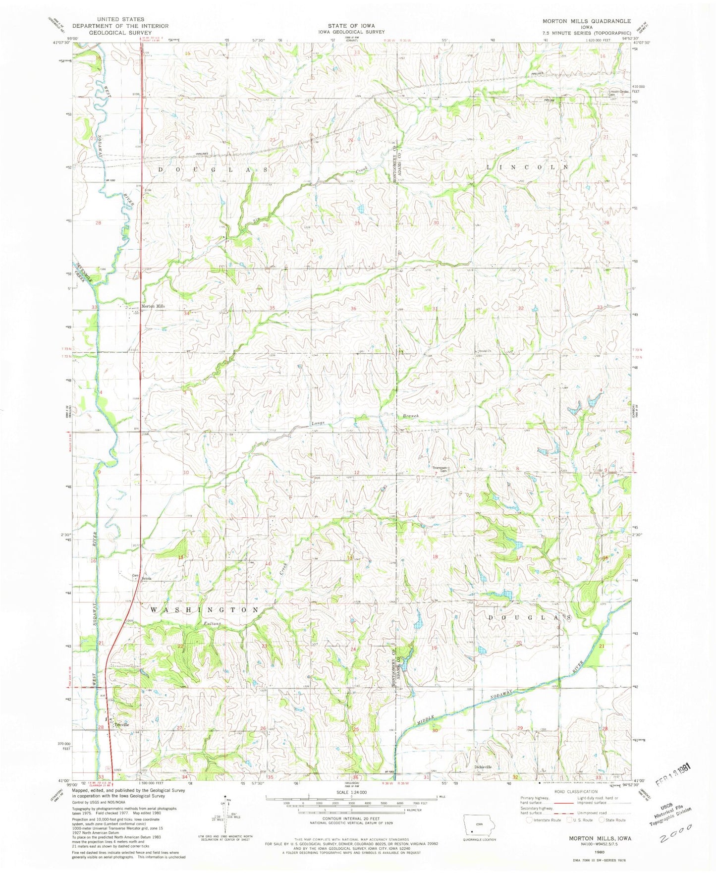
Classic USGS Morton Mills Iowa 7.5'x7.5' Topo Map
Couldn't load pickup availability
Historical USGS topographic quad map of Morton Mills in the state of Iowa. Map scale may vary for some years, but is generally around 1:24,000. Print size is approximately 24" x 27"
This quadrangle is in the following counties: Adams, Montgomery.
The map contains contour lines, roads, rivers, towns, and lakes. Printed on high-quality waterproof paper with UV fade-resistant inks, and shipped rolled.
Contains the following named places: Alix Post Office, Bolt Family Burying Ground, Dickieville, Fultons Creek, Indian Burial Ground, Lincoln Center Cemetery, Longs Branch, Morton Mills, Morton Mills Post Office, Sciola, Sciola Baptist Cemetery, Sciola Post Office, Sevenmile Creek, Sin Creek, Strand, Strand Cemetery, Strand Church, Strand Post Office, Tenville, Tenville Access, Tenville Post Office, Thompson Cemetery, Township of Douglas, Township of Washington, Wallace Post Office