MyTopo
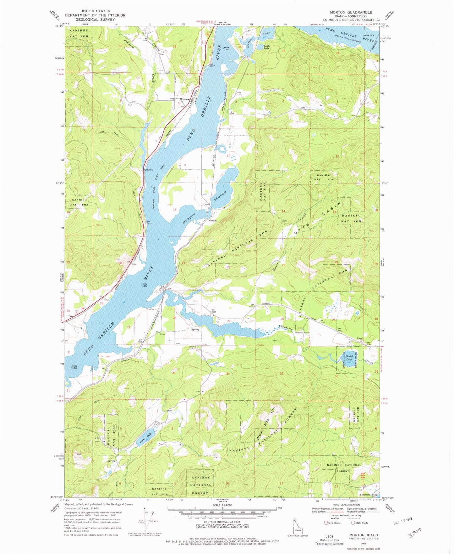
Classic USGS Morton Idaho 7.5'x7.5' Topo Map
Couldn't load pickup availability
Historical USGS topographic quad map of Morton in the state of Idaho. Map scale may vary for some years, but is generally around 1:24,000. Print size is approximately 24" x 27"
This quadrangle is in the following counties: Bonner.
The map contains contour lines, roads, rivers, towns, and lakes. Printed on high-quality waterproof paper with UV fade-resistant inks, and shipped rolled.
Contains the following named places: Beaux Ranch Field, Black Pine Mountain, Cocolalla Creek, Cocolalla Creek Fish Weir, Jewel Lake, Jewel Lake Access Area, Johnson Creek, Little Lake, Mallard Bay, Moore Creek, Morton, Morton Slough, Morton Slough Access, Morton Slough Game Management Area, Muskrat Lake, Otts Basin, Pend Oreille Wildlife Management Area Mallard Bay Unit, Pend Oreille Wildlife Management Area Morton Slough Unit, Round Lake, Round Lake Campground, Round Lake State Park, Trickle Creek, Wrencoe