MyTopo
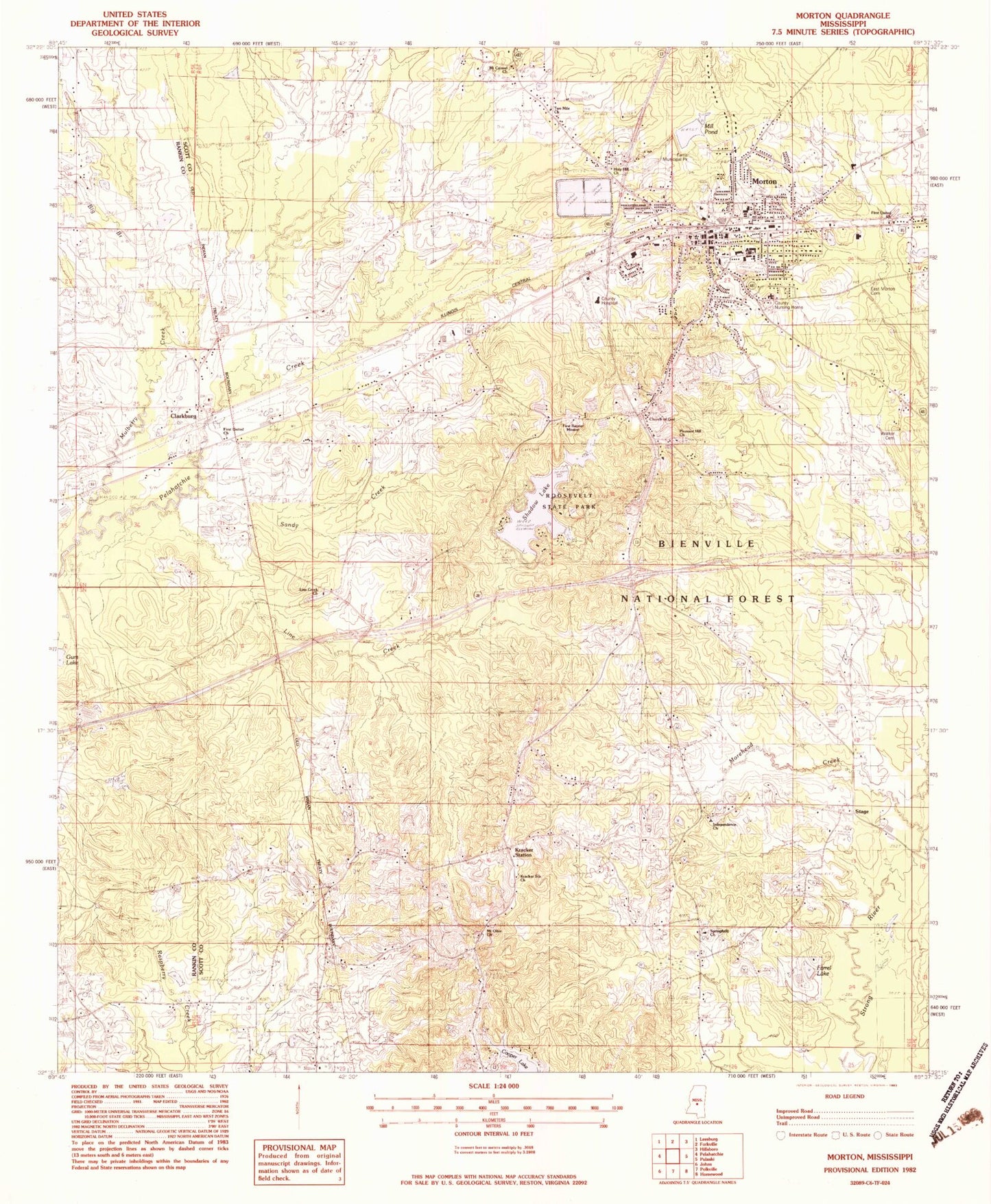
Classic USGS Morton Mississippi 7.5'x7.5' Topo Map
Couldn't load pickup availability
Historical USGS topographic quad map of Morton in the state of Mississippi. Map scale may vary for some years, but is generally around 1:24,000. Print size is approximately 24" x 27"
This quadrangle is in the following counties: Rankin, Scott.
The map contains contour lines, roads, rivers, towns, and lakes. Printed on high-quality waterproof paper with UV fade-resistant inks, and shipped rolled.
Contains the following named places: A B Farris Pond Dam, B Jones Pond Dam, Big Branch, Church of God, City of Morton, Clarkburg, Cooper Lake, East Morton Baptist Church, East Morton Cemetery, Farrel Lake, Farris Municipal Park, First Baptist Church, First Baptist Mission, First United Church, First United Methodist Church, Holy Hill Church, Independence, Independence Church, Jack Stewart Lake Dam, Jack Stewart Pond Dam, Kracker Station, Kracker Station Church, Line Creek, Line Creek Cemetery, Line Creek Church, Mill Pond, Morton, Morton Elementary School, Morton High School, Morton Junior High School, Morton Police Department, Morton Post Office, Morton Waste Stabilization Ponds Dam, Mount Carmel Church, Mount Olive Church, Mulberry Creek, Myers Mill, North Morton Baptist Church, Pleasant Grove Church, Pleasant Hill Church, Roosevelt State Park, Roosevelt State Park Lake Dam, Sandy Creek, Scott County Nursing Home, Scott Regional Hospital, Shadow Lake, Springfield Church, Stage, Supervisor District 3, Two Mile Church, Walker Cemetery, West Scott Baptist Hospital, ZIP Code: 39117