MyTopo
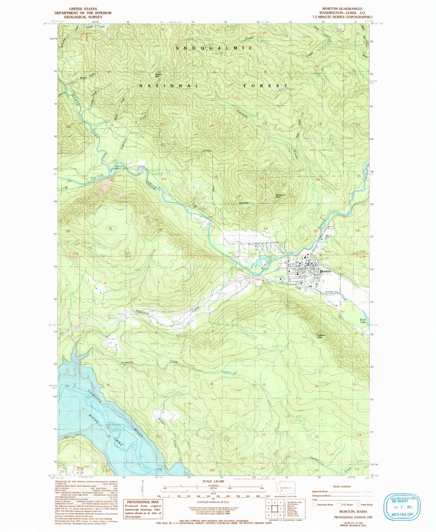
Classic USGS Morton Washington 7.5'x7.5' Topo Map
Couldn't load pickup availability
Historical USGS topographic quad map of Morton in the state of Washington. Typical map scale is 1:24,000, but may vary for certain years, if available. Print size: 24" x 27"
This quadrangle is in the following counties: Lewis.
The map contains contour lines, roads, rivers, towns, and lakes. Printed on high-quality waterproof paper with UV fade-resistant inks, and shipped rolled.
Contains the following named places: Beaver Creek, Bergen Mountain, Bromo Creek, Connelly Creek, Coon Creek, Cottlers Rock, Coyote Creek, Fisher Creek, Heller Creek, Highland Creek, Hopgood Rock, Lake Creek, Morton, North Fork Tilton River, Riffe (historical), Simmons Creek, Snow Creek, Tumble Creek, Weasel Spring, Indian Hole Campground, Hopkins Hill Viewpoint, Morton Junior - Senior High School, Morton Elementary School, Strom Field, City of Morton, Morton General Hospital, Lewis County Fire District 4 Morton Fire Department, Morton Police Department, Morton Post Office, Morton Cemetery