MyTopo
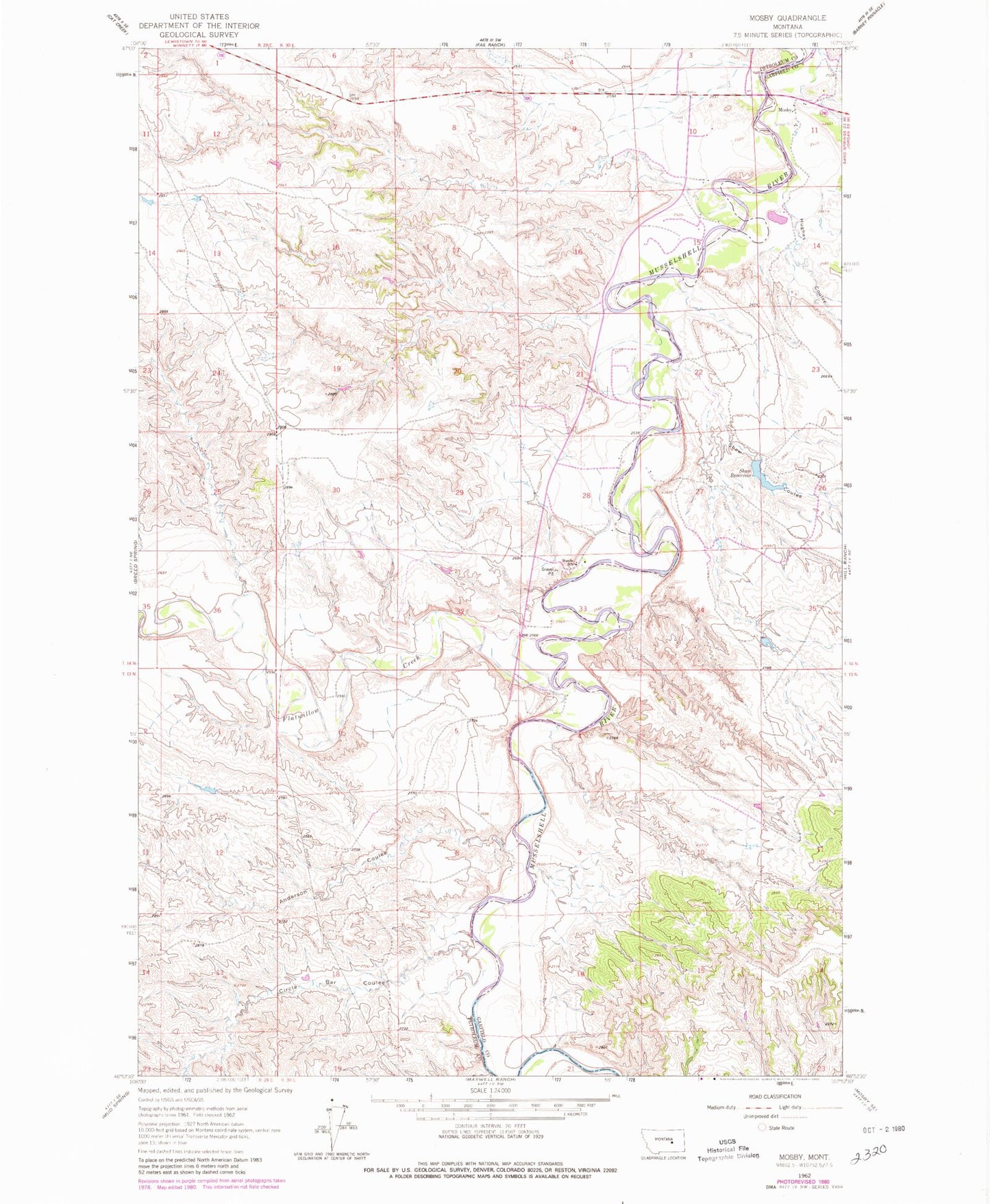
Classic USGS Mosby Montana 7.5'x7.5' Topo Map
Couldn't load pickup availability
Historical USGS topographic quad map of Mosby in the state of Montana. Map scale may vary for some years, but is generally around 1:24,000. Print size is approximately 24" x 27"
This quadrangle is in the following counties: Garfield, Petroleum.
The map contains contour lines, roads, rivers, towns, and lakes. Printed on high-quality waterproof paper with UV fade-resistant inks, and shipped rolled.
Contains the following named places: 14N29E25ADD_01 Well, 14N30E09DBC_01 Well, 14N30E11BDBB01 Well, 14N30E27DCDB01 Well, Anderson Coulee, B Shaw Number 1 Dam, Circle Bar Coulee, Flatwillow Creek, Hill Number 2 Dam, Hughes Coulee, L and V Rowten Number 1 Dam, Lower Weede School, Mosby, Mosby Bridge, Mosby Post Office, Mosby School, Shaw Coulee, Shaw Number 3 Dam, Shaw Reservoir, Shaw Reservoir Dam, Weede, Weede Post Office, Weede School, Williams Coulee Number 2 Dam