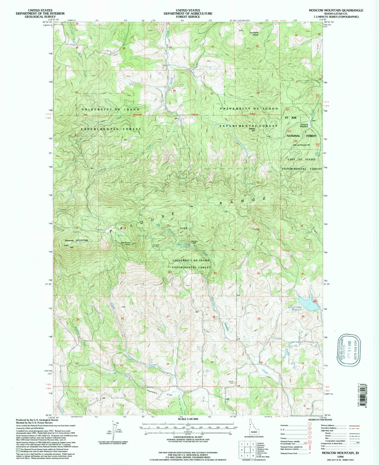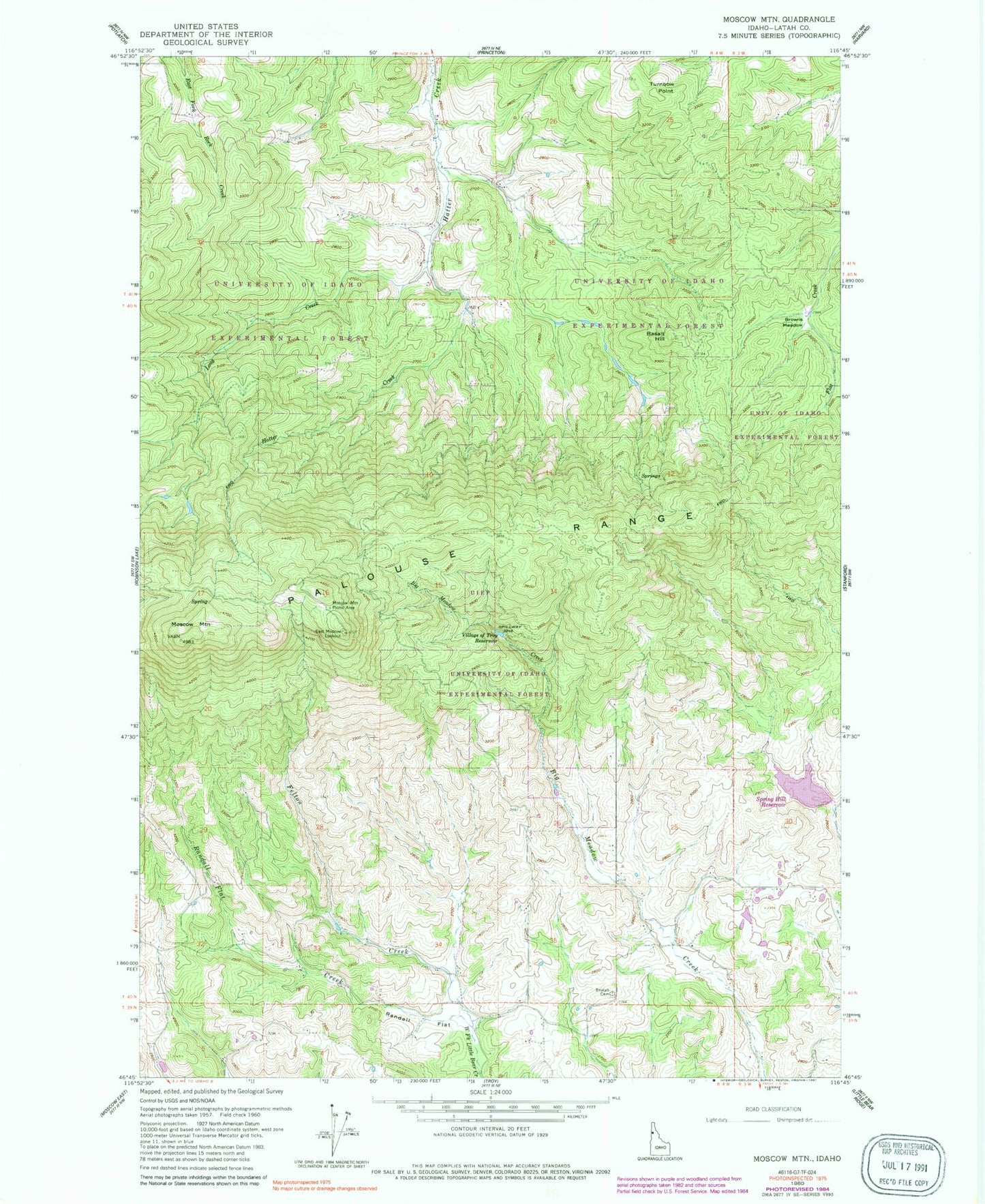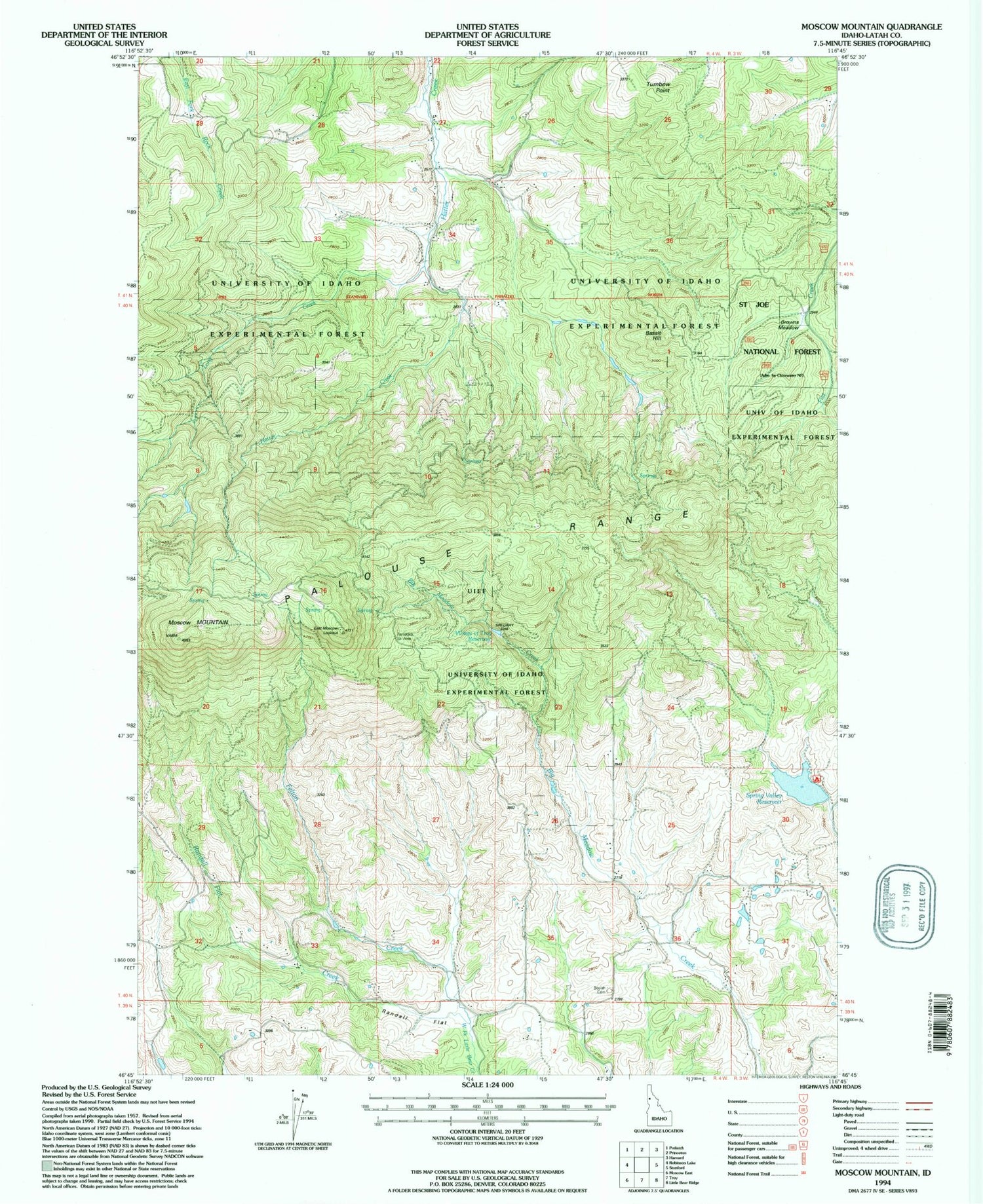

MyTopo
Classic USGS Moscow Mountain Idaho 7.5'x7.5' Topo Map
Couldn't load pickup availability
Historical USGS topographic quad map of Moscow Mountain in the state of Idaho. Map scale may vary for some years, but is generally around 1:24,000. Print size is approximately 24" x 27"
This quadrangle is in the following counties: Latah.
The map contains contour lines, roads, rivers, towns, and lakes. Printed on high-quality waterproof paper with UV fade-resistant inks, and shipped rolled.
Contains the following named places: Basalt Hill, Bergs Creek, Beulah Cemetery, Browns Meadow, East Moscow Lookout, East Moscow Mountain, Felton Creek, Lamarack Ski Area, Long Creek, Moscow Mountain, Moscow Mountain Picnic Area, Palouse Range, Randall Flat, Randall Flat Creek, Spring Valley Dam, Spring Valley Recreation Site, Spring Valley Reservoir, Spring Valley Reservoir Public Fishing Area, Troy Dam, Turnbow Point, University of Idaho Experimental Forest, Village of Troy Reservoir